

ARM’s Decadal Vision, Part 4: Observations to Models
Published: 29 June 2022
ARM envisions amplifying the impact of its measurements on earth system models
Editor’s note: This is the fourth and final article in a series about the four themes in ARM’s Decadal Vision document.

The Atmospheric Radiation Measurement (ARM) user facility has spent the last 30 years collecting continuous data that help researchers better understand atmospheric processes and improve how these processes are represented in earth system models (ESMs).
ESMs simulate how the Earth functions as a system of interconnected components, such as the atmosphere, ocean, and land surface. ESMs can run as small-scale models that operate in a limited area and focus on regional phenomena. They can also be large-scale models representing predicted conditions over the whole Earth.
One example is the Energy Exascale Earth System Model (E3SM) simulation project, funded by the U.S. Department of Energy (DOE).
The same observations-to-models mission is reflected in funding from DOE’s Atmospheric System Research (ASR) program. ASR researchers often turn to ARM observations to improve global and regional simulations of climate and weather.
ARM underscores the vital connection of observations to models in its Decadal Vision document, which lays out how ARM plans to address increasingly complex scientific challenges over the next five to 10 years.
In the report, ARM Technical Director Jim Mather outlines strategies for amplifying the influence of ARM measurements on models.
That’s a challenge, he says, “because there tends to be a disconnect between the observation community and the modeling community.”
To overcome that disconnect, adds Mather, “deliberate action is required.”
Planned Action
Outlining deliberate action is the point of the Decadal Vision report.
The document includes strategies to improve field measurements, advance techniques of data analytics, and expand data services through computer infrastructure and software tools.
In the category of observations to models, action means taking three main steps:
- Offer data in forms that make comparing observations to models easier
- Create modeling frameworks that bridge the gaps in scale between data and models
- Work with modelers on focused projects.
Luckily, there is precedent. ARM data have already had a significant impact on climate modeling. Researchers routinely use ARM measurements in large-scale simulations of clouds, aerosols, and radiative heating and cooling. ARM also develops higher-order data products that make data easier to use.
The ARM Best Estimate (ARMBE) data products, for instance, represent one of the strongest historical connections the user facility has to the global modeling community.
With that success as a starting point, says Mather, “we are looking at how to make ARM data as impactful as we can.”
The Challenge of Making Models
ARM’s plans to enhance the impact of its data on modeling unfold against a backdrop of challenges.
Models must reflect the complex, dynamic realities of the Earth’s atmosphere, oceans, land surfaces, and cryosphere, where ice and snow reign.
Climate models must simulate the interacting influences of solar radiation, cloud microphysics, and the fluid dynamics of wind and water. They must account for a chessboard of influences from biology, chemistry, geology, hydrology, and ecology.
Scale is another challenge.
The models that perform co-analysis with ARM data may take various forms, explains Mather, “from global to regional to a single vertical column of a global climate model.”
It is a challenge for ARM data to directly inform ESMs because there tends to be what he calls a “mismatch in scales.”
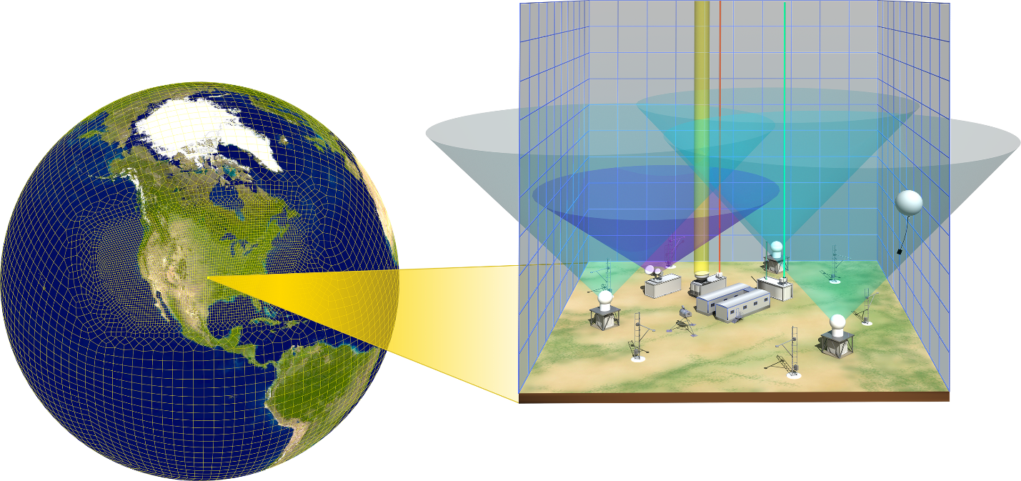
ESMs normally have spatial resolutions of tens to hundreds of kilometers. ARM usually makes measurements on much smaller spatial grid scales―from about 100 meters (328 feet) to 1 kilometer (0.62 miles).
ARM’s limited-area models, however, allow researchers to study phenomena at these finer scales. That permits investigating cloud processes more directly, for instance, than is possible in an ESM.
LASSO’s Widening Loops
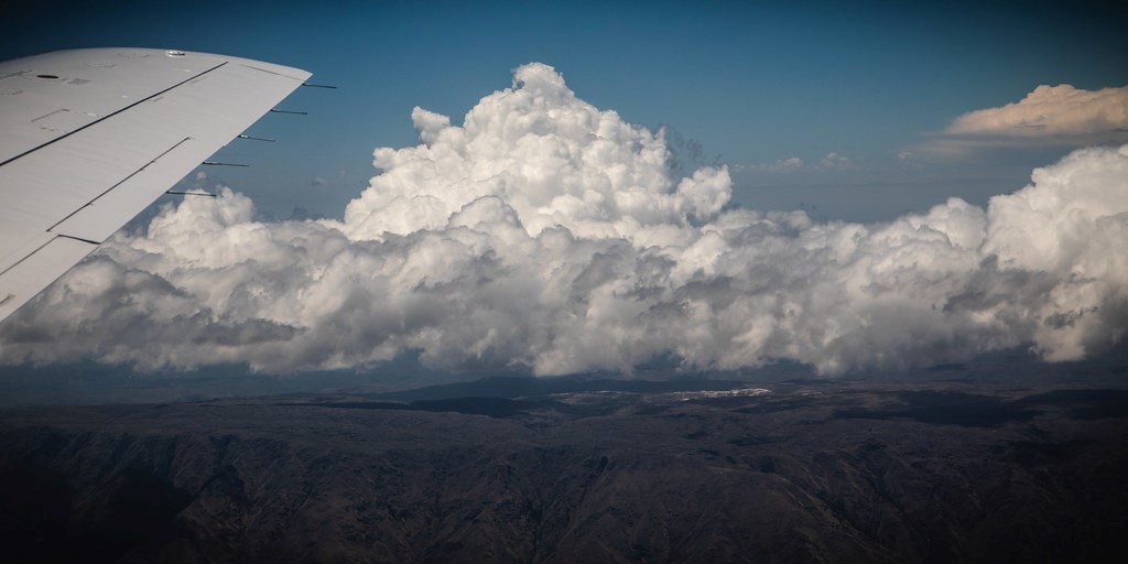
To make its data more impactful for modelers, ARM will first expand its approach for combining observations and models. It’s based on large-eddy simulations (LES), mathematical models of the turbulence and fluid dynamics that characterize air circulation in the atmosphere.
The LES ARM Symbiotic Simulation and Observation (LASSO) activity produces high-resolution simulations based on ARM measurements. LASSO enables researchers to better understand the atmosphere around an ARM site and improve how weather and climate models represent it.
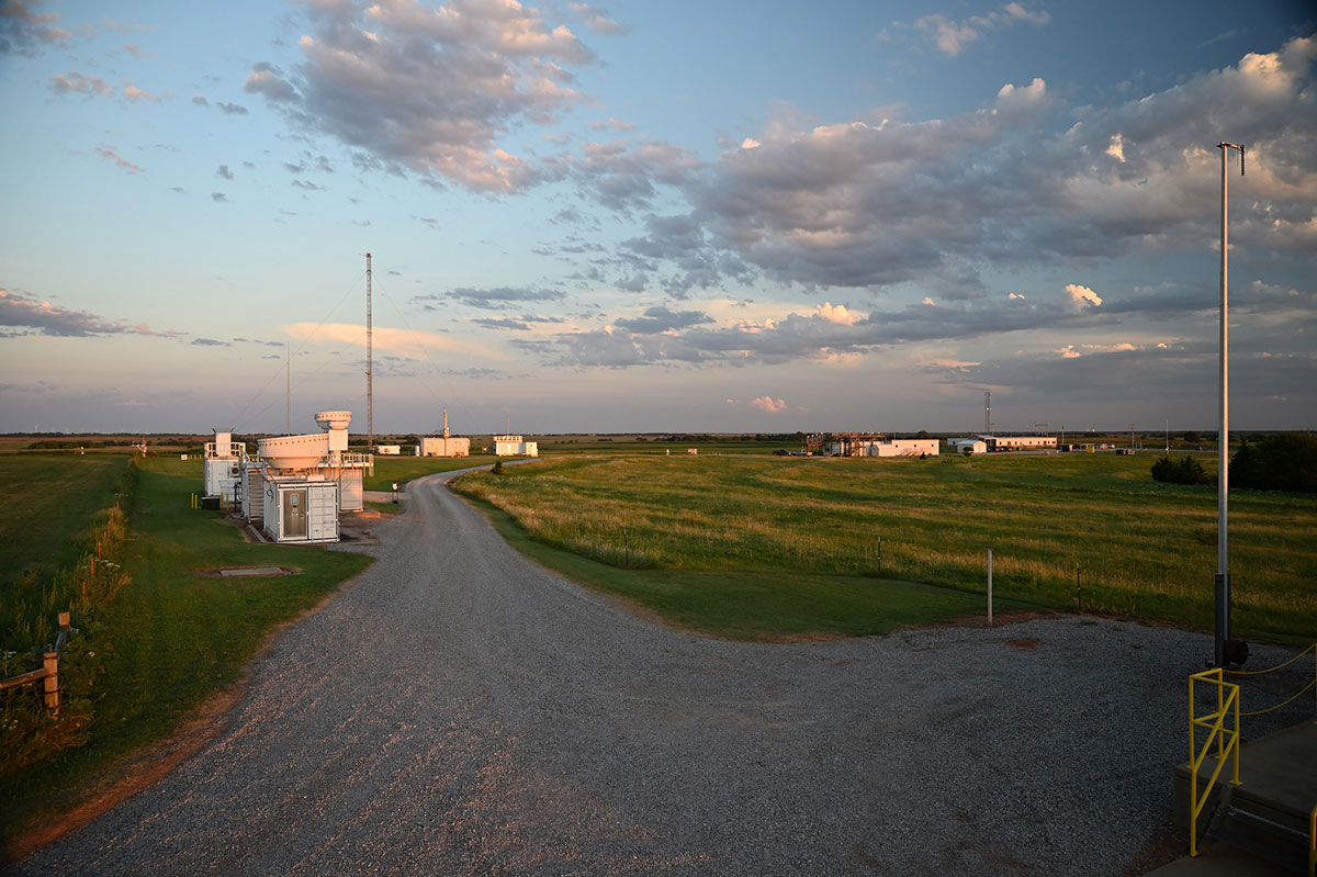
At first, LASSO focused on bundling observations and LES of shallow cumulus clouds. The data came from ARM’s Southern Great Plains (SGP) atmospheric observatory, which spans parts of Oklahoma and Kansas.
Now, LASSO is shifting to deep convection observed during ARM’s 2018–2019 Cloud, Aerosol, and Complex Terrain Interactions (CACTI) field campaign in Argentina.
In May 2022, ARM announced a beta release of LASSO-CACTI data. From CACTI data, modelers and others can target research on deep convection and how its cloud properties are represented in weather and climate models.
“LASSO represents one framework that provides a mechanism to use ARM observations to constrain and evaluate atmospheric simulations,” says Mather.
From there, he adds, LASSO’s high-resolution, four-dimensional (4D) data sets will make it easier to study “atmospheric processes and parametric relationships,” the assumptions required when modeling affect the model’s representation of reality. “LASSO will also provide opportunities to increase the linkages between the model simulations and observations.”
ARM plans to assemble libraries of LASSO case studies focusing on additional climate regimes. Being considered are marine stratocumulus clouds in the Eastern North Atlantic and clouds sampled during a year of ARM data collection in the central Arctic.
Virtual Field Campaigns
“The value for a modeler is that the virtual field campaign pulls together diverse sets of data that are applicable to a particular issue―in this case, a modeling issue.”
ARM Technical Director Jim Mather
Mather calls LASSO one way “we are going to turn (all these data) into action” for modelers.
Another is in the idea stage now: to organize ARM measurements around virtual field campaigns, which would support collaborative observation-model projects.
In a foreshadowing of such an idea, ARM hosted data sets from the period 2008–2010 as a contribution to the Year of Tropical Convection, an international effort that used a virtual global field campaign to investigate hard-to-model atmospheric phenomena in the tropics. ARM’s data came from three observation sites collectively called the Tropical Western Pacific, which ceased operations in 2014.
In the future, ARM virtual campaigns would likely be subject to a proposal process. Such campaigns would focus on a set of science goals and data from one location. Project data sets would be identified upfront, based on meteorological phenomena, and organized through metadata tags.
The SGP, for instance, has logged about 250,000 hours of data. Why not tag a particular phenomenon in a particular time frame? The resulting “mined subsets of data,” according to the Decadal Vision report, would make collecting data for a virtual campaign much easier.
“The value for a modeler is that the virtual field campaign pulls together diverse sets of data that are applicable to a particular issue―in this case, a modeling issue,” says Mather. “A campaign would be used to evaluate model performance or the performance of a specific portion of the model―for example, how convection is triggered.”
A New Case Library
Another way to link high-resolution data to ESMs is to exploit other model configurations. One of those goes back decades to ARM’s original DNA: the single-column model (SCM).
SCMs are high-resolution, limited-area models that for years have been developed around ARM sites. Think of them as a vertical column based on the size of a grid cell, stretching from the Earth’s surface to the top of the atmosphere.
E3SM has a library of ARM data cases to help test and evaluate simplified representations of complex processes in its own SCM. The idea here is for ARM to build an SCM case library of its own―one that builds on that of E3SM.
In the Decadal Vision document, Mather says that such a case library would span a variety of meteorological regimes. It would allow modelers to use ARM data as a testbed for model parameters.
“There are opportunities to cover a broader array of conditions,” says Mather, “and to include LASSO cases, which offer highly curated observation data sets.”
ARM plans to continue working with the E3SM community to identify cases that are within a period of scientific interest―particularly those associated with LASSO simulations or virtual campaigns.
The resolution of ESMs will continue to improve, even down to the 3‑kilometer level. At the same time, E3SM can run with a “mesh” (a variable-resolution grid) that overlays an ARM domain of observation. This would provide a LASSO-like framework that directly connects ESMs to ARM data sets.
As part of its Decadal Vision, ARM plans collaborations with modeling centers to execute these kinds of direct observation-model comparisons.
Simulations
Instrument simulators, based on a piece of diagnostic code in a simulation, represent another avenue for modelers interested in using ARM data to evaluate and develop ESMs.
This concept makes “apples-to-apples” comparisons possible between measurements and models, says Shaocheng Xie, a modeler and member of the E3SM leadership team at Lawrence Livermore National Laboratory in California. “There are significant differences between how a climate model represents clouds and what ARM instruments see.”
The model-observations comparison becomes more meaningful by generating “pseudo-instrument observations,” he adds, which emulate an actual instrument’s limitations.
“An instrument simulator accounts for realities of measurements, such as measurement sensitivity and signal attenuation,” says Mather.
Signal attenuation is the reduction in the amplitude or force of a signal. In the case of radar attenuation, a radar signal is absorbed or reflected by, say, an area of precipitation. That halts the utility of a signal to see what is even farther out.
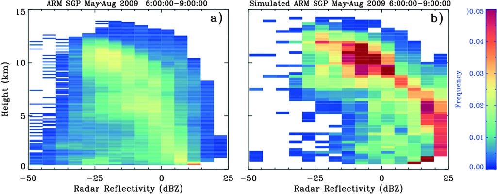
A 2018 paper described a ground-based cloud-radar simulator that compares how clouds are represented in a climate model based on ARM observations. (Xie was a co-author.) The idea is to improve the comparison between modeled clouds and cloud observations.
“There is a tie-in with satellites,” says Mather. “Simulators are used to compare a model’s output to either ground-based observations or satellite observations.”
ARM was also involved in developing an instrument simulator for its radars and lidars. The Cloud-resolving model Radar SIMulator (CR-SIM) enhances high-resolution models by using model outputs to emulate what observed remote-sensing data might look like.
As part of the Decadal Vision, ARM is looking for other instrument-simulation priorities and opportunities.
Also, ARM is exploring Observing System Simulation Experiments (OSSEs), which are used extensively to assimilate new measurements into forecasting models.
“In an OSSE, virtual observations are made on model output,” says Mather. “Analysis of those virtual observations is used to guide real observations.”
ARM does not use OSSEs yet, he adds, but envisions combining them with high-resolution models―for example, to gain insight into where to emplace field campaign instruments or how to configure flight patterns for research aircraft.
Leverage Long-Term Data
The Decadal Vision document lays out another way to improve the movement of measurements to models: Leverage the power of long-term data sets from ARM’s three fixed atmospheric observatories.
In 30 years, for instance, the SGP has collected continuous measurements on temperature, wind speed, humidity, solar radiance, and other factors that are critically important to weather and climate.
Such data exceed the value of measurements from short-term field campaigns. After all, instruments at the SGP observe many types of meteorological events many times over. With the right metadata and accessibility, such data could help models determine how these phenomena appear in models.
Data sets this long, from climate-critical areas of the world, hold great appeal to the modeling community.
That makes it important to improve the connection between ARM data and modelers.
The Decadal Vision action steps are just a start, says Mather. “In the coming years, we will also identify other mechanisms.”
Follow Us:


Keep up with the Atmospheric Observer
Updates on ARM news, events, and opportunities delivered to your inbox
ARM User Profile
ARM welcomes users from all institutions and nations. A free ARM user account is needed to access ARM data.


