

ARM’s Radar Network Evolves to Serve Research
Published: 22 June 2020
New paper explores history of ARM’s radar effort—and what might be next
Since 1992, radars have been a big part of the Atmospheric Radiation Measurement (ARM) user facility’s observing capability. Yet ARM’s impressive radar network—now more than 20 worldwide—has changed significantly to continue supporting cutting-edge cloud and precipitation science.
In a May 2020 article published online by the Bulletin of the American Meteorological Society (BAMS), ARM radar experts detail the history of ARM’s radar effort. The article also summarizes a recent decadelong push to transform ARM’s sites from cloud measurement locations into three-dimensional cloud and precipitation observatories.
Lead author Pavlos Kollias of Brookhaven National Laboratory and Stony Brook University in New York has been deeply involved in radar meteorology, especially with ARM, since his doctoral studies. He says the trigger for ARM’s radar transformation was “the need to observe both clouds and precipitation over a large domain to capture their organization and evolution as one integrated system.”
To achieve that stretch goal, ARM overcame operational, maintenance, and calibration challenges with inspired practicality. For example, the paper notes two unique strategies developed by ARM radar operations to calibrate remotely sited systems: lightweight, field-deployable millimeter-wave calibration/measurement kits and use of triangular corner reflectors as simulated aiming targets.
ARM also pioneered a new paradigm for radar deployment under diverse, trying conditions. This new methodology involves merging the expertise of engineers and scientists from the weather, climate, and radar communities to develop innovative sampling strategies and retrieval techniques. The authors say that the payoff has been significant progress toward providing the all-inclusive, multiscale observations of clouds and precipitation required to constrain models.
A Wide-Ranging Radar Collection
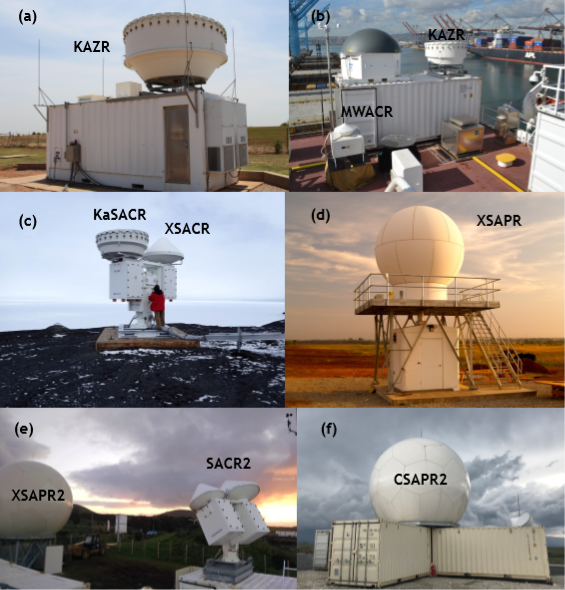
ARM’s current radar array includes millimeter- and centimeter-wavelength units installed from the Arctic to the tropics. These provide comprehensive measurements of clouds and precipitation as well as rich data sets on storm microphysics and dynamics.
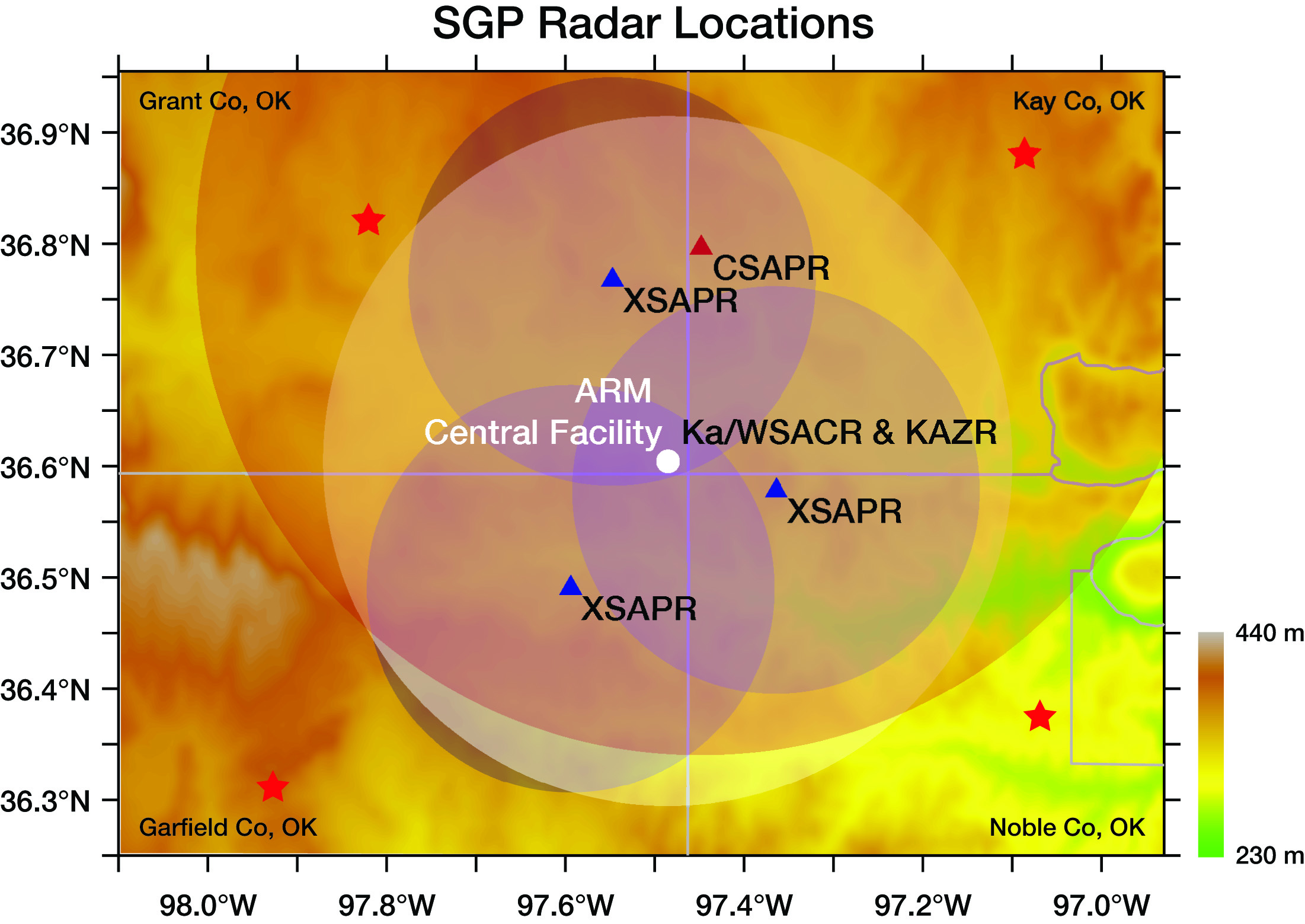
Each ARM site has a unique complement of radars. For example, the flagship Southern Great Plains atmospheric observatory in Oklahoma hosts a Ka-Band ARM Zenith Radar (KAZR), a Ka-/W-Band Scanning ARM Cloud Radar (Ka/WSACR), three X-Band Scanning ARM Precipitation Radars (XSAPRs), and a C-band SAPR (CSAPR). This distributed radar network samples precipitation and clouds from shallow cumulus to severe convective cells.
The authors of the BAMS paper say that ARM now offers unprecedented diversity in radar wavelength and detection capabilities. However, they add that more work lies ahead to realize the radar network’s full potential, including synergy with other observations and data-model integration, and working through additional operations and maintenance challenges.
Follow Us:


Keep up with the Atmospheric Observer
Updates on ARM news, events, and opportunities delivered to your inbox
ARM User Profile
ARM welcomes users from all institutions and nations. A free ARM user account is needed to access ARM data.


