

Chasing Aerosols and Atmospheric Rivers
Published: 23 January 2015
ARM Cloud Aerosol Precipitation Experiment (ACAPEX) sets sail and takes flight
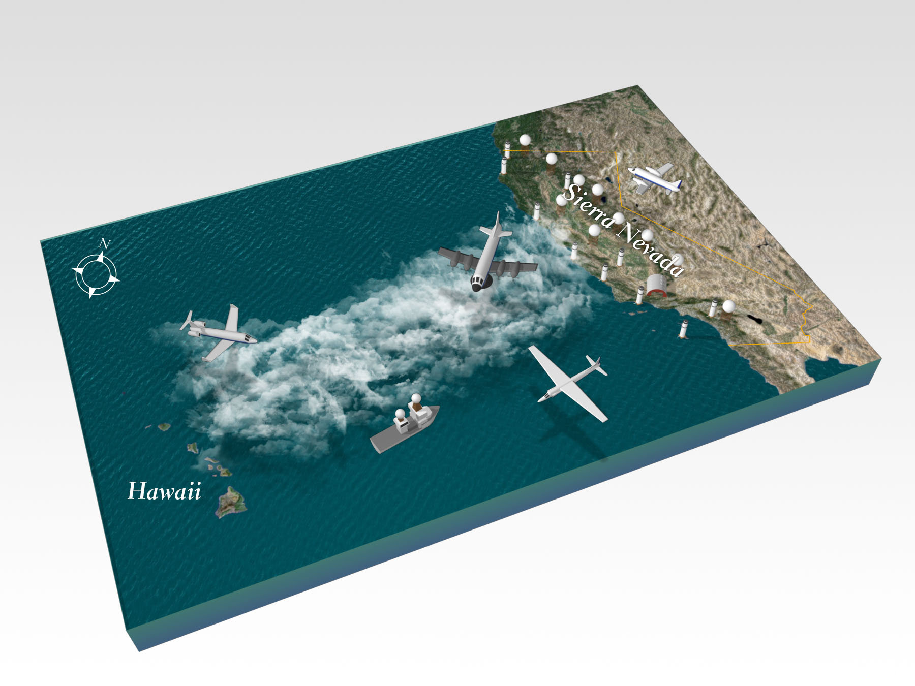
Over the next six weeks during ACAPEX, DOE’s second ARM mobile facility (AMF2) and ARM Aerial Facility (AAF) will be collecting data to improve computer models that predict extreme events in a changing climate. Collaborating with the National Oceanic and Atmospheric Administration (NOAA) field campaign called CalWater2, ACAPEX includes instruments on a NOAA ship traversing the Pacific Ocean in search of atmospheric rivers and on a DOE-sponsored plane flying into clouds over land and sea.
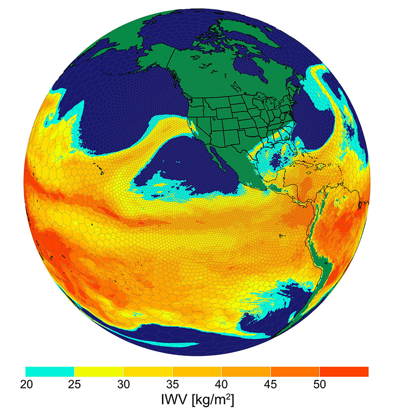
“We are collecting these data to improve computer models of rain that represent many complex processes and their interactions with the environment,” said Pacific Northwest National Laboratory’s Ruby Leung, lead scientist for ACAPEX. “Atmospheric rivers contribute most of the heavy rains along the coast and mountains in the West. We want to capture those events better in our climate models used to project changes in extreme events in the future.”
In a typical winter, a few atmospheric rivers account for 30-50% of the annual perception in California. With more accurate modeling of atmospheric rivers, scientists can improve understanding and predictions of climate changes that affect specific regions of the globe. Researchers are looking for new insights into how precipitation processes associated with atmospheric rivers can also be influenced by different sources of aerosols particles.
lead to.
The team will be at the mercy of the weather during the next few weeks. When an atmospheric river forms, researchers will sail the research ship to follow it and collect data. Four aircraft—the NOAA WP-3D and G-IV, the National Aeronautics and Space Administration (NASA) ER-2, and the DOE-sponsored Gulfstream-1 (G-1)—will also be launched and coordinated to collect data through the clouds at various elevations by flying in stacked formations.
NOAA’s research vessel Ronald H. Brown was launched in the Pacific Ocean on January 15, 2015, with the AMF2 installed on board. The G-1, operated by the ARM Aerial Facility, also took its first liftoff out of Sacramento, California, where it is making routine flights over the Sierra Nevada Mountains and coastal California and over the AMF2 on the Ron Brown as it nears San Francisco and Bodega Bay, California.
For more information, see the Scripps’ press release and PNNL’s press release.
# # #
The ARM Cloud Aerosol Precipitation Experiment is sponsored by the U.S. Department of Energy through the Office of Science’s Office of Biological and Environmental Research and an integral part of CalWater 2015. CalWater 2015 is an interagency, interdisciplinary field campaign combining the resources of CalWater2 and ACAPEX. The CalWater 2015 research team includes scientists from Scripps Institution of Oceanography at University California, San Diego, the Department of Energy’s Pacific Northwest National Laboratory, NOAA, and NASA.
The ARM Climate Research Facility is a national scientific user facility funded through the U.S. Department of Energy’s Office of Science. The ARM Facility is operated by nine Department of Energy national laboratories.
The ARM Climate Research Facility is a DOE Office of Science user facility. The ARM Facility is operated by nine DOE national laboratories, including .
Follow Us:


Keep up with the Atmospheric Observer
Updates on ARM news, events, and opportunities delivered to your inbox
ARM User Profile
ARM welcomes users from all institutions and nations. A free ARM user account is needed to access ARM data.


