

Power Your Research with ARM
The U.S. Department of Energy’s Atmospheric Radiation Measurement (ARM) User Facility provides 30-plus years of atmospheric measurements, including data sets from all seven continents and five oceans, to advance the understanding of the Earth’s atmosphere.
Access ARM Data
ARM collects continuous measurements and develops data products that promote the advancement of earth system models.
New to ARM?
As a U.S. Department of Energy Office of Science user facility, ARM makes its data freely available to scientists around the world.
Use ARM Facilities for Your Research
Coast-Urban-Rural Atmospheric Gradient Experiment
1 December 2024 - 30 November 2025 View All CampaignsExplore the ARM Observatories
Discover ARM's Capabilities

Read the Latest from ARM
Features
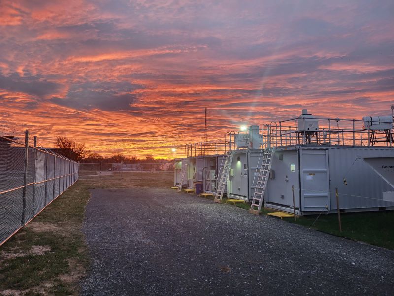
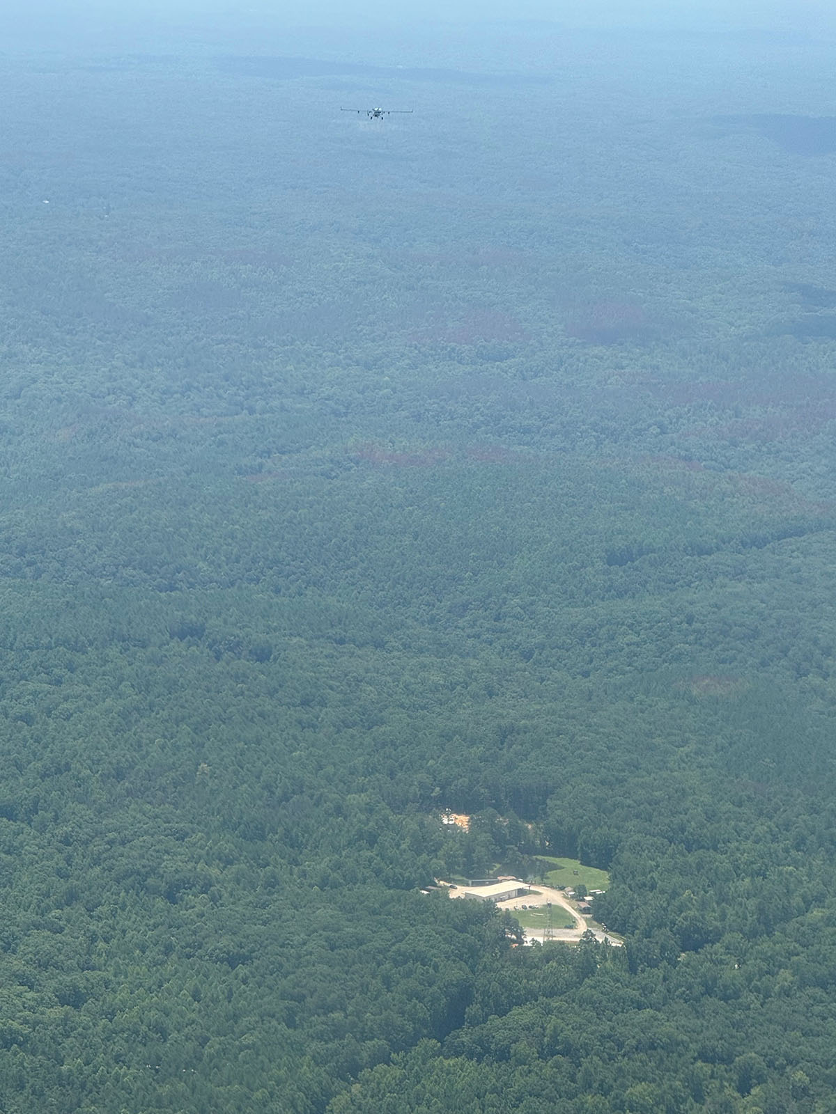
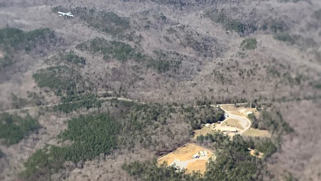
Bankhead National Forest Observations Are Reaching Full Speed
Continuous data and measurements from recent intensive operations, including ArcticShark uncrewed aerial system flights, are available from ARM’s atmospheric observatory in Alabama.
Welcome to the New-Look ARM.gov!
ARM.gov has gotten a refresh after more than eight years with its previous look. Peruse the site's new features!
Busy at Bankhead
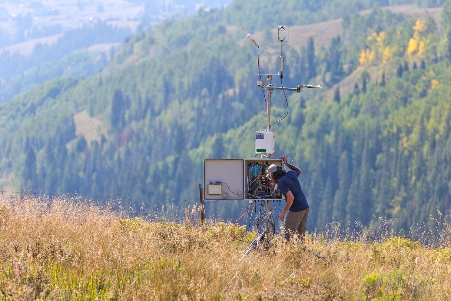
More instruments are going up at ARM’s newest long-term atmospheric observatory, and science activity is increasing.
Data Announcements
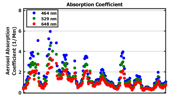
Aerosol Optical Properties Data Produced for 2 Ongoing ARM Deployments
The Aerosol Optical Properties (AOP) value-added product is now available for ARM’s Bankhead National Forest atmospheric observatory in Alabama and the Coast-Urban-Rural Atmospheric Gradient Experiment (CoURAGE) in the Baltimore, Maryland, area.
New ARM Trajectory Data Now Available for Evaluation
The multipurpose ARM trajectory (ARMTRAJ) value-added product now consists of six trajectory data sets to support atmospheric research using ARM data.
New Cloud Optical Properties Data Released
This value-added product generates cloud optical depth for overcast liquid clouds using ARM multifilter rotating shadowband radiometer measurements.
Research Highlights
Seasonality and albedo dependence of cloud radiative forcing in the upper Colorado River basin
The hydrologic cycle is strongly influenced by the balance of sunlight and thermal radiation on the ground or snow surface. We quantify the combined impacts of clouds and snow cover on the surface radiative energy balance in a high-elevation region of the upper Colorado River basin. Since snow is bright and reflects sunlight, our results demonstrate that the surface energy balance will become increasingly sensitive to cloud cover as snow cover declines.
New parameterizations to connect aerosol phase state with their ice nucleation abilities
We combined laboratory experiments, modeling, and field data to demonstrate that organic aerosols may significantly contribute to the formation of ice clouds in certain atmospheric regions.
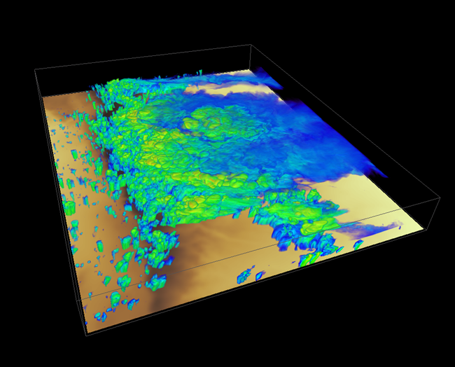
AI-based classification of marine cloud cell patterns from ARM radar
Marine stratocumulus clouds often organize into mesoscale cellular convection (MCC), forming large-scale open or closed cell patterns. However, Earth system models struggle to simulate these regimes due to limited observations and understanding of physical processes. In this study, researchers at Pacific Northwest National Laboratory applied an artificial intelligence/machine learning (AI/ML) approach to analyze long-term vertically pointing cloud radar data from the Atmospheric Radiation Measurement (ARM) user facility’s Eastern North Atlantic (ENA) site. The method enables continuous time series of MCC classification, performs well, and reveals clear cloud and meteorological differences between the two MCC types. It also holds great potential for application to other ARM locations.
Follow Us:


Keep up with the Atmospheric Observer
Updates on ARM news, events, and opportunities delivered to your inbox
ARM User Profile
ARM welcomes users from all institutions and nations. A free ARM user account is needed to access ARM data.


