

Bankhead National Forest Observations Are Reaching Full Speed
Published: 17 July 2025
2025 operations marked by achievements, challenges, new capabilities
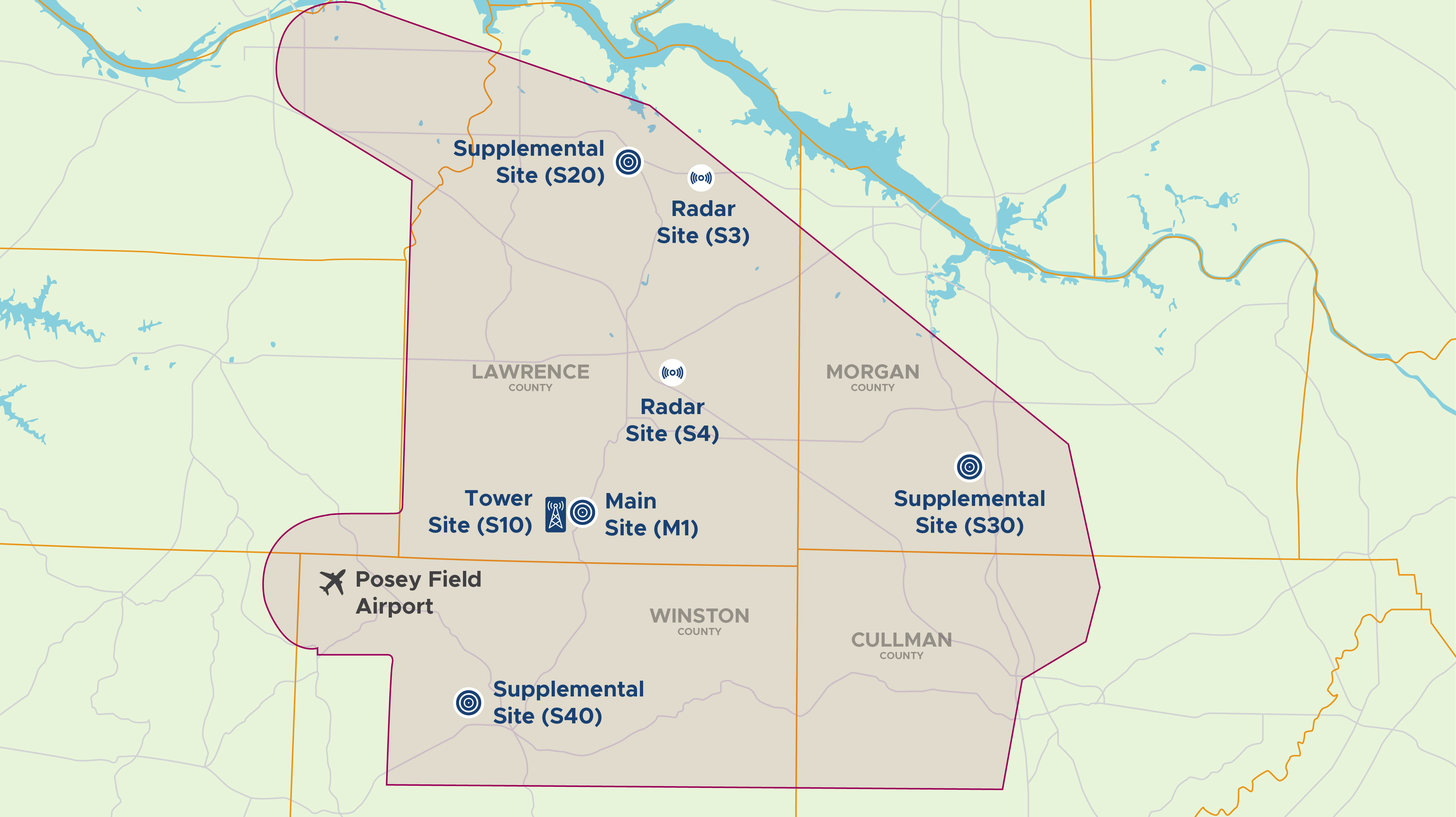
Since October 2024, the U.S. Department of Energy’s (DOE’s) Atmospheric Radiation Measurement (ARM) User Facility has collected continuous atmospheric data at its new forest observatory in northern Alabama. These data and additional measurements from recent intensive operations are available in the ARM Data Center.
The data from ARM’s Bankhead National Forest (BNF) atmospheric observatory are being used by researchers to study clouds, aerosols, and land-atmosphere interactions. The research will ultimately improve earth system models, providing critical information to strengthen the resilience of the nation’s energy infrastructure.
Period of Prolific Observations
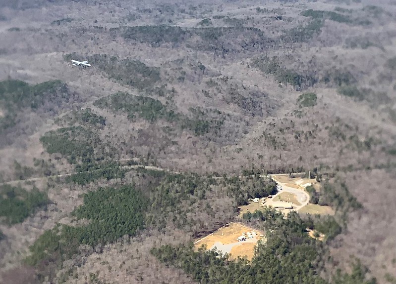
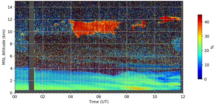
In March 2025, an intensive operational period (IOP) at the BNF surpassed expectations and demonstrated the performance of ARM’s cutting-edge observational technologies from the ground to the sky.
ARM staff, including scientists, engineers, and technicians, executed a large-scale deployment of advanced atmospheric instruments, capturing high-quality data sets and making them available to the research community in the ARM Data Center.
ARM deployed its ArcticShark uncrewed aerial system and tethered balloon system (TBS), supplemented by the BNF’s ground- and tower-based instruments. This multi-platform approach, says BNF Site Science Team Lead Chongai Kuang of Brookhaven National Laboratory in New York, is essential to improving understanding of atmospheric processes over forested regions.
The BNF data will also be useful for refining models needed to better understand conditions in the atmosphere that could affect the nation’s energy supply.
Mission Accomplished
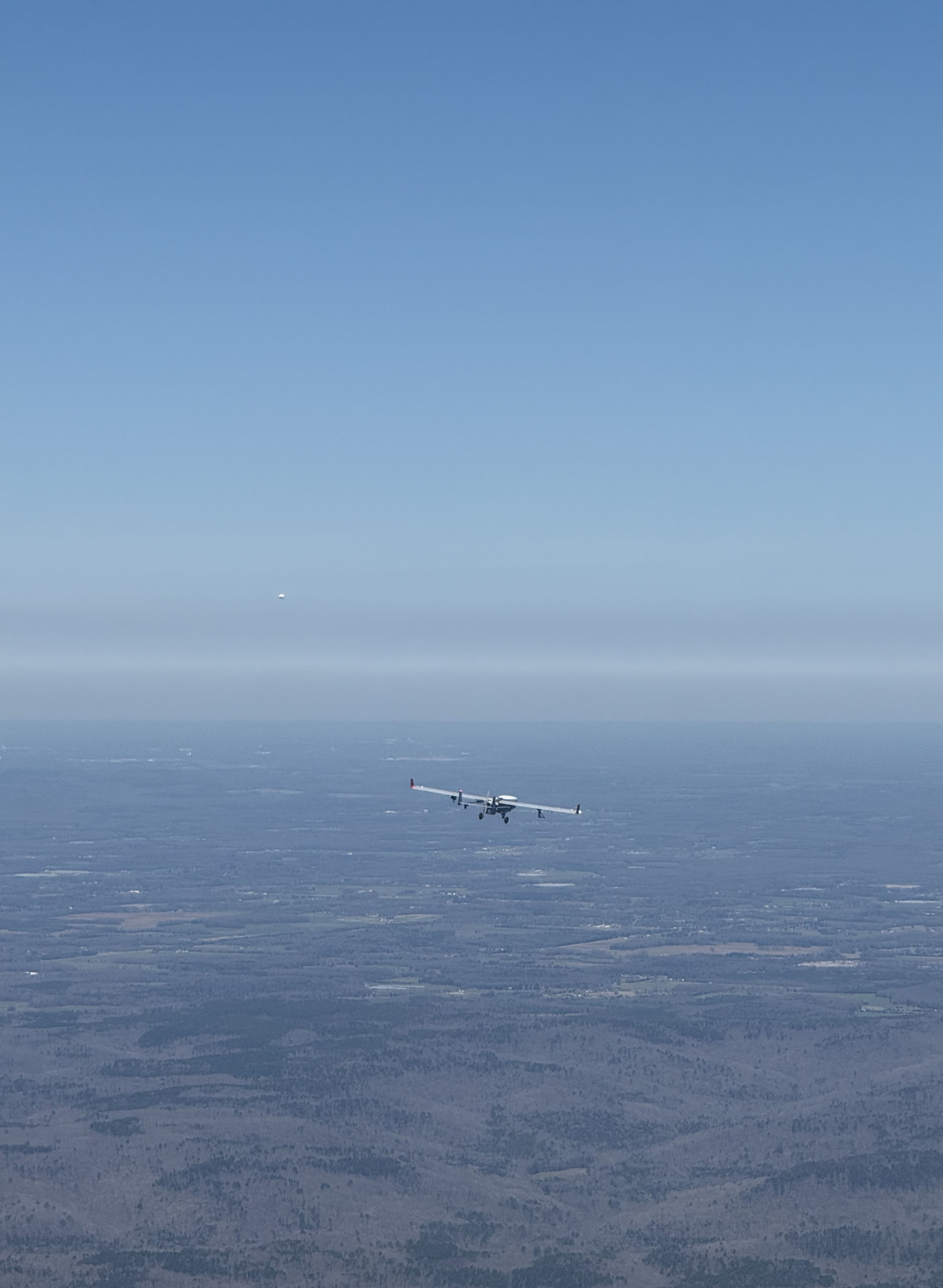
Despite high winds and storms, the ArcticShark completed over 32 hours of flight time, surpassing its summer 2024 deployment in the BNF area by 12 hours.
For two days, the ArcticShark and ARM’s TBS worked together above the forest’s dense hickory, oak, and pine tree canopy. It was the first time the ArcticShark and TBS operated simultaneously during the same deployment.
Keeping a safe distance of 2 nautical miles (3.7 kilometers), the ArcticShark flew a square pattern around the TBS at different altitudes while the TBS collected comprehensive vertical data.
The ArcticShark can fly up to 18,000 feet (5,500 meters) and carry 100 pounds (45.4 kilograms) of scientific instruments. Instruments on the ArcticShark for the March flights included a miniaturized scanning electrical mobility sizer (mSEMS) and a portable optical particle spectrometer, enabling detailed particle size distribution observations.
The TBS was also fitted with an mSEMS. On the ground, a larger ARM instrument, the scanning mobility particle sizer, collected additional comparative data.
“We were studying new particle formation from the gas phase,” says ARM Aerial Facility Manager Beat Schmid. “Together, the ArcticShark, TBS, and ground observations help us determine whether aerosol formation occurs on the ground, at an intermediate altitude, or at the top of the boundary layer.”
Initial observations indicate that new particles were forming at the top of the boundary layer, which is the lowest part of the atmosphere directly influenced by the Earth’s surface. This is a detail that ground instruments alone would have missed.
New Instrument Tested
The March IOP flights also introduced a new instrument, the Fast Water and Spectroscopic Temperature Instrument (FWASTI), to the ArcticShark’s growing list of measurement capabilities. DOE’s Small Business Innovation Research (SBIR) program supported development of the FWASTI.
ARM engineers closely monitored the data quality with the staff from Nikira Labs on each flight. They found that the FWASTI had a “noise issue” with these test flights, making it not yet ready to provide high-frequency data. Once fully calibrated, the new instrument will provide data on humidity and condensation near clouds—important information for understanding the physics of cloud formation and improving earth system models.
Weather Disrupts June ArcticShark Flights
ARM’s ArcticShark returned to northern Alabama in June for a user-led field campaign, Characterizing HEterogeneous Land-Atmosphere eXchanges at BNF (CHELAX-BNF).
Led by Timothy Juliano (formerly at the National Science Foundation National Center for Atmospheric Research and now a data scientist at AiDASH), CHELAX-BNF was the first user-driven ArcticShark campaign over the BNF.
The planned flight days were dominated by low clouds and severe weather, including heavy rain. Unless operated in special-use airspace, under current FAA rules, the ArcticShark must maintain prescribed distances from clouds. Schmid describes the conditions in two words: “very difficult.” The combination of weather and other operational challenges limited the ArcticShark to just 12.7 flight hours in June.
During its March and June BNF flights, the ArcticShark carried instruments that measured humidity, temperature, trace gases, aerosols, and surface reflectivity. These factors affect cloud formation and precipitation patterns.
ArcticShark data from the March and June flights are in the ARM Data Center.
The TBS also returned to the BNF and collected data in May and June, but this time, it did not fly simultaneously with the ArcticShark.
Scaling New Heights
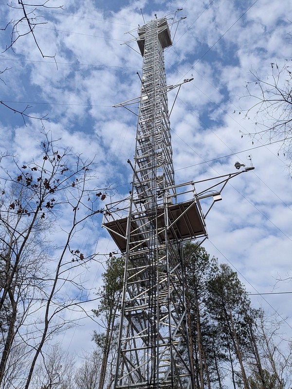
While ARM aerial platforms soared, ARM staff also focused on a new BNF vantage point—a 140-foot (42.7‑meter) instrumented walk-up tower.
A key component of the BNF observatory, the tower is outfitted at multiple heights with cutting-edge instruments that provide measurements to help scientists improve the simulation of two-way interactions between surface vegetation, moisture, clouds, and aerosols (including biogenic or natural aerosols) in earth system models.
Among the high-resolution instruments on the tower, Kuang highlights the distributed temperature sensing technology as particularly noteworthy. This technology, which typically flies on the TBS, is installed on each leg of the tower.
“It nicely shows the evolution of vertically resolved temperature profiles throughout the day—from sunset into the evening and then sunrise,” says Kuang.
The tower’s multi-level instrumentation suite also includes meteorological sensors, infrared thermometers, and photosynthetically active radiation sensors that measure forest ecosystems’ role in earth system dynamics.
ARM users can access data from the tower-based instruments in the ARM Data Center.
New Lidar Capability
Back on solid ground, ARM staff deployed a state-of-the-art high-spectral-resolution lidar (HSRL) at the BNF to improve the study of biogenic aerosols.
Kuang says this new infrared HSRL, the first of its kind, provides more detailed observations than ever of aerosol properties throughout the atmospheric column.
Biologically derived aerosols, which include pollen, spores, microbes, and those formed from organic compounds released by plants, play a crucial role in cloud formation. Understanding how these particles reflect and absorb sunlight requires precise vertical profiling—a task well suited for the newly installed HSRL.
The instrument’s 1064-nanometer infrared channel, developed by researchers at the University of Wisconsin, significantly enhances the range of aerosol and cloud parameters that can be measured from the ground. This will help scientists better describe the types and properties of aerosols and assess how forested regions influence the atmosphere.
Data from the HSRL are expected to be available in the ARM Data Center in July.
Follow Us:


Keep up with the Atmospheric Observer
Updates on ARM news, events, and opportunities delivered to your inbox
ARM User Profile
ARM welcomes users from all institutions and nations. A free ARM user account is needed to access ARM data.


