

Science Workshop Outlines a TRACER Future
Published: 27 June 2023
Researchers gather in Texas and online to share data, preliminary results, collaborations, and next steps from the Houston-focused ARM campaign
To gain the most from an atmospheric science field campaign, it is important to reflect on what happened, its meaning, lessons learned, and what remains to be done.
Take TRACER, for example, which you may know as the TRacking Aerosol Convection interactions ExpeRiment of 2021 and 2022.
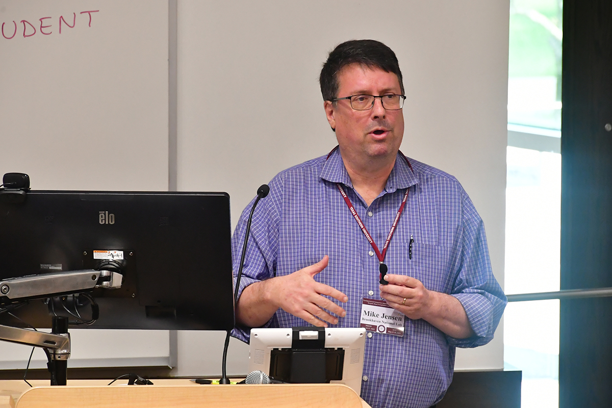
In May 2023, TRACER’s lead scientist, Michael Jensen, a meteorologist at Brookhaven National Laboratory in New York, convened a two-day TRACER Science Workshop for researchers to share campaign data, preliminary results, future research plans, and collaborations.
Funded by the U.S. Department of Energy (DOE), TRACER was an international, multi-agency investigation of how storms evolve in coastal Texas.
DOE’s Atmospheric Radiation Measurement (ARM) user facility provided the core instruments for the yearlong campaign.
About 150 field participants from 45 institutions fanned out to more than 10 fixed and mobile observation sites. Those numbers include an array of smaller sister campaigns, which joined this grand coordinated effort to measure the complex alchemy of factors that can affect the formation, growth, intensification, and dissipation of convective systems.
Sister Campaigns
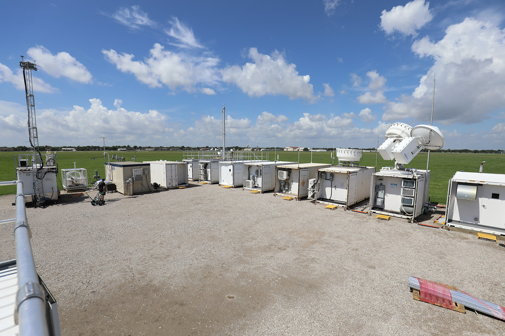
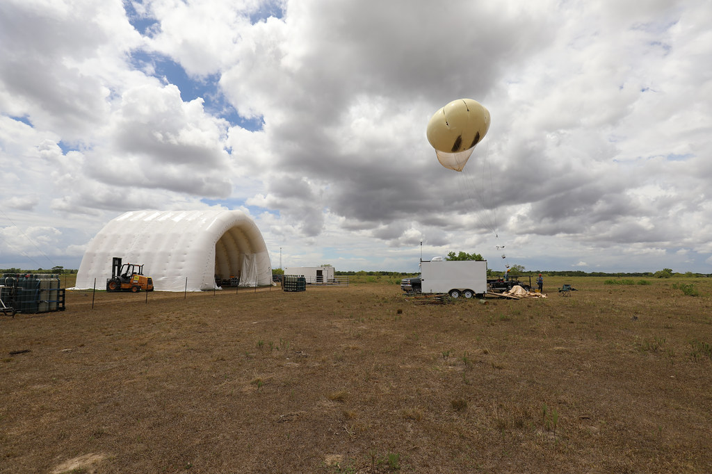
Researchers from TRACER’s sister campaigns, often from universities and national laboratories, deployed surface instruments, truck-mounted gear, tethered balloon systems, fleets of radiosondes, and uncrewed aerial systems.
During TRACER’s 395 operational days, sounding launches―from both the ARM core measurements and these smaller campaigns―numbered 1,885.
DOE’s Atmospheric System Research (ASR) program funded many of the sister campaigns. ASR is now funding much of the scientific analysis following TRACER’s field deployment phase.
A major agency partner, NOAA, provided satellite assets, which measured reflected radiation over Houston, and meteorological data from its regional weather stations and coastal buoys.
Meanwhile, the National Science Foundation (NSF), NASA, and the Texas Commission on Environmental Quality oversaw complementary campaigns “at the same time and in the same area,” says Jensen.
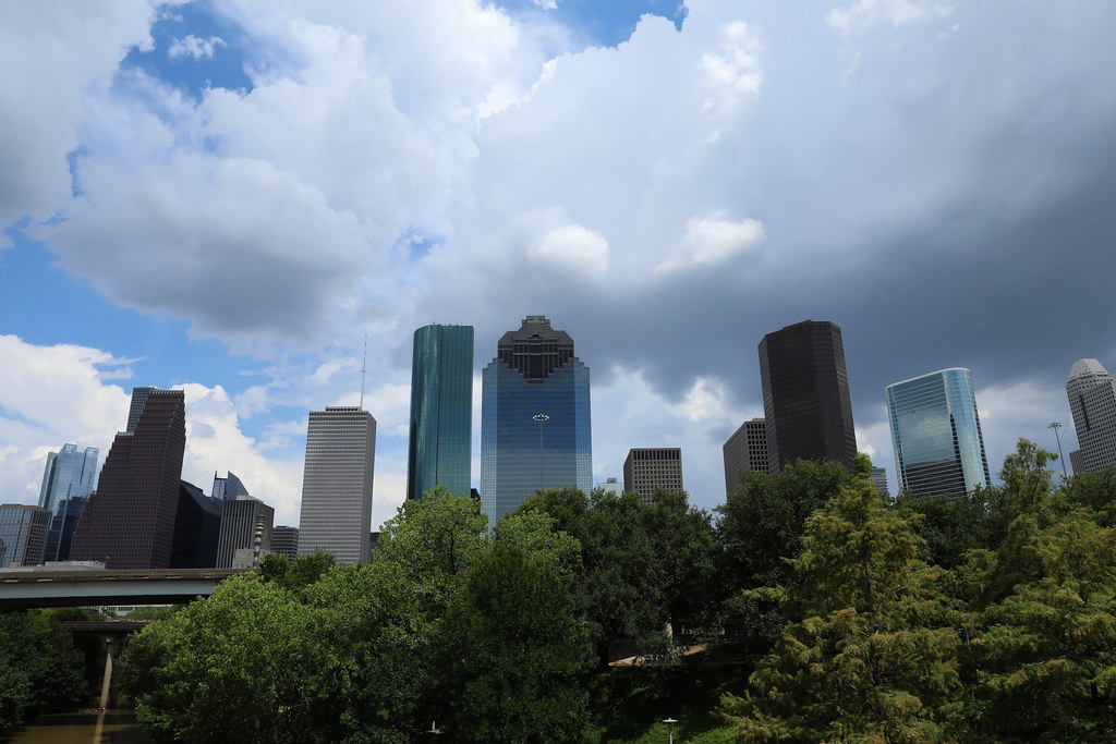
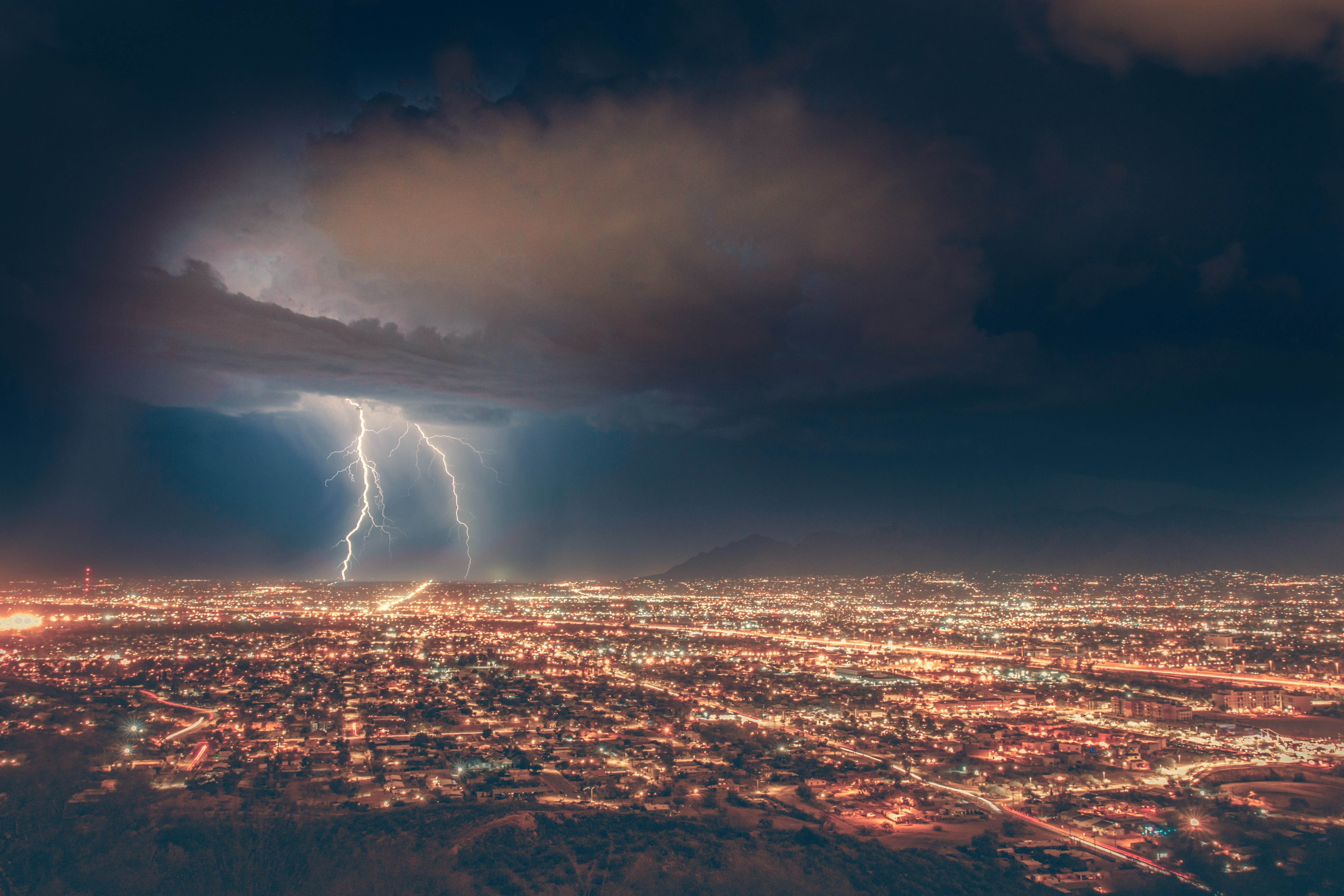
Central to it all was famously stormy Houston, with its intriguing regional mix of urban, rural, and marine atmospheric influences.
A Workshop’s Pause to Reflect
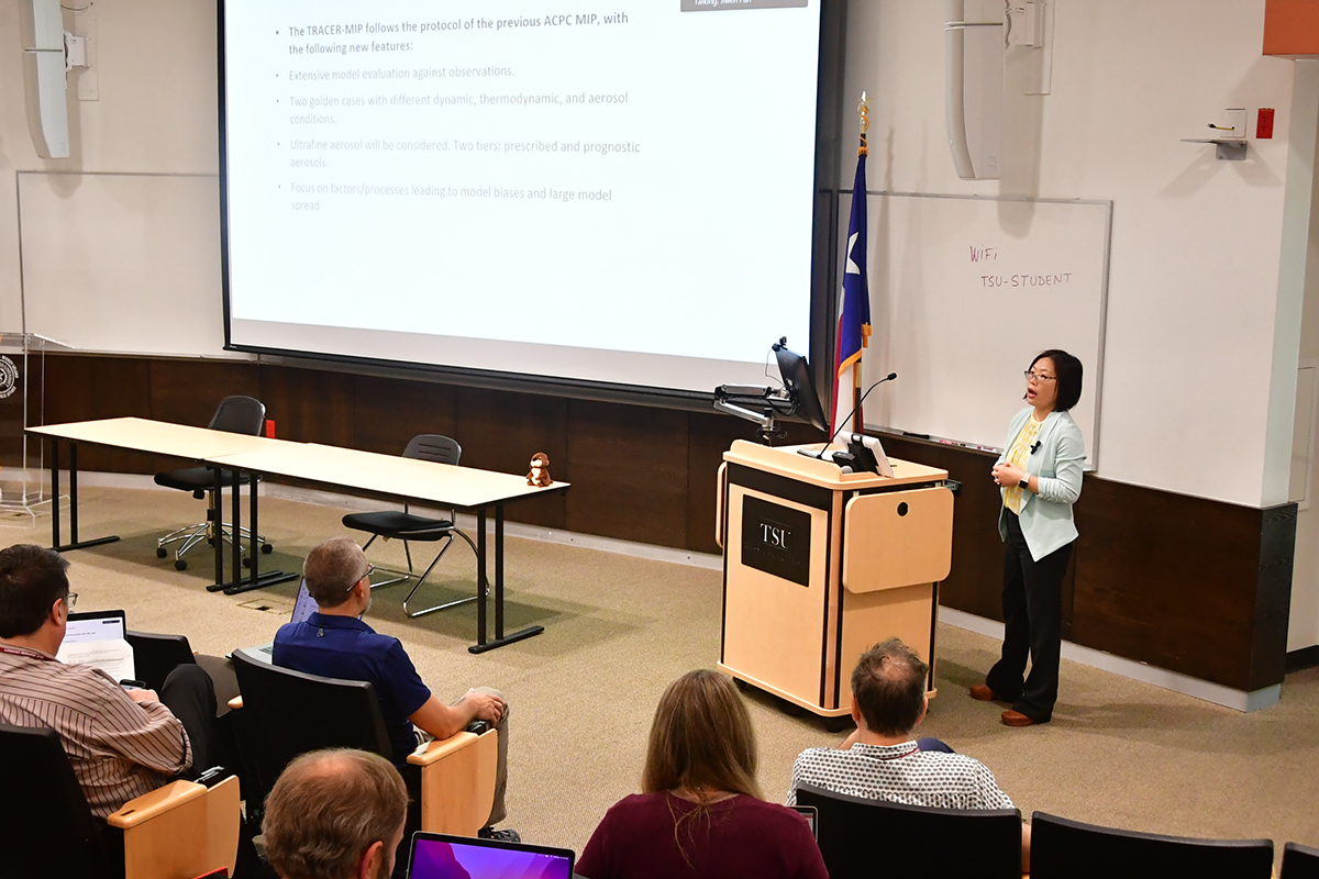
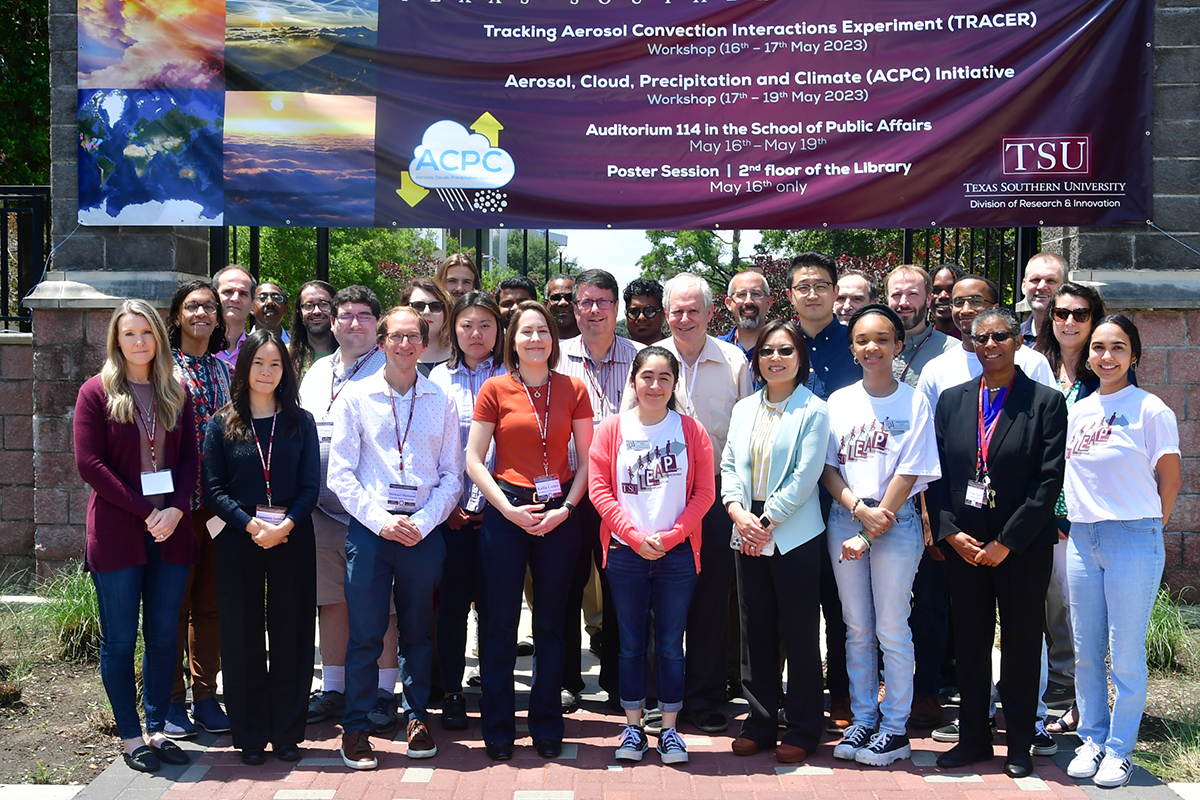
The May 16–17 TRACER workshop was hosted in Houston by Texas Southern University (TSU), one of the nation’s Historically Black Colleges and Universities.
Faculty and students from TSU’s College of Science, Engineering, and Technology contributed to TRACER measurement activities. They have continued collaborations with science team members on data analysis and modeling activities.
The in-person/virtual workshop overlapped with a complementary science workshop held by the Aerosol, Cloud, Precipitation, and Climate (ACPC) initiative, an international consortium of experts. It was ACPC working group research, dating back a decade, that inspired the need for a measurement campaign like TRACER.
Based on case-study simulations of Houston in June 2013, ACPC researchers such as Sue van den Heever (Colorado State University) and Ann Fridlind (NASA Goddard Institute for Space Studies) recognized the imperative to provide detailed, targeted, and high-resolution observations of how localized aerosol sources affect the prevalence of isolated deep convection.
Fridlind also led a 2019 paper that framed the statistically likely summer weather in the Houston region.
Both van den Heever and Fridlind are veterans of DOE-supported research.
Jensen and others, with TRACER observations tucked into databases, see the campaign as a key to unlocking the puzzle of a worldwide reality of risk: big storms common in coastal cities. Such storms bring needed rain but also periodic floods and other disasters.
TRACER Data Analysis
“It’s an extremely busy and exciting time for TRACER researchers right now.”
TRACER Principal Investigator Michael Jensen
“It’s an extremely busy and exciting time for TRACER researchers right now,” says Jensen.
It is so busy that TRACER’s burgeoning data—169 data products so far in the ARM Data Center—may require quarterly meetings for a time. Jensen says such meetings would provide “an opportunity for the science team to stay up to date on the latest data analysis and modeling activities, avoid duplicating efforts, and build new collaborations.”
At the very least, researchers grappling with TRACER’s data analysis and modeling phase will convene for a breakout session August 7 during the 2023 Joint ARM User Facility/ASR Principal Investigators Meeting in Rockville, Maryland.
Aerosols, Breezes, and Lightning
During the workshop, about two dozen scientists delivered 10-minute glimpses of their TRACER research. Twenty others showed off their work in a poster session at the TSU library.
Among other topics, presenters touched on storm-affecting aerosols, Gulf of Mexico sea breezes, diurnal cycles of coastal convection, isolated storm cells, new particle formation, and Houston-area lightning strikes.
A presentation on lightning by Eric Bruning of Texas Tech University outlined data from a “cross-Texas collaboration” that captured flash rates by day and hour. Bruning also identified “golden days” in June 2022 when radar tracked storm cells with lightning at close range.
With aerosols at the forefront of TRACER investigations, Brookhaven Lab’s Maria Zawadowicz took on the basics of what made up these tiny particles in the Houston region. Chemical composition is an important factor in how aerosols interact with water vapor and radiation to influence the life cycle of convective clouds.
The takeaway message, she says, pointing to a paper underway, is “the strong seasonal signal” in the observed aerosol concentrations. Summer air, for instance, is generally cleaner than in other seasons.
Black Carbon and Fine Dust
Some of those aerosols are linked to mixed black carbon—soot—and dust, according to presenter Allison Aiken of Los Alamos National Laboratory in New Mexico.
She is impressed with the richness of the TRACER data and how exciting intercomparisons will be. Data to consider are black-carbon events at night as well as modeling predictions of dust transported to Texas from the Sahara Desert.
Aiken led a TRACER-CAT (Carbonaceous Aerosol Thrust) campaign in July 2022. It investigated the composition of particles and how they influence light absorption and water uptake in clouds. She and her team are now busy identifying “dust episodes” that could help model the effect of dust on deep convection.
Some of these dust events involve the kind of ultrafine aerosol particles (less than 100 nanometers in diameter) investigated by University of California, Irvine, chemist Jim Smith and others.
Smith led ASR-funded research that used a barrel-like capture chamber in July and August 2022 to match particles with their gaseous precursors.
The many sources of ultrafine particles are hard to determine, says Smith, a “metaphorical cloud that’s over us now.”
A Collaborative Undercurrent
Most talks left time for questions. The most common was: How can I help? That is, the workshop awakened TRACER participants to new pathways of data sharing and collaboration.
Some collaborative activities were already in place by the time of the workshop.
For one, the American Meteorological Society is planning a collection of journal articles on TRACER.
And Stephen Saleeby, a cloud processes specialist in van den Heever’s research group at Colorado State, talked about an upcoming ACPC TRACER model intercomparison project. It will build upon previous ACPC work comparing how aerosol-convection interactions are represented in seven state-of-the-art cloud-resolving models.
Detailed measurements from TRACER will help inform the simulations and evaluate the results.
There is a push to get additional modeling groups from ASR and the larger community into this intercomparison study.
The Role of Forecasting
The May workshop also offered a look behind TRACER’s operational curtain, which included 181 ARM weather forecast briefings.
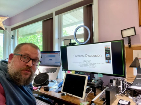
Forecasting during the campaign “is actually the subject of a paper being written by part of the team,” says Scott Collis of Argonne National Laboratory in Illinois, referring to a study led by Brookhaven Lab’s Sid Gupta and Aryeh Drager.
Collis was part of TRACER’s Houston-based forecasting team in June 2022.
Such daily weather checks, he says, “made the best use of ARM resources. There were several assets that had a limited number of days they could be used,” including mobile observation teams that could not deploy every day.
Supplied with timely weather forecasts, says Collis, “mission scientists could decide what days should have enhanced observations―conditions most ripe for TRACER science.”
To get ready, Collis and others participated in a three-week pre-TRACER forecasting exercise during June and July 2020.
Space-Sky-Surface Intercomparisons
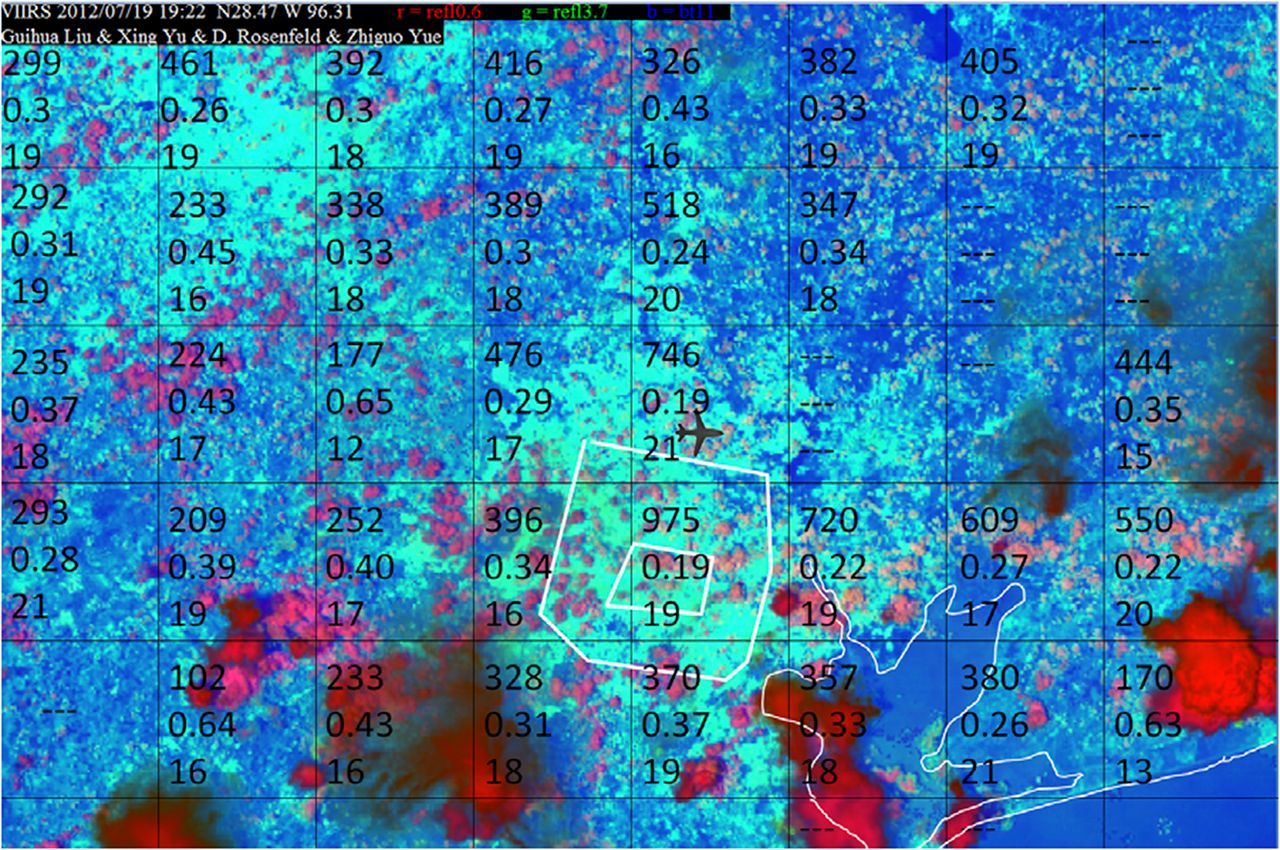
Workshop presenter Daniel Rosenfeld of the Hebrew University of Jerusalem led a 2016 paper on cloud condensation nuclei (CCN) and cloud-base updraft velocities in the Proceedings of the National Academy of Sciences (PNAS). This paper was one in a series of articles by ACPC researchers that led to TRACER.
Rosenfeld pointed to one satellite image from the study as “the picture that motivated TRACER.”
The color composite image includes retrievals of CCN concentrations, supersaturation, and cloud base temperature.
At the time of the image, clean, unstable air masses flowed northward from the Gulf of Mexico. Of note is a near tripling of the CCN concentrations over the Houston metropolitan area.
Rosenfeld’s CCN-cloud microstructure work is a good example of a TRACER leitmotif: the fruitful synergy of satellite, surface, and aircraft observations.
He overlaid his satellite data retrievals with measurements from an aircraft used during an NSF-funded sister campaign called the Experiment of Sea Breeze Convection, Aerosols, Precipitation, and Environment (ESCAPE). In addition, surface radar picked up a mix of clean, partly clean, and polluted cloud cells.
Presenter Greg McFarquhar of the University of Oklahoma says ESCAPE came away with “a unique set of high-quality data” that will spin off insights into how updraft dynamics, meteorology, and aerosols affect cumulus development.
However, he says that the vertical velocities of cloud-critical updrafts—an early ACPC focus—are still complicated to analyze.
Pavlos Kollias, a Stony Brook University professor and Brookhaven Lab scientist, delivered a look at convective storm-cell tracking. It involved a combination of ESCAPE aircraft, surface observatories, and radar, including a second-generation C-Band Scanning ARM Precipitation Radar in the town of Pearland.
The result of this “most important” NSF-ARM collaboration, he says, was the largest database so far on isolated convective cells. Many were tracked in near-real time thanks to a new algorithm.
Rosenfeld, pleased by all this complementary data from ESCAPE, looks forward “to intercomparing measurements. That’s the whole idea here.”
On the Street, on the Water
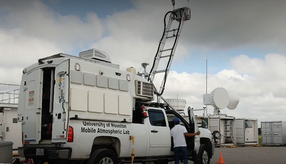
TRACER co-investigator James Flynn, a research associate professor at the University of Houston, presented an overview of another sister campaign, TRACER-AQ (Air Quality), a joint effort with NASA and the Texas Commission on Environmental Quality.
It was a good example of how smaller-scale, university-based fieldwork, when paired with bigger collaborators, can collect important data from a wide array of low-tech platforms. One main target of TRACER-AQ was ozone, its precursor chemicals, and its photochemical evolution over water.
Flynn directed an observing system that included a quadcopter uncrewed aerial system and other airborne assets, land instruments, equipment mounted on a University of Houston truck, and a mobile air quality laboratory nicknamed “the Baylor trailer.”
He also oversaw ozonesondes launched over water from four small watercraft in 2021 and 2022. About 600 square miles of Galveston Bay, he points out, are normally without any air-quality monitors.
One of the boats will remain in dock as a stationary coastal monitoring site. And a new University of Houston truck-mounted lab may be dispatched in 2024 to supplement ARM instruments at its new Bankhead National Forest observatory in Alabama, slated to open in fall 2023.
Mapping Aerosols
Flynn’s air, surface, wheeled, and seaborne research platforms illustrate that TRACER was often a showcase for early career scientists whose instruments hit the road in a variety of ways.
A team led by Rebecca Sheesley, a volatile organic compounds researcher at Baylor University, deployed a mobile air quality laboratory to five sites across the Houston metroplex. One of the sites was an urban forest. Another was next to ARM’s main TRACER site in the Houston suburb of La Porte.
The deployment team included a number of postdoctoral researchers and graduate students who were critical to the success of the campaign.
Sheesley says that the campaign, TRACER-MAP (Mapping Aerosol across Houston), will provide a “more nuanced vision” of air pollutant and aerosol distributions across the city―in part a map of how urban and naturally occurring emissions intersect.
TRACER-MAP also has collaboration in mind, says Sheesley. “We want to link the mobile air pollutant and aerosol data with TRACER data sets.”
Following Air Masses
“Early career scientists were major contributors in every facet of TRACER. … The experience gained gives them the foundation to someday lead the next big field campaign.”
Jensen
Milind Sharma, a postdoctoral research associate at Texas A&M University (TAMU), talked about the TRACER-TAMU field campaign, which over 39 days in the summer of 2022 paired an instrument trailer with radiosonde launches.
Researchers measured the variability of regional air masses while sea breezes pushed inland from the coast. They also used radar observations to track storm cells and thunderstorm characteristics.
In this way, says Sharma, the team got “a first look” at taller continental cells as clouds transitioned from shallow to deep.
TAMU graduate research assistant Seth Thompson described another TRACER-TAMU mobile asset: the university’s Rapid Onsite Atmospheric Measurements Van, which tracked maritime and continental air masses over nine days. The van included an aerosol inlet, condensation particle counter, lidar, and CCN counter.
TRACER-TAMU’s lead scientist, Anita Rapp, joined Sharma, Thompson, and others in laying out some preliminary results. Data will add to understanding the vertical distribution of CCN and ice-nucleating particles in air masses associated with deep convection initiated by sea breezes.
Like TRACER-MAP, the TAMU campaign showed the prevalence of early career researchers in a lot of TRACER’s sister-campaign fieldwork. Four faculty members and one research scientist took part in TRACER-TAMU. But they were outnumbered by 18 undergraduates, 10 graduate students, and two postdoctoral researchers.
“Early career scientists were major contributors in every facet of TRACER,” says Jensen, who added “a debt of gratitude for scientific results” that will come from collecting data, contributing to forecasts, and working on data analysis and modeling.
“The experience gained,” he adds, “gives them the foundation to someday lead the next big field campaign.”
Follow Us:


Keep up with the Atmospheric Observer
Updates on ARM news, events, and opportunities delivered to your inbox
ARM User Profile
ARM welcomes users from all institutions and nations. A free ARM user account is needed to access ARM data.


