

For Careful, Comprehensive COMBLE, It’s a Wrap
Published: 17 August 2020
After six months of collecting data on cold-air outbreaks in northern Norway, elated scientists are ready to wrestle with the data
COMBLE is over, but its rich data will now begin to take life.
That ear-pleasing acronym stands for Cold-Air Outbreaks in the Marine Boundary Layer Experiment, a field campaign supported by experts and instruments from the U.S. Department of Energy’s (DOE) Atmospheric Radiation Measurement (ARM) user facility.
COMBLE’s lead scientist is University of Wyoming atmospheric scientist Bart Geerts, who is busy coordinating next steps for a data set he calls “quite exciting.”
His 2018–2021 project with DOE’s Atmospheric System Research (ASR) includes a provision for analyzing data from COMBLE, a field campaign within a larger study of mixed-phase clouds in the polar marine boundary layer. (Such clouds are made of both liquid and ice.)
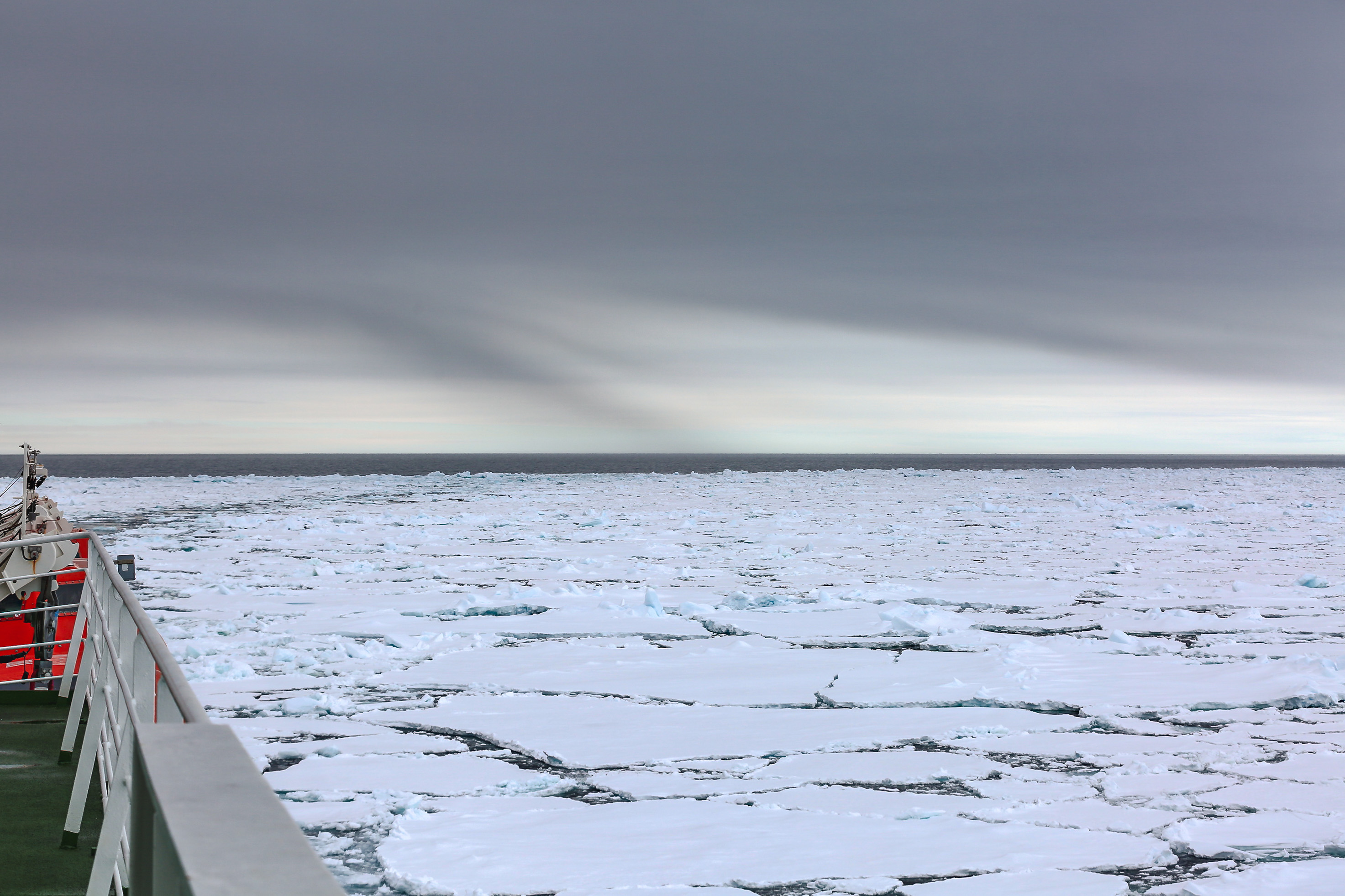
COMBLE’s science plan, formulated with 20 international collaborators, was to study cold-air outbreaks (CAOs) in the marine boundary layer to examine important but little-understood atmospheric processes. The campaign’s outdoor laboratory was a vast stretch of open water in the Norwegian Sea.
“We wanted to sample the arctic airmass, modified by this relatively warm sea, on the downwind shore as far north as we could go in Scandinavia,” says Geerts.
Across Open Water
“We’re very pleased to have the (cold-air outbreak) data set. This is the first time such a high-quality, comprehensive data set has been collected.”
Bart Geerts, principal investigator for the Cold-Air Outbreaks in the Marine Boundary Layer Experiment (COMBLE)
A cold-air outbreak happens when a mass of cold air from an edge of polar ice sweeps across an open area of warm water. Among other things, CAOs prompt the formation of shallow convective clouds, which then grow and evolve into a characteristic cloud regime that plays a key role in the Earth’s energy balance.
Shallow low clouds over the oceans have been extensively studied, but little is known about the properties of such clouds formed during CAOs or about related processes within the boundary layer. Key questions include: What controls the macrostructure of this cloud regime? What is the liquid/ice phase distribution in these clouds? And what is the role of cloud-active aerosols?
COMBLE will narrow those knowledge gaps.
The campaign started a month earlier than planned, in December 2019, and finished in late May 2020. It was on time, smoother than rough conditions warranted, and took CAO-related measurements of unparalleled quality over a longer time period than ever done before.
“We’re very pleased to have the (CAO) data set,” says Geerts. “This is the first time such a high-quality, comprehensive data set has been collected.”
‘A Hot Spot’
Geerts says previous CAO studies were brief and rely on just a few aircraft measurements.
COMBLE, on the other hand, has the duration, comprehension, and focus to observe marine CAO cloud regimes that occur predominantly in winter and early spring off the large boreal continents and the ice sheets of the Arctic and Antarctic. It also helps that CAOs have been observed in other recent campaigns, including the ARM-supported Measurements of Aerosols, Radiation, and Clouds over the Southern Ocean (MARCUS) campaign.
CAO cloud regimes are also sampled at ARM’s North Slope of Alaska atmospheric observatory in Utqiaġvik (formerly known as Barrow)―“but only for a short period in fall before the arctic sea ice covers the open water,” says Geerts.
He calls the Arctic Ocean in the North Atlantic, off the coast of Norway, “a hot spot for these cold-air outbreaks and clouds that develop over relatively warm water.”
During the campaign, researchers focused on shallow cloud processes over open water during CAOs. They were also on the lookout for other atmospheric phenomena, including air-sea exchange, cloud-organization patterns, the role of aerosols and surface environments, and the impact of CAOs on atmospheric and ocean circulation.
The backdrop for such research is dramatic: Temperatures in both the Arctic and neighboring boreal regions are rising twice as fast as anywhere else on the globe, a phenomenon known as arctic amplification. Boreal regions, mostly forest and bogs, trace a green line around the Arctic and include large areas of Russia, Scandinavia, and Canada.
An Early Start
To pull in the best CAO data, Geerts and his science-plan collaborators put the right instruments in the right places.
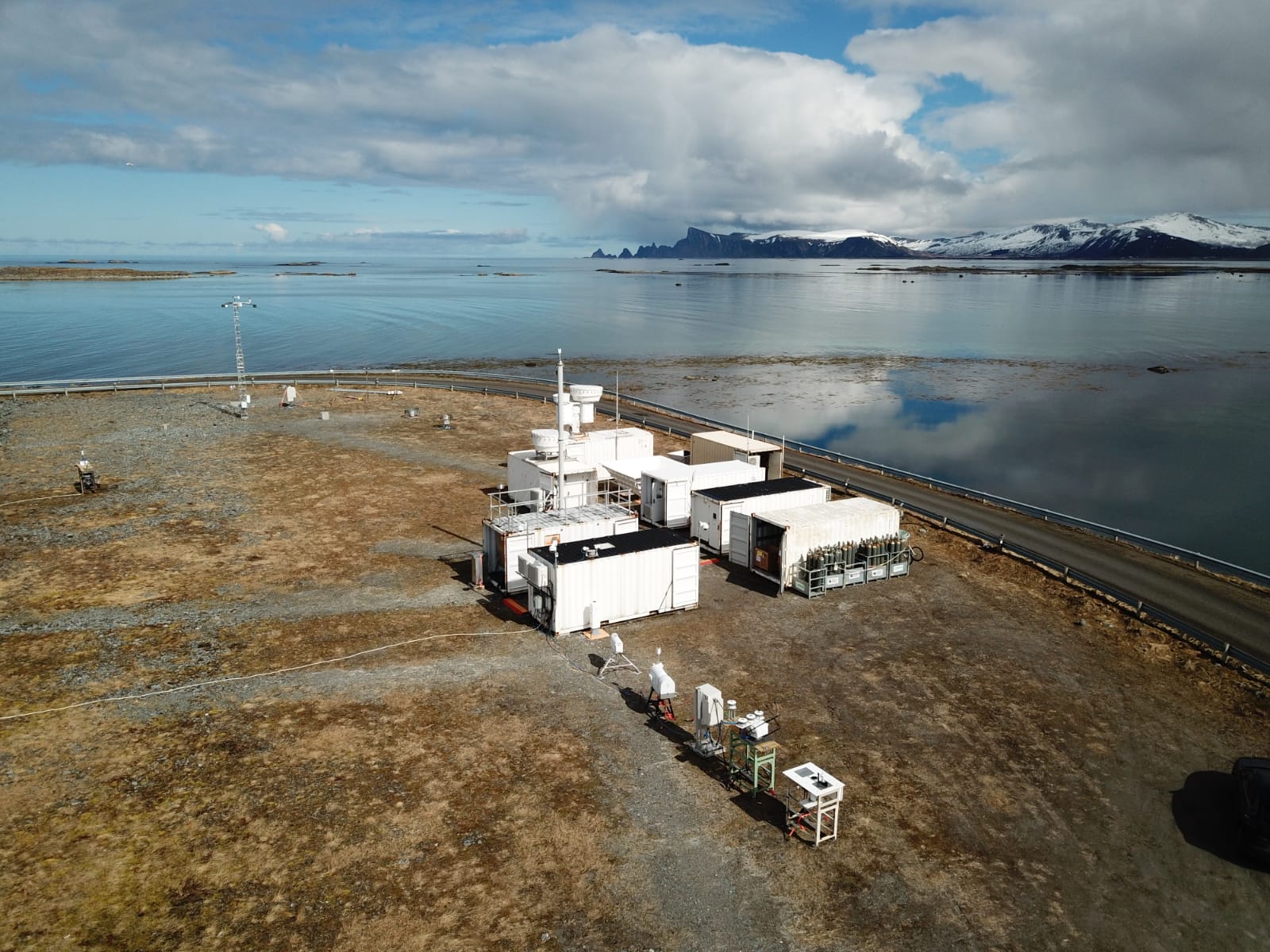
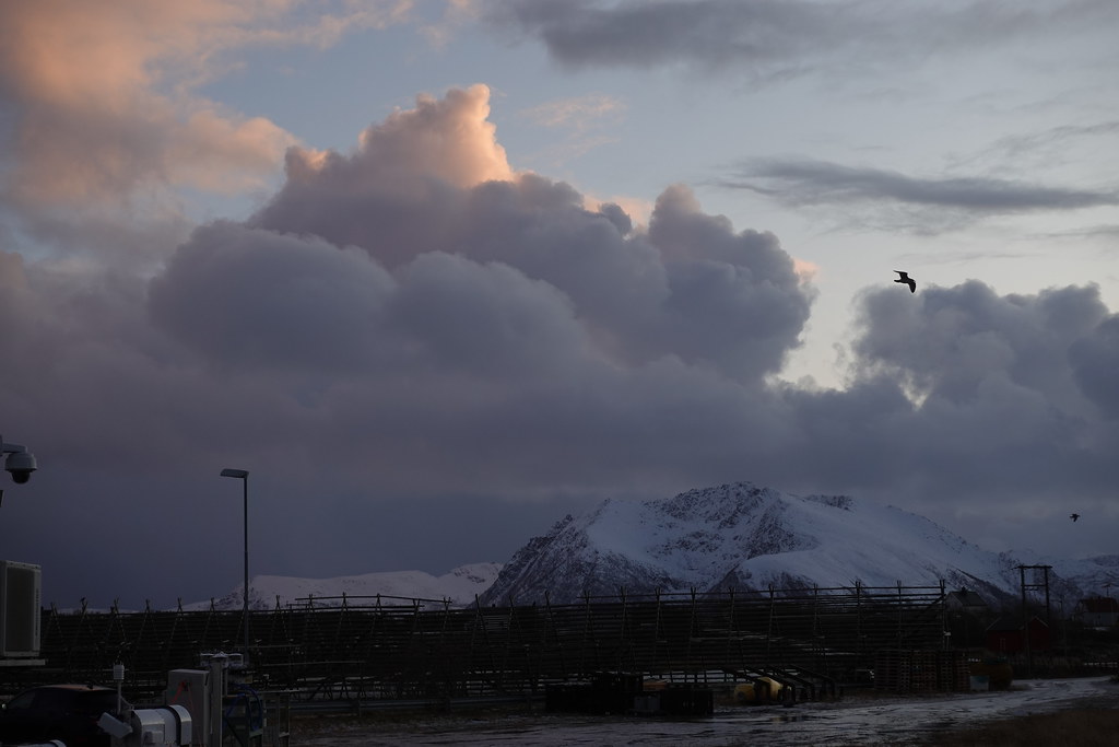
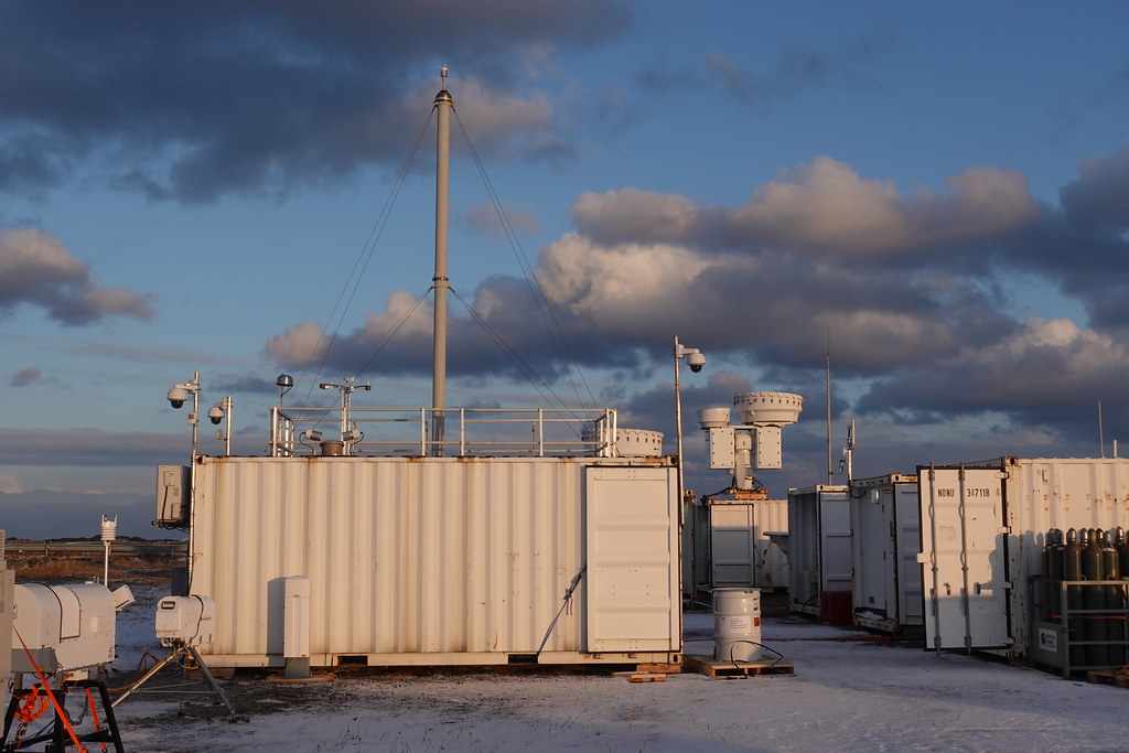
In the fall of 2019, ARM technicians set up the first ARM Mobile Facility (AMF1) in Nordmela, Norway, a fishing village within the Arctic Circle on the island of Andøya. The icy edge of the Arctic Ocean is approximately 1,000 kilometers (620 miles) away.
A secondary observational site, not as heavily instrumented, was on Bear Island, which is typically no more than 500 kilometers (310 miles) from the ice, which shrinks and advances.
There were challenges getting to Norway. AMF1 had to be packed up after its role during ARM’s 2018–2019 Cloud, Aerosol, and Complex Terrain Interactions (CACTI) field campaign in Argentina. Then its seatainers had to be shipped, sited on Andøya, and tested before data collection could begin.
Even so, says Geerts, “COMBLE started a month before we intended,” and its instruments hummed with precision―notwithstanding a few breakdowns in harsh conditions “and the occasional polar bear visits on Bear Island.”
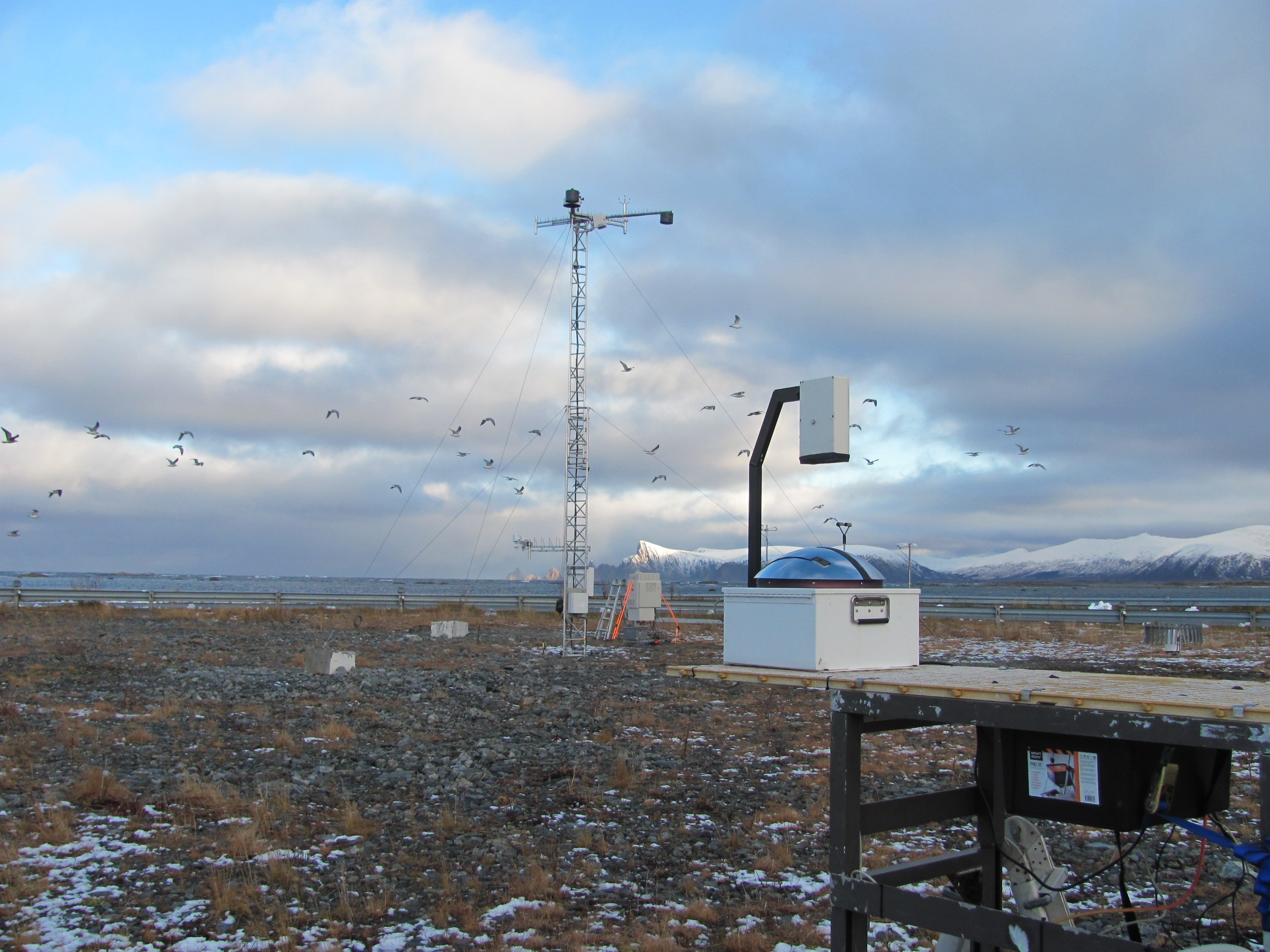
Instruments collected data on aerosols, trace gases, surface fluxes, and basic meteorological information. COMBLE also profiled the lower atmosphere with passive microwave radiometers and ceilometers. Some of its radar and lidar instruments measured upwards, and its Ka- and W-band radars scanned the skies for broader measurement ranges.
After-COMBLE Discussions
COMBLE was the subject of a two-hour, 100-listener breakout session during the June 2020 Joint ARM User Facility/Atmospheric System Research (ASR) Principal Investigators Meeting. All four days of presentations from the virtual meeting are archived.
With Geerts, Mikhail Ovchinnikov of Pacific Northwest National Laboratory (PNNL) in Washington state co-hosted the COMBLE session and outlined the session’s objectives.
Greg McFarquhar of the University of Oklahoma described CAOs and shallow cumulus clouds observed during the 2017–2018 MARCUS campaign. He outlined similar high-latitude studies that drew in data on boundary-layer aerosols and other factors, as well as ARM value-added products that will soon be developed for COMBLE data too.
Nathan Wales, AMF1 operations manager from Los Alamos National Laboratory in New Mexico, summarized the campaign, saying it “went smoothly (and was) trouble-free.” He praised the Norwegian Meteorological Institute for its role in setting up the main site on Andøya and explained what instruments were in play. (The Ka-Band ARM Zenith Radar alone recorded 734 hours of data.)
Geerts and a series of research associates provided a preliminary survey of CAO-related cloud properties during COMBLE.
Next, one of those Geerts associates, Yonggang Wang of Texas Tech University, provided a COMBLE case study. He singled out a set of observations from March 28 to 30, 2020―“one of the best cases in COMBLE,” said Wang, backed up by NASA satellite images.
Roel Neggers, a researcher at the University of Cologne in Germany, described a large-eddy simulation of CAO clouds in the Fram Strait based on atmospheric data from research flights and dropsondes to the north of the main COMBLE site. The simulation could shed light on the spectral evolution of linear “cloud streets” that foreshadow storm-cell evolution following CAOs. (A dropsonde is a GPS-equipped weather device. Dropped from an aircraft, it collects measurements during a slow, parachute-assisted descent.)
Zachary Lebo of the University of Wyoming used a case study from MARCUS to illustrate CAO differences in different ocean basins.
Alexis Hunzinger, PNNL, discussed the status of COMBLE radar data and the challenges of calibration.
ARM data translator Damao Zhang, PNNL, introduced plans for COMBLE value-added products.
During the discussion, Ovchinnikov summarized the campaign through the lens of modeling.
“There are a lot of processes that we need to understand better,” he said. “That’s what models are for.”
Among the challenges, cautioned Ovchinnikov, are that CAOs in transition occur over a space of 1,000 kilometers or more, and their large-scale environment is very complex.
Coming Research
During a smaller meeting later in the summer of 2020, says Geerts, a core of experts will discuss how to proceed with “data analysis and modeling efforts at various scales.”
Meanwhile, research funds from ASR are “just being announced,” he adds. “We are just getting a grasp on who will do COMBLE research. Many are willing and ready.”
Some of the research will combine the prescient synergy of COMBLE with the concurrent 2019–2020 Multidisciplinary Drifting Observatory for the Study of Arctic Climate (MOSAiC) expedition. MOSAiC set sail from Tromsø, Norway, in September 2019 and is doing most of its work much farther north from COMBLE and for twice as long. Its main observatory, locked into ice for much of the time, is arrayed aboard the German research icebreaker R/V Polarstern.
Geerts has called the two campaigns “quite coupled,” though they differ in scale and funding sources. MOSAiC will measure warm-air intrusions into the Arctic and the movement of clouds over ice. COMBLE measured cold air moving across open warm water and its convective consequences.
He identified two cases, both in March, which captured atmospheric flow data from the Polarstern, through the Fram Strait, and southward across the Norwegian Sea to the AMF1 site.
“These (MOSAiC) upstream measurements from 1,200 kilometers (745 miles) away from Andøya can be used to better constrain modeling efforts,” says Geerts. “All that can be used to drive models at a fairly large scale.”
Next, Please
On his own, Geerts will conduct “discovery tours” with his students, he says, “exploring what these (CAO) clouds look like,” including their structures, how deep they are, and their liquid-water and ice characteristics.
He has plans to work with the National Center for Atmospheric Research in Colorado (and others) to capture COMBLE CAO clouds on large-eddy simulations that span the entire Norwegian Sea.
Geerts will also use a specific data set from one “golden case” to develop an initialization data set so that modeling groups can start on COMBLE data from the same place.
That way, “comprehensive intercomparisons” are possible, he says of modelers. “They really need to capture the effect of these heat fluxes, boundary-layer developments, and cloud processes in order to capture the impact of CAOs on the climate system. That’s ultimately what this is all about.”
Says Geerts of COMBLE: “We hope it’s a great leap forward.”
Follow Us:


Keep up with the Atmospheric Observer
Updates on ARM news, events, and opportunities delivered to your inbox
ARM User Profile
ARM welcomes users from all institutions and nations. A free ARM user account is needed to access ARM data.


