

When the Sun and Moon Are Not the Only Circles in the Sky
Published: 20 January 2020
Using ARM total sky images, a university team fine-tunes its algorithm to detect ice halos
When Sylke Boyd needed help finishing a longtime research project, she turned to long-term data from the Atmospheric Radiation Measurement (ARM) user facility.
For 15 years, Boyd has taught at the University of Minnesota, Morris (UMM), a liberal arts college of 1,500 students in west-central Minnesota. Boyd, an associate professor of physics, spent several years working with undergraduates on a project about ice halos, which are rings of light that appear around the sun or moon.
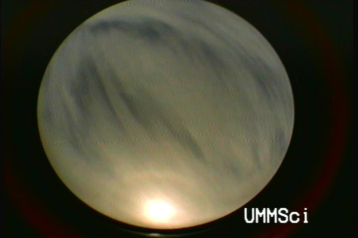
In the atmosphere, ice crystals make up thin, layered cirrostratus clouds starting at about 5,000 meters (16,400 feet). The crystals bend light that passes through them, forming a halo. The most common halo is a 22-degree halo, which occurs when hexagonal ice crystals orient themselves within a cloud. Its name represents the halo’s 22-degree radius around the sun or moon.
Only hexagonal ice prisms with smooth surfaces can form halos, but various types of ice particles in a cloud will scatter light differently. To learn more about cirrostratus cloud composition, a group of UMM students made computer image analysis of halos the focus of their undergraduate research project. Advised by Boyd, they wrote and refined an algorithm to detect 22-degree halos in all-sky camera images, including ones from ARM.
In August 2019, the journal Atmospheric Measurement Techniques published a paper summarizing the project. Boyd wrote the paper with four UMM alumni who worked on the algorithm: Stephen Sorenson, Shelby Richard-Hoffman, Michelle King, and Morton Greenslit.
A Project Blooms
Sorenson, a physics major, was one of the first students on the project. He visited internet forums to explore how others performed image analysis and found an open-source programming library, OpenCV, to help with the processing.
“We were hoping to automate collection of the sky data and use some computer processing to determine if a halo was present in an image instead of going through each image by hand,” says Sorenson.
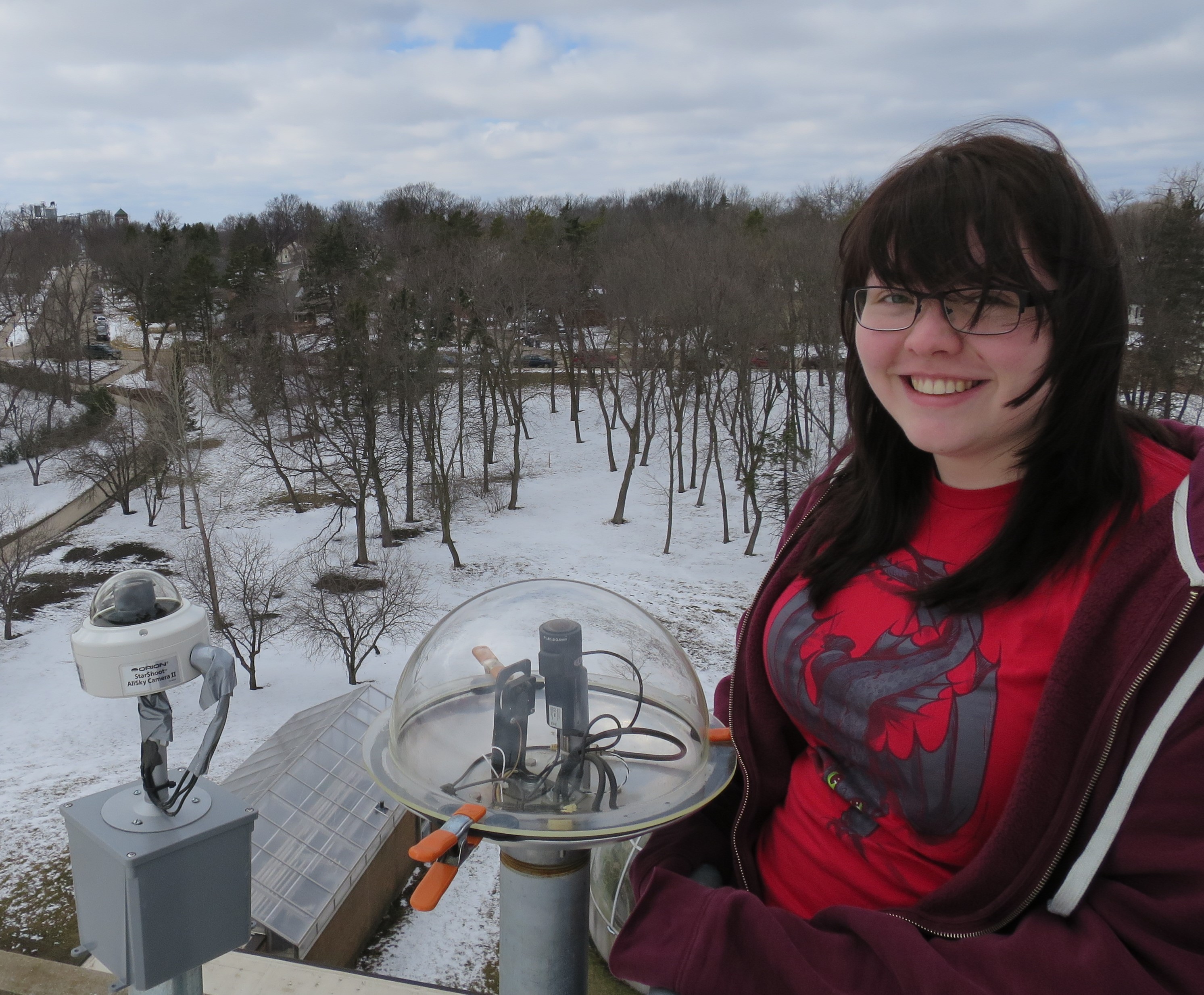
The first images fed into the algorithm came from a camera that captured the sky over the UMM campus.
As students graduated, others continued the work for their own undergraduate research.
Richard-Hoffman, an environmental science major, came in after Sorenson and learned C++ so she could contribute to the algorithm.
“Prior to this, I had no programming experience,” says Richard-Hoffman, “so I was learning side-by-side on writing that program that would go and find our folder, pull up each picture, locate the sun, and then look out from the sun and say: ‘Is there a brightness spot? Is there a potential halo?’ ”
King cleaned up distortion from the camera lens and mirror imaging, while Greenslit sought to remove foreground clouds in the images that interfered with the halo.
Over time, the algorithm evolved from picking out halos to also classifying each image as one of four photographic sky types—cirrostratus (muted blue), partly cloudy, cloudy, or clear.
When the UMM all-sky camera failed because of water intrusion, Boyd had to find a new source for images.
Enter ARM
While attending the Gordon Research Conference on Radiation and Climate, Boyd learned about ARM and its long data record. After the conference, she downloaded total sky images from ARM’s Southern Great Plains, North Slope of Alaska, and Eastern North Atlantic atmospheric observatories.
Total sky imagers look like overhead projectors. Their images are processed to measure how much of the sky is covered by clouds.
Boyd used raw images from the Southern Great Plains, ARM’s oldest observatory, to further train the algorithm.
“That’s 20 years’ worth of data in 30-second intervals, throughout almost every day along the way, so that’s a really nice long-term record that’s worth looking at,” she says.
Boyd tested the algorithm on a series of Southern Great Plains images from January through April 2018. Analyzing the March images, the algorithm correctly recognized 86 percent of the halos and was 90 percent reliable in identifying the sky types.
In January, a full or partial 22-degree halo appeared in 9 percent of cirrostratus skies. That number rose to 22 percent in April.
Across the four-month period, the algorithm showed that halos lasted from five minutes to almost four hours.
Full Circle
“The value of the ARM data lies in their length and continuity, giving a chance to find out how often ice halos appear and how they are seasonally and geographically distributed.”
Sylke Boyd, associate professor of physics, University of Minnesota, Morris
Boyd took a semester off from teaching to finish the research, which had been mostly spread across summer breaks. By that time, Sorenson, Richard-Hoffman, King, and Greenslit had all graduated from UMM.
When Boyd approached her former students about writing a paper on the project, they were excited to revisit their work.
“Just having professors willing to work on this type of stuff with undergrads is huge,” says Sorenson, now a senior software engineer at AMD in the Minneapolis, Minnesota, area.
When writing the algorithm, says Richard-Hoffman, she thought it was a fun challenge.
“I definitely felt like Sylke and I were there to learn and understand and discover more,” says Richard-Hoffman, now a feedlot officer for Stearns County, Minnesota. “She’s so interested in it and so passionate that it kind of wore off on me, and I got really interested and passionate.”
Richard-Hoffman graduated in 2014 and King in 2016 from UMM, but they still send Boyd halo photos.
“None of them works on atmospheric science at this time, but they all are aware and taking pictures and having their eyes open and watching the sky, which is good,” says Boyd.
Looking to the Future
Current UMM undergraduates are using the ARM images Boyd downloaded. Boyd is working with sophomore Spencer Graff on analyzing almost 20 years of the Southern Great Plains record. In the spring of 2020, senior Nasir Siddiqui will train a machine learning algorithm to see if it can improve on the earlier students’ algorithm.
“The value of the ARM data lies in their length and continuity, giving a chance to find out how often ice halos appear and how they are seasonally and geographically distributed,” says Boyd.
Follow Us:


Keep up with the Atmospheric Observer
Updates on ARM news, events, and opportunities delivered to your inbox
ARM User Profile
ARM welcomes users from all institutions and nations. A free ARM user account is needed to access ARM data.


