

RACORO’s Durable Data
Published: 23 September 2019
Measurements from a 2009 ARM field campaign continue to enlarge what we know about boundary layer cloud microphysics
Ten years after it began, an investigation of continental boundary layer clouds overseen by the Atmospheric Radiation Measurement (ARM) user facility is still inspiring influential papers and improving weather and earth system models.
The Routine ARM Aerial Facility (AAF) Clouds with Low Optical Water Depths (CLOWD) Optical Radiative Observations (RACORO) field campaign ran from January through June 2009. RACORO’s principal investigator was Andrew Vogelmann, an atmospheric scientist at Brookhaven National Laboratory in New York.
During late winter and early spring, the campaign investigated and sampled low-level liquid-water clouds above ARM’s Southern Great Plains (SGP) atmospheric observatory, a representative mid-continental land surface. The aim was to support future cloud studies and improve the accuracy of how such clouds are represented statistically.
“I am still using that data,” says Yangang Liu, a BNL senior scientist. “In the future, we need more of this kind of campaign.”
Ground and Air
“RACORO has been a great option for aircraft measurement data for boundary layer cloud studies. It provides many cases of boundary layer clouds of different types.”
Satoshi Endo, scientific associate at Brookhaven National Laboratory
The boundary layer is the lowest part of the atmosphere in contact with the ground. It is characterized by the turbulent mixing of moisture and aerosols (tiny particles in the air). With an average thickness of 1 to 2 kilometers (0.62 to 1.24 miles), the boundary layer is where the Earth’s surface is the predominant atmospheric influence.
Within the boundary layer, reflective shallow, warm clouds help regulate the Earth’s surface energy budget by controlling incoming radiation. Despite their importance, such clouds remain a major source of uncertainty in weather and earth system models.
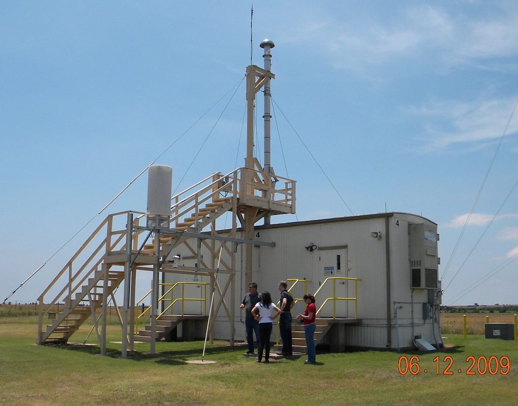
During RACORO, ARM’s ground-based radars at the SGP measured cloud cover fraction, optical depths, and other properties of boundary layer clouds.
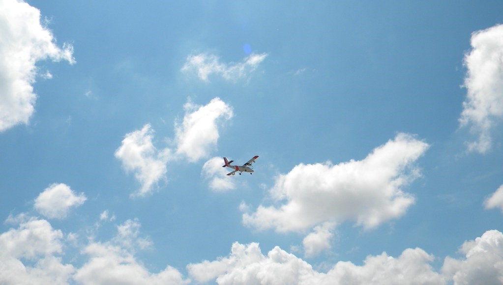
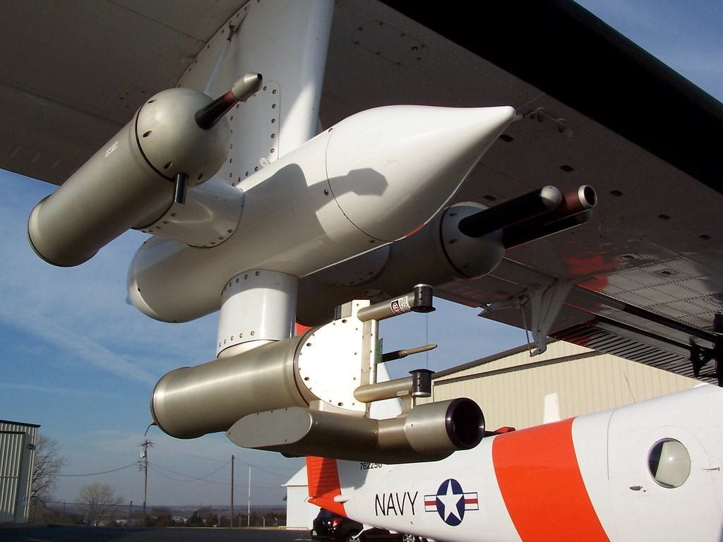
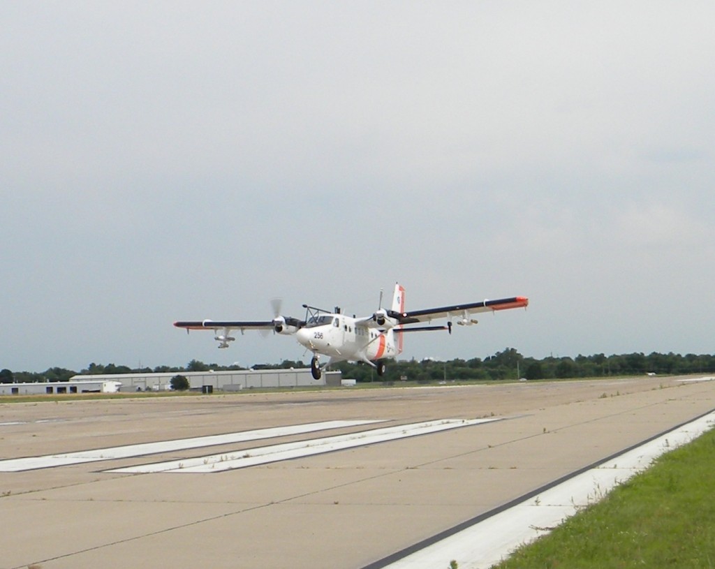
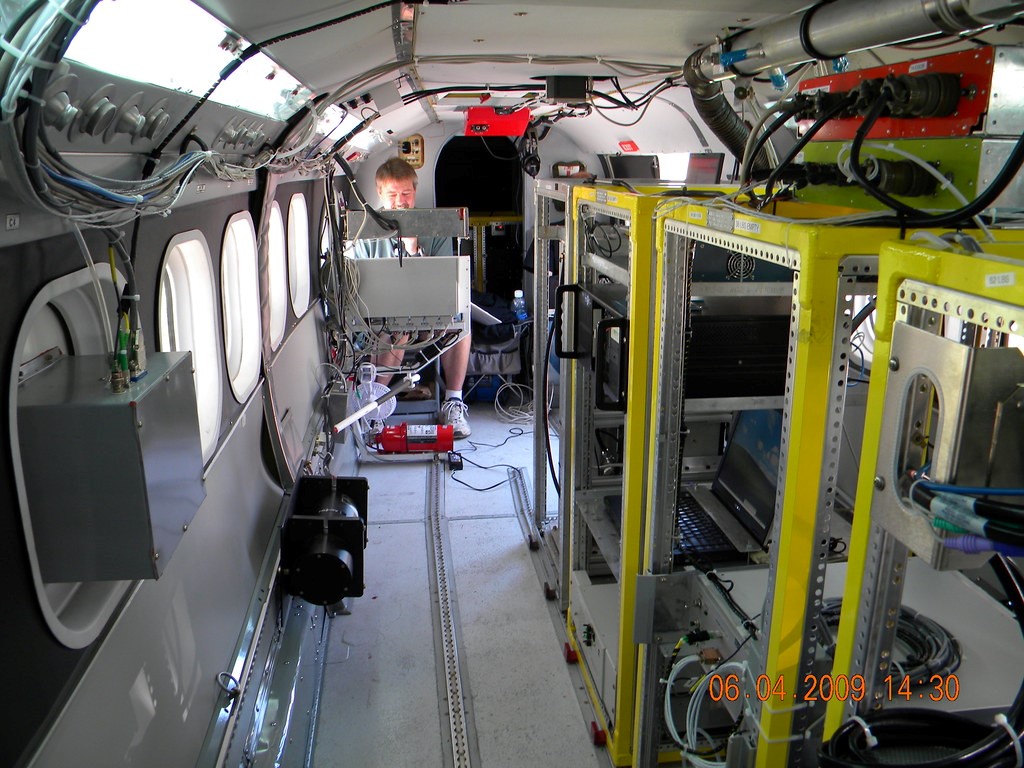
The most unique data, however, came from instruments aboard a U.S. Navy Twin Otter research aircraft. It was on loan to ARM from the Center for Interdisciplinary Remotely-Piloted Aircraft Studies (CIRPAS) based in Monterey, California. The Twin Otter put in 260 hours of research flights.
“RACORO has been a great option for aircraft measurement data for boundary layer cloud studies,” says BNL scientific associate Satoshi Endo, lead author or contributor to many papers using the campaign’s data set. “It provides many cases of boundary layer clouds of different types.”
Learning From RACORO
RACORO was a first-of-its-kind cloud data campaign. It collected airborne measurements over an extended period (more than five months) with the aim of improving the statistical characterization of continental boundary-layer clouds.
Since then, RACORO data have informed how cloud processes work at a microphysical level and paved the way for observationally based case studies and large-eddy simulations (LES).
Endo and others pointed to a series of key papers from 2015 that emerged from RACORO data: a Vogelmann-led study on three 60-hour case study periods during RACORO; a paper Endo led on microphysics in LES; and one led by BNL’s Wuyin Lin on low-cloud parameterization biases.
RACORO data have also helped scientists evaluate fine-scale models, calculate cloud albedo (reflectivity), refine retrieval algorithms, and improve cloud simulations. In particular, the data have been used to reduce uncertainties and biases in weather and earth system models that simulate continental boundary layer clouds.
The U.S. Department of Energy’s FAst-physics System TEstbed and Research (FASTER) project, for instance, used RACORO data to reduce uncertainties in models by using ARM data to improve representations of fast processes such as clouds, aerosols, and precipitation.
Liu, the project’s principal investigator, oversaw a 42-paper special issue of Journal of Geophysical Research: Atmospheres devoted to fast processes and how RACORO data improved our understanding of them.
‘Durable by Design’
RACORO shares a few qualities with other campaigns that created very durable data, says Ann Fridlind, an atmospheric scientist at NASA’s Goddard Institute for Space Studies in New York, who has contributed papers to FASTER.
The data sets are extensive, she says, and they contain a lot of co-located measurements―ones that compare ARM’s routine, continuous ground data with data from other sources that are short-term and intensive.
“A foundational vision for the ARM program included carrying out intensive observation periods at ARM’s long-term measurement sites,” says Fridlind, who pointed to a 1994 paper on programmatic background and design. “The RACORO field campaign epitomizes the implementation of the vision by deployment at the SGP site for a full five months.”
Something like RACORO, she says, with its convergence of space, air, and ground data, “was absolutely, exactly what had been envisioned, and it was extremely effective. It was durable by design.”
Since then, a pleasing windfall of papers has occurred. From 2013 to 2019 alone, for instance, Liu’s group has used RACORO data in at least a dozen studies, including a 2018 paper on entrainment and relative humidity led by his BNL protégé Chunsong Lu. He praised the campaign data sets for their “sampling size and good statistics.”
Meanwhile, adds Vogelmann, Liu’s work with Lu “made extensive use of RACORO data during innovative research on aerosol-cloud interactions, turbulent mixing, and convective entrainment.” (In 2015, Lu received the prestigious American Geophysical Union’s James R. Holton Junior Scientist Award.)
More Key Papers
RACORO co-investigator Greg McFarquhar, now a professor of atmospheric science at the University of Oklahoma, had his own list of especially influential papers to come out of the campaign, including those Endo mentioned.
He began with Vogelmann’s 2012 study in the Bulletin of the American Meteorological Society (BAMS) on RACORO as a first-ever extended-term cloud aircraft campaign.
The paper, says McFarquhar, “describes the unique nature of RACORO in that routine observations of cumuli were collected following predefined flight paths.” (The paper has been cited 57 times, according to the Web of Science.)
The sampling strategy of flying largely predefined flight tracks, he says, “allowed us to collect more representative data for the climatic impact of clouds, rather than focusing on some more visually exciting clouds.”
Other key papers involve those evaluating models of continental boundary layer clouds using RACORO observations. In that way, says McFarquhar, “the processes and their representation in models can be better understood.”
Collect, Assess, Validate
Instruments aboard the Twin Otter collected data on solar and thermal radiation, the meteorological state of the atmosphere, and the physical properties of aerosols and clouds.
Meteorological observations provided data on moisture, the intensity of updrafts at the base of clouds, and other factors that influence cloud dynamics. (Updraft speed, a critical measure of cloud behavior, affects precipitation and aerosol mixing.)
So far, says Liu, most papers using RACORO data touched on two main topics. One is cloud-aerosol interactions.
To form clouds, you need aerosols to act as condensation nuclei. Changes in aerosols recorded during RACORO―in volume, size distribution, and number of cloud condensation nuclei―continue to inform how aerosols affect cloud properties.
The second big topic is entrainment―the mechanics of how dry or moist air is mixed into clouds from the environment outside them. The rate of entrainment is a key parameter because it influences how the amount of energy and water that vapor clouds transport, which in turn influences precipitation and the earth system itself.
“To study this process, we need to have very good measurements of turbulence,” says Liu. “We need a large data set with good statistics.”
Taking his group’s work together with other papers based on RACORO, says Liu, “in my personal view, we made some quite major contributions in both fields with these data―and we learned what we need to improve in the future.”
Researchers also use RACORO measurements to evaluate data retrieved from commonly deployed remote sensing platforms. The suite of radiometers at the SGP and the satellites observing overhead during the campaign, for instance, retrieved data on cloud drop size and the amount of liquid water in a cloud. How accurate are those retrievals? RACORO is still helping to find out.
Lasting Impacts
“RACORO data on projects such as FASTER will permit the impact of the data to extend far beyond observational studies alone, allowing the data to be used to improve atmospheric models that have a variety of temporal and spatial scales.”
RACORO co-investigator Greg McFarquhar, now at the University of Oklahoma
In McFarquhar’s view, RACORO will have a lasting impact in two major ways―by defining a new paradigm for field campaigns and by influencing modeling studies related to cloud-aerosol interactions.
Regarding that new paradigm, he says, RACORO covered a long time period, routinely sampled winter-to-summer cloud transitions, and employed a sampling strategy of flying largely predefined flight tracks.
“The development of these sampling techniques,” says McFarquhar, “will have a big impact when the community moves to more routine sampling of clouds with UAS (unmanned aerial systems).”
He calls this data collection technique “a breakthrough, in much the same manner that ARM pioneered the use of routine ground-based observations for continually sampling cloud and aerosol properties.”
As for RACORO’s impact on modeling studies: McFarquhar notes the number of campaign-related papers looking at cloud-aerosol interactions and the role of entrainment.
“RACORO data on projects such as FASTER will permit the impact of the data to extend far beyond observational studies alone,” he says, “allowing the data to be used to improve atmospheric models that have a variety of temporal and spatial scales.”
Given the routine nature of RACORO data collections, says McFarquhar, “the observations offer important statistics on cloud properties in a variety of meteorological and aerosol conditions. That will allow us to evaluate how well high-resolution models are able to replicate conditions observed in nature.”
In turn, RACORO observations and the statistics they yield, he adds, “will improve our understanding of processes impacting the water and energy budget of the planet.”
LASSO Too
Experts also say that RACORO data helped make an important contribution to the LES ARM Symbiotic Simulation and Observation (LASSO) workflow, the high-resolution modeling capability co-developed for ARM by Vogelmann and William Gustafson at Pacific Northwest National Laboratory in Washington state. It’s a way of combining LES modeling with daily observations of shallow clouds.
“The concept and methodology of RACORO,” says Endo, “helped to develop LASSO for SGP shallow convection.”
For decades, atmospheric scientists have used LES for the numerical simulation of the turbulent and often cloudy boundary layer over areas 15 to 25 kilometers (9 to 16 miles) wide. As computing power improves, LES is more common and easier to do. However, LES is still often used for idealized simulations rather than real-world conditions.
Within the LASSO framework, LES is combined with ARM observational data on atmospheric conditions and land-atmosphere exchange processes become part of a hybrid simulation of reality that samples a wide range of observed conditions. LASSO becomes a proxy for conditions on a high-resolution meteorological scale.
It’s a way of “forcing the models to the reality of observations,” says McFarquhar, “and allows models to be used to understand and quantify cloud-evolution processes.”
LASSO also helps address the persistent “cloud problem” in atmospheric science―the fact that global and regional models systematically misrepresent the distribution of clouds, which are the main source of uncertainty in simulations of the future earth system.
Follow Us:


Keep up with the Atmospheric Observer
Updates on ARM news, events, and opportunities delivered to your inbox
ARM User Profile
ARM welcomes users from all institutions and nations. A free ARM user account is needed to access ARM data.


