

Bart Geerts: Observer and Modeler Takes the Lead
Published: 19 October 2019
University of Wyoming researcher is poised to launch his first ARM field campaign
This is the first in a series of periodic profiles on scientists who create and apply ARM data.
For nearly 20 years, atmospheric scientist Bart Geerts has taught meteorology, forecasting, and weather analysis at the University of Wyoming. His research interests include radar meteorology, cloud and precipitation physics, and numerical weather and earth system modeling.
Geerts focuses on atmospheric processes that occur at the mesoscale in the expanse of sky and boundary layer just above the Earth’s surface. It’s where weather happens.
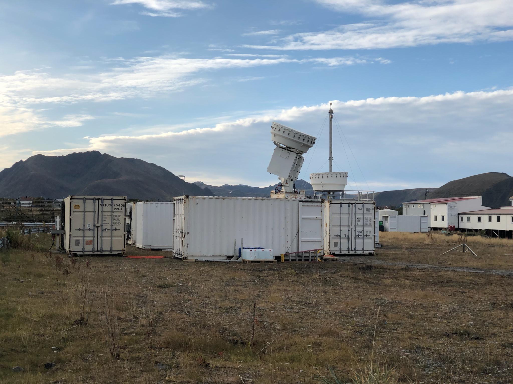
Starting in January 2020, he will lead a field campaign intended to unpack the processes behind cold-air outbreaks (CAOs). The U.S. Department of Energy’s Atmospheric Radiation Measurement (ARM) user facility will supply and deploy the instruments for the Cold-Air Outbreaks in the Marine Boundary Layer Experiment (COMBLE).
The point is to unravel some of the puzzles around CAOs, common but little-understood phenomena. The cloud and boundary layer processes they prompt, explains Geerts, lead to “some of the largest surface sensible heat fluxes observed anywhere on Earth.”
Such fluxes are changes in the kind of heat that can be felt in the body or another thermodynamic system. Unlike latent heat, sensible heat results in temperature changes.
These CAO-caused fluxes are especially notable “in the region we are interested in,” says Geerts.
Up to the Ice Edge
The region of interest in COMBLE is the northernmost reaches of boreal Norway. That includes 1,000 kilometers (621 miles) of open water in the Norwegian and Barents seas―a straight line north to the ice edge of the Arctic.
In all, COMBLE’s area of study is an unpredictable place meteorologically, especially when CAOs sweep across waters kept warm by the Gulf Stream.
“In terms of global climate,” says Geerts, “cold-air outbreaks―and especially the cloud regime associated with them―are poorly understood.”
Geerts is an enthusiastic veteran of field campaigns; he was part of one in 1986, as a graduate student. But COMBLE is his first as an ARM principal investigator.
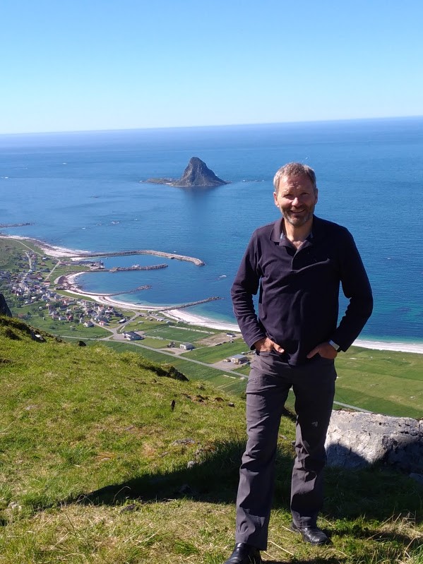
He scouted sites for the campaign in June 2018 and conferred with collaborators at the Andøya Space Center Observatory near the seaside village of Bleik, Norway.
Four times a day, meteorology technicians at the space center―a service center for users of ground and aerial research platforms―routinely release radiosondes, which are telemetry instruments carried by untethered balloons. During COMBLE, the Norwegian technicians will launch eight radiosondes a day when CAO conditions appear, as determined by a predictive mechanism Geerts designed.
During the five months of the campaign, an ARM Mobile Facility will operate on its own every day, around the clock, says Geerts, who will watch and guide the data-gathering from his office in Wyoming. “We are not planning to be out there.”
Getting to Science
“I was interested in thunderstorms, rainfall, cloud formations―really, back then, any natural phenomena I could see with the naked eye.”
Bart Geerts, researcher at the University of Wyoming
Geerts was born into a family in Belgium that appreciated science. His parents and grandparents were in the medical field, but his father had a deep interest in the geosciences. Beginning at a young age, Geerts was drawn to nature’s visibilia (things that can be seen).
“I was interested in thunderstorms, rainfall, cloud formations―really, back then, any natural phenomena I could see with the naked eye,” he says.
As an undergraduate at Catholic University (1980–1984) in Louvain (Leuven), Belgium, he studied physical geography, which in part satisfied his early interests in the natural world.
At the same university, from 1984 to 1985, that interest took a fine-grained, practical turn when Geerts earned the equivalent of a master’s degree in irrigation sciences engineering.
That avenue of study was a “side spur,” says Geerts. What influenced him to eventually pursue atmospheric science was his prizewinning, 530-page undergraduate thesis, “Observations and analytic modeling of the sea breeze.” (It was written in Dutch, his native language; he speaks four others.)
Geerts gathered data from sea breezes along ocean shores in Belgium and the Netherlands, and applied his measurements to an early numerical modeling formulation.
Numerical modeling was then in its infancy, he says, and “sea breezes were probably the easiest for a numerical model to capture with some realism.”
A First Campaign
Geerts moved to the United States in 1985 to enroll in the atmospheric science program at the University of Washington (PhD, 1990).
As luck would have it, just as he arrived, scientists at the National Center for Atmospheric Research (NCAR) in Boulder, Colorado, were making final arrangements for the Genesis of Atlantic Lows Experiment (GALE).
The mission, from January 15 to March 15, 1986, was to use meteorological perches in coastal North Carolina to learn more about cyclogenesis and air-sea interaction processes in East Coast winter storms.
Geerts got to participate under the guidance of a senior graduate student, Owen Hertzman. During GALE, both were stationed at a ground-based scanning radar operation at Cape Hatteras, in a secondary control center for the campaign.
In his first year as a graduate student, Geerts also spent two weeks at NCAR, again with Hertzman, to learn about new radar data-processing software.
“This field campaign and data analysis experience was formative for my career,” says Geerts.
Science and Writing Influences
In another stroke of luck, GALE involved the preeminent cloud physicist of his day, Peter V. Hobbs, a passionate airborne research adventurer who went on to become Geerts’ dissertation advisor at the University of Washington.
Hobbs is famous for measuring the largest raindrops ever observed―samples collected while airborne that were nearly 1 centimeter wide. As an investigator of aerosols (tiny particles in the air) emitted from ships, volcanoes, and wildfires, he flew through the volcanic plume from Mount St. Helens in Washington state just after its May 18, 1980, eruption. He also took airborne measurements over burning Kuwaiti oil wells during the First Gulf War.
Hobbs and Hertzman have since passed away, says Geerts of his graduate school mentors, “but both left a profound influence on me as a scientist and writer.”
Unraveling Storm Kinetics
“If we had an instrument today that could estimate water or temperature at the same resolution as a radar can measure airflow in a storm, we would be way ahead.”
Geerts
London-born and England-educated, Hobbs was a fierce and prompt editor, sending back manuscript pages “covered in red ink,” says Geerts. “He taught me how to write―in British English.”
For his dissertation, Geerts adapted a previous measurement-interpretation scheme that allowed a few strands of scanning radar data to create a full three-dimensional view of a storm’s kinetics, including representations of temperature, pressure, and water vapor.
A Doppler radar can very quickly scan 360 degrees and is very good at measuring the kinetics―but not so good at measuring the water vapor or the heat and other forms of energy in a storm.
“If we had an instrument today that could estimate water or temperature at the same resolution as a radar can measure airflow in a storm,” says Geerts, “we would be way ahead.”
Getting Around
After finishing his PhD, Geerts signed on as a lecturer at Macquarie University in Sydney, Australia, where he worked from 1991 to 1995.
The Aussie years were followed by a series of temporary positions at Purdue University in Indiana, the University of Alabama in Huntsville, and Embry-Riddle Aeronautical University in Arizona. He also held research scientist positions at NASA’s Marshall and Goddard space flight centers. Then came the University of Wyoming in 2000, where Geerts and his wife started a family. (They have three sons, ages 8 to 15.)
Today, the busy research scientist and his family range out into the Wyoming countryside to enjoy nature’s abundant visibilia. In the winter, they ski; in the summer, they hike and camp.
Aside from his passion for atmospheric science, says Geerts, “I lead a simple life.”
Follow Us:


Keep up with the Atmospheric Observer
Updates on ARM news, events, and opportunities delivered to your inbox
ARM User Profile
ARM welcomes users from all institutions and nations. A free ARM user account is needed to access ARM data.


