

For the Arctic, an Epic Investigation
Published: 21 January 2020
Embedded in sea ice for a year, a shipborne observatory will take a rare look at conditions in the rapidly evolving central Arctic
More than 10 years after the idea was conceived, the largest research expedition to the central Arctic will commence September 20, 2019. Researchers will travel to the heart of the Earth’s northernmost polar region on behalf of the Multidisciplinary Drifting Observatory for the Study of Arctic Climate (MOSAiC).
The field campaign will marshal over 60 research institutions in 17 countries and involve more than 600 scientists, technicians, and logicians. (Editor’s note: As of September 17, 2019, the number of countries participating is 19.) Throughout a full year, for time spans of two to three months, about two-thirds of those involved will rotate on and off a research ship embedded in arctic sea ice.
The U.S. Department of Energy (DOE) is participating in the expedition—the biggest ever in the central Arctic. For one, DOE’s Atmospheric System Research program is funding some of the research that will come out of the campaign, now and into the future.
And DOE’s Atmospheric Radiation Measurement (ARM) user facility will deploy some of the most critical atmospheric instruments during MOSAiC and is expected to eventually create more terabytes of data than any other campaign participant.
ARM will provide more than 50 instruments, including the first scanning radars to operate in the arctic ice pack.
The atmosphere—with its radiative exchanges, clouds, aerosols (tiny particles in the air), complex chemistry, precipitation, and fluxes of energy and humidity—is one of MOSAiC’s main scientific focus areas.
The others are ocean chemistry and circulation, biogeochemical fluxes, ecosystem dynamics, and patterns of formation, drifting, deformation, and melting in sea ice and snow.
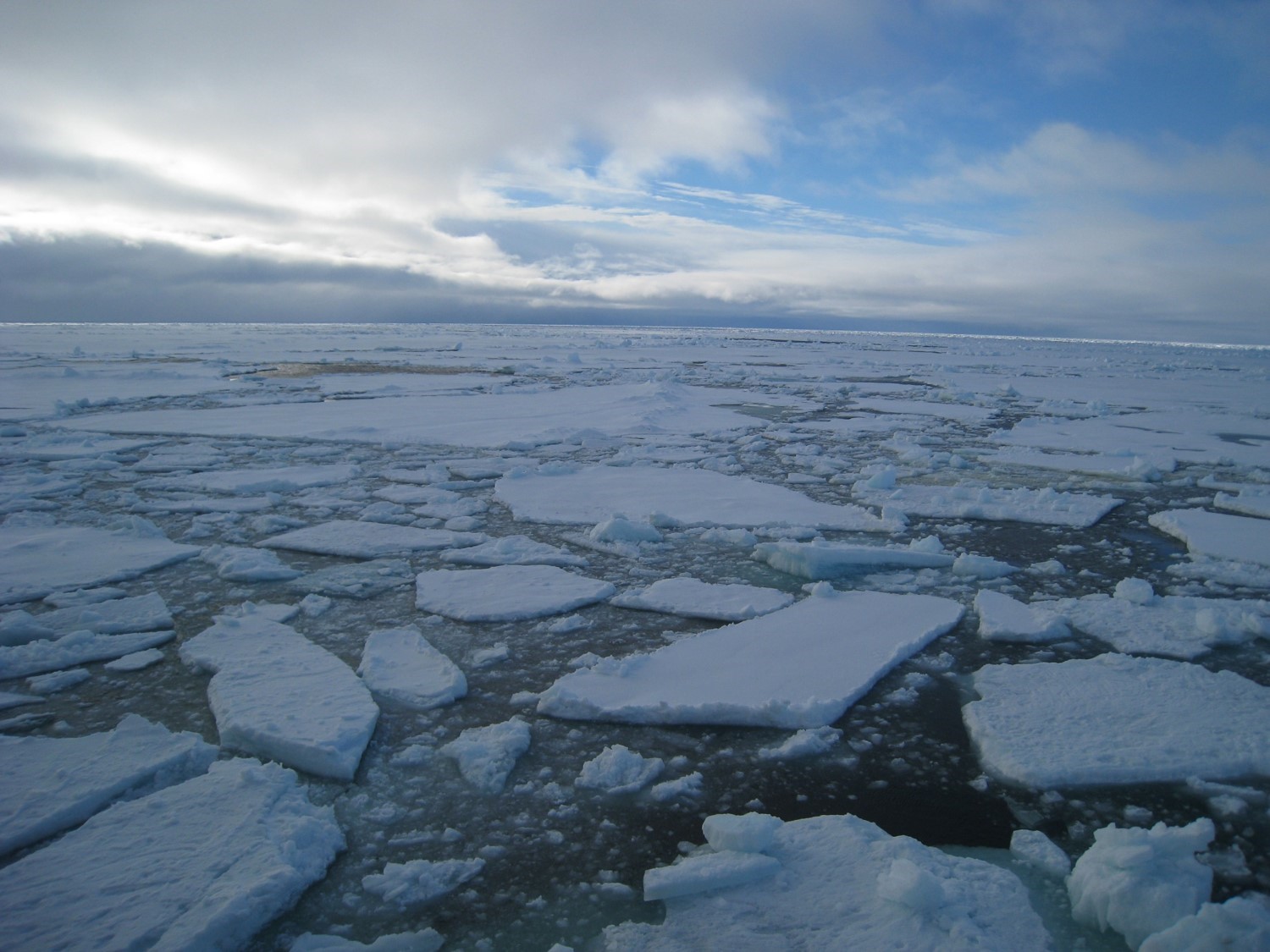
Overall, the campaign will be an attempt to observe, measure, and better understand the central Arctic, a region of dramatic changes. Unlike most field campaigns, MOSAiC will have a full year to gather data on how ice, atmosphere, and ocean systems are dynamically linked.
A Last Chance
“Where on Earth is climate change so impactful? I can’t find another place.”
Matthew Shupe, co-coordinating scientist for MOSAiC at the Cooperative Institute for Research in Environmental Sciences (CIRES)
The expedition’s principal organizer, the Alfred Wegener Institute (AWI) in Germany, says MOSAiC comes at a time when those alive today may be the last to see the Arctic Ocean covered by ice year round. Sea ice extent today is already less than half of what it was in 1984.
Other dramatic changes taking place: surface temperatures in the Arctic are rising at twice the rate of the global average, coastal areas are eroding, and permafrost is melting.
Such changes may be contributing to a less stable jet stream in the Northern Hemisphere, which until now has marked a reliably bright line in temperature contrasts between the high and middle latitudes.
The jet stream, destabilized, has started to meander. That means warm and humid air from the south seasonally pulses into the Arctic’s Atlantic sector and intense cold air from the north penetrates unusually far into North America, Europe, and Asia.
“Where on Earth is climate change so impactful?” wonders Matthew Shupe, a co-coordinating scientist for MOSAiC and a veteran atmospheric researcher in high-latitude environments. “I can’t find another place.”
Shupe, a 15-year ARM collaborator, is a senior research scientist with the Cooperative Institute for Research in Environmental Sciences (CIRES) at the University of Colorado, Boulder. CIRES is affiliated with the National Oceanic and Atmospheric Administration’s Earth System Research Laboratory.
During MOSAiC, Shupe will be out on the ice for nearly five months, including the first three months of the campaign.
Imperatives
MOSAiC “is a huge opportunity—a once-in-a-generation opportunity,” says Shupe—not only for the scientists out on the ice, but for arctic researchers and modelers who by 2020 can start analyzing terabytes of data.
One major motivation is centered on dramatic changes in the Arctic, including changes in warming, circulation, habitat, and ocean and ecosystem productivity.
Another is the fact that changing earth system patterns in the Arctic are not well represented in current models.
MOSAiC is also motivated by an emerging international economic imperative. AWI estimates that from 2014 to 2024 alone, planned investments in the Arctic will be around $100 billion worldwide—mostly for infrastructure related to shipping, mining, and fishing.
The campaign also “matters for global forecasting,” says Shupe, and may help answer a question he shares with other scientists: “Can we get the Arctic right?”
Getting Stuck—for Science
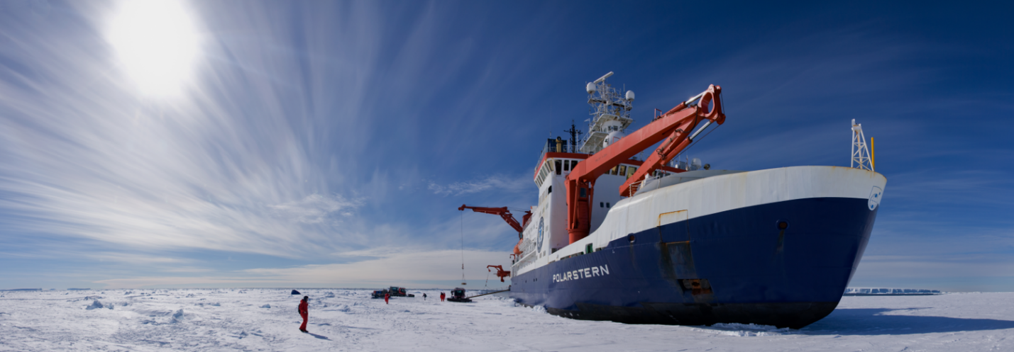
The chief MOSAiC observatory will be the AWI research icebreaker R/V Polarstern, a double-hulled ship rated for breaking through ice 5 feet thick.
By the time of its departure from Tromsø, Norway, on September 20, the Polarstern will bristle with field instrumentation designed to measure conditions in the ocean, sea ice, biosphere, and atmosphere.
ARM will contribute what Shupe calls an “unprecedented cloud observatory” in the Arctic, including scanning radars linked to a suite of precipitation instruments, three radiation measurement suites, an Aerosol Observing System, and instruments to profile the wind and atmosphere.
On September 1, ARM staff will gather at a Tromsø wharf, including scientists known as “instrument mentors,” who are responsible for the measurements from ARM’s many atmospheric instruments. Over two weeks, they will load and prepare shipboard instruments for a frigid, rugged year at sea.
By the 20th, the Polarstern will depart for the Laptev Sea off the coast of Siberia, where the ship will shut down its propellers and freeze into ice to begin its drift through the central Arctic.
Eight members of the ARM installation crew will travel to the freeze-in site and return to Tromsø by October 16 aboard the Russian icebreaker R/V Fedorov.
Three MOSAiC operators representing ARM will live on the Polarstern during the first leg of the mission, slated for three months.
Data Grids
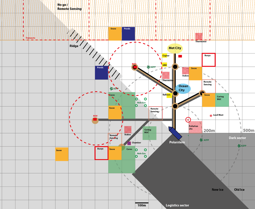
Within a week of the Polarstern freezing in, researchers will establish a network of installations around the ship, blocking out a 40-by-40-kilometer area (25 miles by 25 miles), where scientists will collect process-scale measurements.
The close-in research infrastructure—including submersibles, radiosondes, instrumented buoys, and marine sample traps—is part of what AWI calls a MOSAiC strategy of “nested multiscale observations.”
Even farther out from the Polarstern, measurement assets around the Arctic will give MOSAiC extended geographical and vertical views of the central Arctic. They are already in place anyway, deployed at distances of 1,000 kilometers (about 621 miles) or more from where the ship will be.
Those assets include collaborating research vessels, aircraft, more arctic buoys, satellites, and additional research stations.
This bigger grid helps capture data on the regional and global scales employed in some models. It is also useful for scientists doing data assimilation studies.
ARM at Work
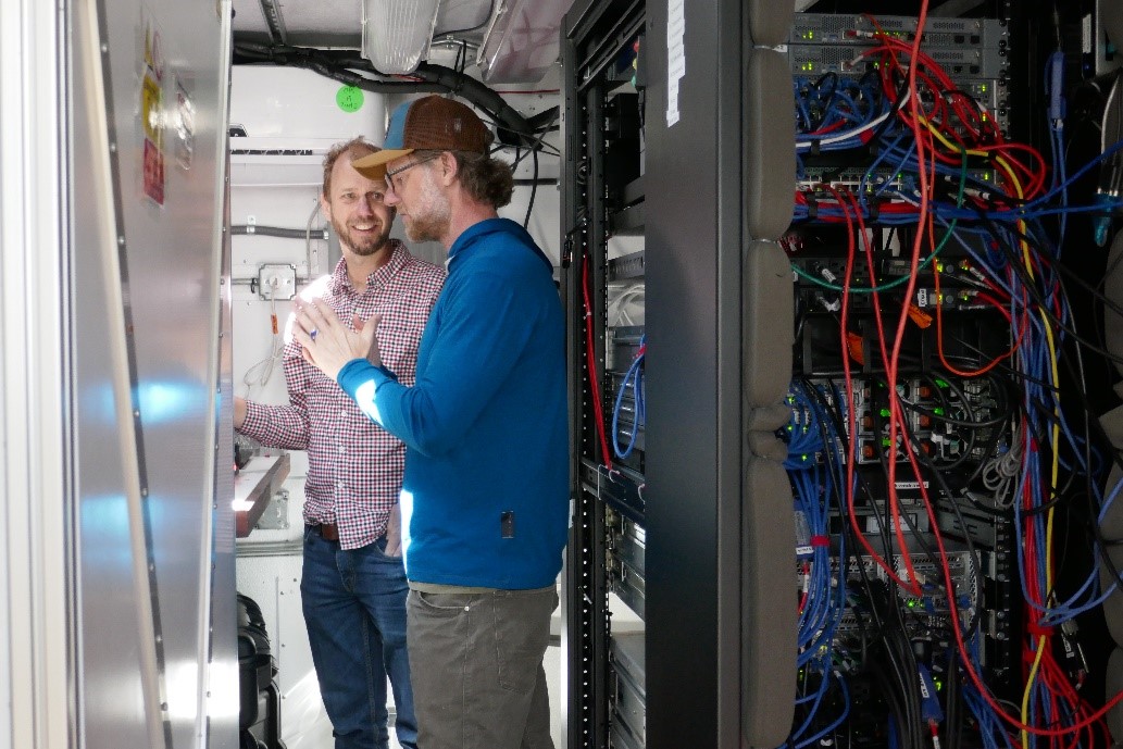
In April 2019, Shupe and others beta-tested ARM Mobile Facility (AMF) instrumentation at Los Alamos National Laboratory (LANL) in New Mexico. ARM campaign instruments are tested and shipped from there under the direction of LANL-based Heath Powers, facility operations manager for the first and second ARM Mobile Facilities (AMF1 and AMF2).
Discussions at LANL touched on how to work through expedition hardships, such as sourcing power at sea, coping with limited bandwidth (data will be shipped out in increments, by sea and air), and keeping instruments running in subzero temperatures.
For the voyage out, stacked in about 20 seatainers at the bow of the Polarstern, will be AMF2, which is ARM’s portable instrument package largely designed to support shipboard research deployments.
Some of AMF2’s instruments will be deployed on the Polarstern, including those mounted on the ship’s forward handrails. Others will be dispersed to an ice camp adjacent to the ship.
The instruments will include cloud radars, three lidars (whose lasers measure atmospheric, aerosol, and cloud properties), a suite of broadband and spectral radiometers (for measuring solar and infrared radiation to understand energy transfer), and instruments for gathering routine meteorological data, such as temperature, humidity, and wind speed.
Another suite of ARM instruments will measure the number, sizes, and optical properties of aerosols.
In all, says Shupe, the Polarstern will be “packed to the rails” with ARM gear.
Follow Us:


Keep up with the Atmospheric Observer
Updates on ARM news, events, and opportunities delivered to your inbox
ARM User Profile
ARM welcomes users from all institutions and nations. A free ARM user account is needed to access ARM data.


