

MARCUS Means a Rolling, Rich Science Look at the Southern Ocean
Published: 20 August 2017
DOE-funded campaign gathers the most complete set of data on aerosol and cloud properties from shipboard instruments over the stormy Southern Ocean
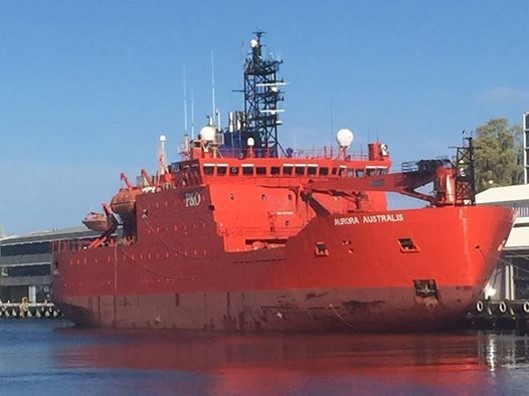
At dockside in Hobart, Australia, the bright red-orange Aurora Australis looks blunt and wide. When not in its berth, the rugged ship pounds like a 100-meter hammerhead through the violent waves of the Southern Ocean. The stormiest seas on Earth are there. Winds can kick to 150 kilometers an hour and waves can crest at 10 meters.
Aurora Australis is capable of cracking through sea ice more than a meter thick and has been traversing the Southern Ocean since 1989. It runs regular resupply missions to a string of Australian research stations on or near the continent of Antarctica 3,500 kilometers away.
Starting in October, the Aurora Australis will do double duty, carrying instruments that gather in atmospheric data of a kind not seen in 40 years, or (in some cases) never seen before: measurements of near-surface conditions over an ocean where fluxes of biogenic aerosols are little known and where remote sensing of cloud, aerosol, and precipitation properties has been rarely done, and only in short increments.
The seven-month campaign, funded by the U.S. Department of Energy (DOE), has a name long enough to sum up its science mission: Measurements of Aerosols, Radiation, and Clouds over the Southern Ocean (MARCUS). Starting October 29, the campaign is slated to deploy four research cruises of about five weeks and 7,000 kilometers each.
“We’re taking advantage of the fact that there is a ship,” and that it traverses an ocean so important to measure, said Greg McFarquhar, a University of Illinois atmospheric scientist who leads a MARCUS team of 10 co-principal investigators. (In August, he will join the Cooperative Institute for Mesoscale Meteorological Studies at the University of Oklahoma.)
The campaign is part of an international, multi-agency U.S.-Australian effort called the Southern Ocean Clouds, Radiation, Aerosol Transport Experimental Study (SOCRATES), which grew out of a 2014 workshop on the need to know more about this remote, pristine, dynamic, and consequential body of water. It influences the oceanic and atmospheric circulation of not only the southern hemisphere, but the dynamics of the whole planet.
Pulling in Rare Data
MARCUS will be unique for many reasons. It will provide the most complete data ever on aerosol and cloud properties. It will last longer than any other research campaign in the region, and cover every season but winter. And MARCUS will take continuous measurements in the rarely investigated latitudes southward of 55 degrees.
McFarquhar cautions that the narrow tracks of the ship’s path “will cover just a small portion of the Southern Ocean” as the supply ship makes its way from Hobart to Australian Antarctic research stations at Mawson (67.5 degrees S), Davis (69 degrees S), and Casey (66 degrees S). But the instruments will cover more sea, and measure more air, for longer, and at a more southern latitude than any of three past intensive observational studies going back to 1993.
The vast Southern Ocean MARCUS will sample is the only oceanic region that circles the planet virtually unblocked by land. It connects to all the world’s major oceans and helps globally redistribute oceanic properties like heat, nutrients, and salt.
Along latitudinal bands, the stormy Southern Ocean also has strong atmospheric and oceanic gradients that influence oceanic heat and carbon uptake. In these regions there are also extratropical cyclones, large-scale (synoptic) low-pressure systems that can create anything from cloudy days and rain to gales and blizzards.
Plans to Improve Today’s Models
Knowing more about the atmospheric dynamics in the Southern Ocean is important for improving present-day earth systems models, said McFarquhar, which right now poorly represent Southern Ocean clouds and which underestimate the amount of shortwave radiation reflected from those clouds. It all adds up to “one of the biggest uncertainties we have” in earth systems models, he said.
The MARCUS science and implementation plan, published in January 2016, remarks on the importance of accurately simulating cloud and aerosol effects over the Southern Ocean, and that observations there so far have been “sparse and infrequent.”
The plan’s authors, led by McFarquhar, added another reason the campaign is so important: “Almost all cloud model parameterizations have been developed using NH [Northern Hemisphere] data.” That gap makes a prolonged campaign in the little-measured region between 55 degrees S and the coast of Antarctica very desirable.
Getting the Right Gear in Place
Such a campaign is desirable for other reasons too, said McFarquhar. For one, the Southern Ocean is the cloudiest region on Earth, making it vital to represent in global cloud feedback loops. It likely has “teleconnections” with other atmospheric regimes. It could influence the stability of ice shelves in Antarctica. And the Southern Ocean, as the most pristine environment of Earth, may hold important clues to the planet’s pre-industrial atmosphere.
Measurements done there could improve the understanding of the indirect effect of aerosols on clouds and precipitation—that is, all the ways energy from solar radiation is redistributed within cloud layers.
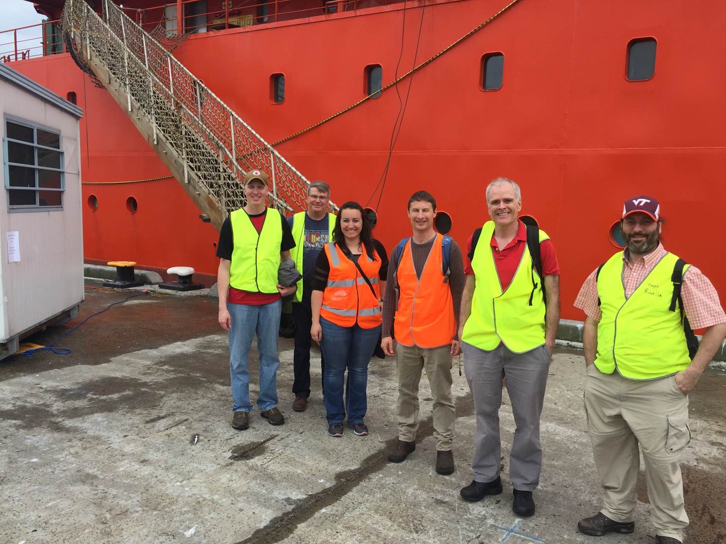
Instruments arrayed aboard the Aurora Australis will be from the second ARM Mobile Facility (AMF2), one of three portable platforms maintained by the DOE’s Atmospheric Radiation Measurement (ARM) Facility and designed to tuck into shipping containers for deployments of up to a year. The exact configuration of which instruments will fit onboard, and where they will be placed, has already been determined. They are currently being tested at the Los Alamos National Laboratory (LANL), and will be first used on a shakeout cruise October 22 to 24.
Sondes, Radars, and ‘a Lot of Roll’
There will be sondes launched to measure temperature, humidity, wind speed, and wind duration four times a day. There will be probes that measure the number, composition, and size of aerosols, including ice nucleating particles and cloud condensation nuclei. Other instruments will use remote sensing to indirectly measure the properties of clouds. Onboard there will also be a total sky imager, a sun photometer, microwave radiometers, and other radars and lidars.
Two technicians will join the Aurora Australis crew, tasked in part to watch over instruments exposed on the trawl deck and elsewhere to salt spray, heavy seas, and high winds. The will also release the soundings.
“There’s going to be a lot of roll,” said McFarquhar in the Southern Ocean’s violent waves. (In some swells, according to the Australian Antarctic Division, the Aurora Australis has been known to roll up to 45 degrees.) That makes a stabilized platform important for the cloud radar, he said, and it sketches out another task for the two technicians: keep the instruments clean.
Testing, Shipping, Deploying, and Then Data
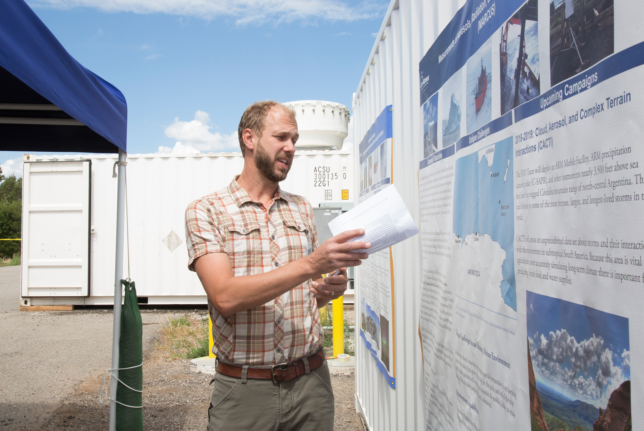
McFarquhar credited LANL’s Heath Powers with testing, packing, and shipping the MARCUS instruments. He will take part in a dry run of instruments on July 13 before they are bundled into two containers.
Onboard the ship, the two technicians will also handle and store filter samples from air sampled close to the ocean surface. (MARCUS will be gathering data on aerosols that could originate from the ocean’s biogenic life—the phytoplankton that ocean waves break into aerosols that can be then entrained into the atmosphere.) They will also check and store instrument data for scientists, and launch four balloon-borne sondes a day. These instrumented platforms will send back data until they burst 14 or 15 kilometers into the atmosphere.
Some data will be transmitted from the ship during cruises, said McFarquhar, including basic imagery. Stored and backed-up data will be sent from Hobart each time the Aurora Australis stops there.
Each journey out by the Aurora Australis will take about two weeks, and the return trip will take the same time. In between, at the three land-bound stations, and during a stop at Macquarie Island closer to Australia, the technicians will check on samples and data, and join the ship’s crew for a rest.
There will be no shipboard science observer during the campaign. But McFarquhar will publish occasional MARCUS blogs. Read the first blog and second blog about MARCUS.
The ARM Climate Research Facility is a DOE Office of Science user facility. The ARM Facility is operated by nine DOE national laboratories, including Los Alamos National Laboratory.
Follow Us:


Keep up with the Atmospheric Observer
Updates on ARM news, events, and opportunities delivered to your inbox
ARM User Profile
ARM welcomes users from all institutions and nations. A free ARM user account is needed to access ARM data.


