

Precipitation Radar Data Product Released for CACTI Campaign
Published: 17 May 2021

The Corrected Moments in Antenna Coordinates Version 2 (CMAC2) value-added product (VAP) has been updated to work with the second-generation C-Band Scanning ARM Precipitation Radar (CSAPR2). A new CSAPR2 data product processed with CMAC2 is now available for the 2018–2019 Cloud, Aerosol, and Complex Terrain Interactions (CACTI) field campaign in Argentina.
Scientists can use this evaluation product to analyze the CSAPR2 data and learn more about microphysical and dynamical processes occurring in convection around complex terrain.
Raw data from ARM precipitation radars must be corrected for atmospheric phenomena and instrument characteristics (e.g., attenuation, clutter) to retrieve precipitation properties. CMAC2 contains a set of algorithms and code that makes such corrections, and it also retrieves precipitation quantities from the radar measurements.
CMAC2 was initially applied to data from the X-Band Scanning ARM Precipitation Radars at ARM’s Southern Great Plains atmospheric observatory. For CSAPR2 data, CMAC2 also does the following:
- adds new fields, in the radar’s natural coordinates of radius, azimuth, and elevation that correct for artifacts
- provides information on how some fields are affected by attenuation—decreased radar signal strength—due to absorption of the microwave radiation by water molecules
- provides an estimate of the rainfall rate.
CMAC2 also introduces the concept of a gate identification (or ID), a pre-retrieval, pre-correction classification of which type of particle (e.g., raindrop, snowflake) is dominant in scattering power back to the radar receiver. The gate ID is then used to determine the appropriate corrections to apply to each measurement.
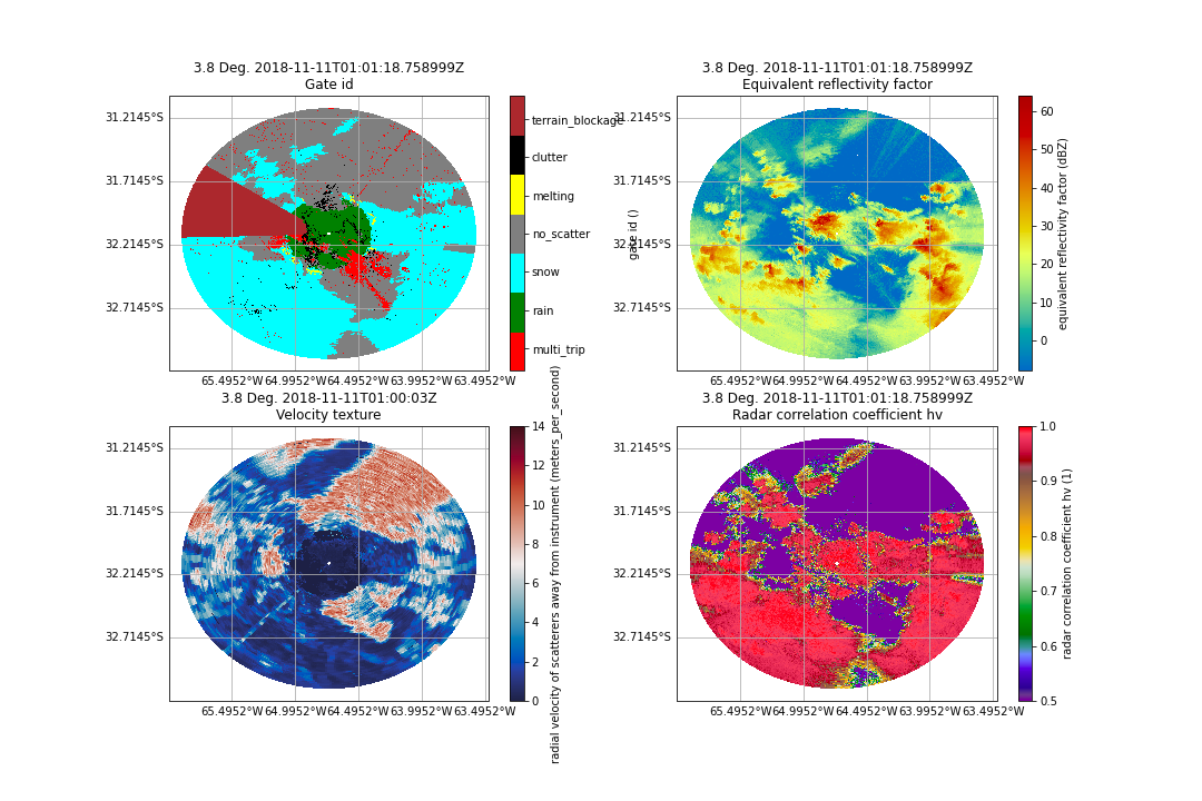
Corrected b1-level CSAPR2 data were used as input for the CACTI release, increasing the quality of the data used in retrievals such as calibrated reflectivity factor and offset corrected differential reflectivity.
Scientists can begin using the new CSAPR2 data product now. More information about CMAC2 can be found on the VAP web page.
For questions or to report data problems with the CSAPR2 product, please contact developer Zachary Sherman or ARM translator Scott Collis.
Data can be referenced as doi:10.5439/1668872. Access the data set in the ARM Data Center. (Go here to create an account to download the data.)
Follow Us:


Keep up with the Atmospheric Observer
Updates on ARM news, events, and opportunities delivered to your inbox
ARM User Profile
ARM welcomes users from all institutions and nations. A free ARM user account is needed to access ARM data.


