

Large-Scale Forcing Data Released for ACE-ENA Campaign
Published: 20 July 2020
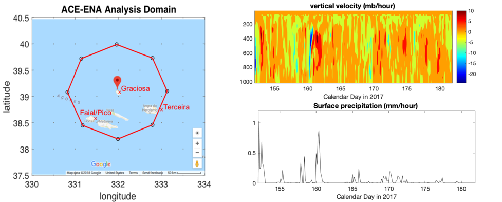
Continuous large-scale forcing data using a constrained variational analysis approach, known as VARANAL, are now available for the Atmospheric Radiation Measurement (ARM) user facility’s Eastern North Atlantic (ENA) atmospheric observatory in the Azores. The time period of available data—June 2017 through February 2018—covers the Aerosol and Cloud Experiments in the Eastern North Atlantic (ACE-ENA) field campaign.
Scientists can use the VAP to drive single-column models, cloud-resolving models, and large-eddy simulation models for different cloud and convective systems. To help validate model simulations, the VAP includes diagnostic fields such as diabatic heating profiles, cloud fields, surface measurements, and large-scale conditions.
These forcing data represent an average over the analysis domain centered at the ENA observatory on Graciosa Island with a diameter of 200 kilometers. The analysis domain represents ocean only, excluding grid points over land.
The VAP constrains ERA-5 reanalysis data from the European Centre for Medium-Range Weather Forecasts (ECMWF) with ARM surface measurements, ocean buoy measurements, and Meteosat-10 and Meteosat-11 satellite data. Sensible and latent heat fluxes are estimated from buoy measurements through a bulk flux algorithm (Fairall et al. 2003) and are incorporated with the ECMWF gridded reanalysis using the Cressman (1959) objective analysis method.
This data set is in netCDF format, with a time resolution of 3 hours and a vertical resolution of 25 hPa.
Scientists can use the ENA forcing data now. These data include the summer 2017 (June to July) and winter 2018 (January to February) intensive operational periods of ACE-ENA.
For questions or to report data problems, please contact Cheng Tao, Shuaiqi Tang, or Shaocheng Xie. More details about the ARM continuous forcing data set are in Xie et al. (2004).
Data can be referenced as doi:10.5439/1602289. To access the data set, please browse the ARM Data Center. (Go here to create an account to download the data.)
References: Cressman GP. 1959. “An operational objective analysis system.” Monthly Weather Review, 87(10), 10.1175/1520-0493(1959)087<0367:AOOAS>2.0.CO;2.
Fairall CW, EF Bradley, JE Hare, AA Grachev, and JB Edson. 2003. “Bulk Parameterization of Air–Sea Fluxes: Updates and Verification for the COARE Algorithm.” Journal of Climate, 16(4), 10.1175/1520-0442(2003)016<0571:bpoasf>2.0.co;2.
Xie S, RT Cederwall, and MH Zhang. 2004. “Developing long-term single-column model/cloud system–resolving model forcing data using numerical weather prediction products constrained by surface and top of the atmosphere observations.” Journal of Geophysical Research: Atmospheres, 109(D1), D01104, 10.1029/2003jd004045.
Follow Us:


Keep up with the Atmospheric Observer
Updates on ARM news, events, and opportunities delivered to your inbox
ARM User Profile
ARM welcomes users from all institutions and nations. A free ARM user account is needed to access ARM data.


