

SACR ADVance Quasi-Vertical Profile Evaluation Product Released
Published: 17 April 2017
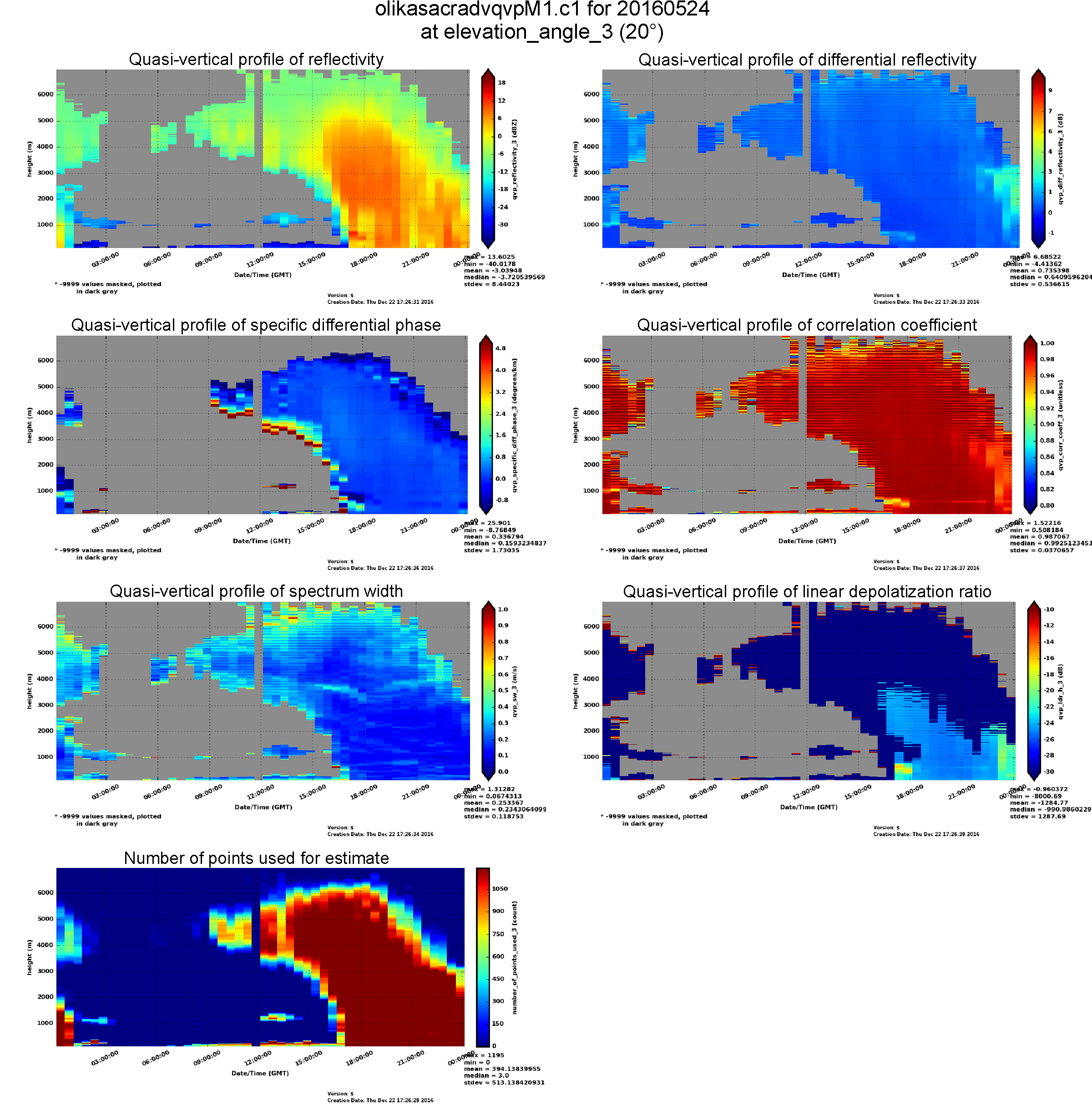 The Scanning ARM Cloud Radar ADVance Quasi-Vertical Profile (SACR-ADV-QVP) provides a quasi-vertical representation of azimuthal-averaged polarimetric variables such as differential reflectivity, specific differential phase and correlation coefficient, and linear depolarization ratio to reveal important signatures in ice and mixed-phase clouds. SACR-ADV-QVPs are produced using a sequence of plan-position-indicator (PPI) scans.
The second-generation SACR (SACR2) is a polarimetric radar capable of observing cloud/precipitation particle properties. The polarimetric variables from lower-elevation-angle observations (e.g., PPI) are more informative. However, it is difficult to directly compare the polarimetric variables observed at lower elevation angles with other profiling measurements (e.g., Ka-band ARM Zenith Radar, microwave radiometer, and ceilometer). Therefore the quasi-vertical profile approach provides a way to average the PPI scans into a time-versus-height format.
PPI scans are at constant elevation with changing azimuth scans. This scan strategy typically covers three different elevation angles and is repeated every 30 minutes. The scientific basis of the algorithm is described in Ryzhkov, et al. (2016). For the three elevation PPIs, observations at constant range are averaged over azimuth angles. The standard deviation over azimuth angles is used as an error estimate.
The input data for this value-added product (VAP) include reflectivity, differential reflectivity, spectrum width, differential phase, linear depolarization ratio, and correlation coefficient, all of which are better off when free of noise, insects, and second trip echo and all of which are in native radar polar coordinates.
This VAP outputs a daily NetCDF file containing quasi-vertical profiles of all aforementioned polarimetric variables every time the PPI scan strategy is performed (this could cause an irregular time stamp). This product is produced at a 10-meter height resolution at an elevation angle of 20 degrees.
For questions or to report data problems, please contact Meng Wang or Scott Giangrande. To access the data, please browse the ARM Data Archive. (Go here to create an account to download the data.)
Ryzhkov A, P Zhang, H Reeves, M Kumjian, T Tschallener, S Trömel, and C Simmer. 2016. “Quasi-Vertical Profiles-A New Way to Look at Polarimetric Radar Data.” Journal of Atmospheric and Oceanic Technology, 33(3), doi:10.1175/JTECH-D-15-0020.1.
# # #
The ARM Climate Research Facility is a national scientific user facility funded through the U.S. Department of Energy’s Office of Science. The ARM Facility is operated by nine Department of Energy national laboratories.
The ARM Climate Research Facility is a DOE Office of Science user facility. The ARM Facility is operated by nine DOE national laboratories, including .
Follow Us:


Keep up with the Atmospheric Observer
Updates on ARM news, events, and opportunities delivered to your inbox
ARM User Profile
ARM welcomes users from all institutions and nations. A free ARM user account is needed to access ARM data.


