

New Ship Navigation Corrections for MAGIC and ACAPEX
Published: 2 November 2015
A new suite of evaluation value-added products (VAPs) is now available for the second ARM Mobile Facility (AMF2) to provide accurate ship location and orientation during ocean deployments and to correct for ship motion.
The AMF2 is designed to support ocean-based deployments and, to date, two deployments have been completed: Marine ARM GPCI Investigation of Clouds (MAGIC)* and ARM Cloud Aerosol Precipitation Experiment (ACAPEX).
During ship deployments, a number of AMF2 instruments collect global positioning system (GPS) and inertial navigation system (INS) measurements. The Navigation Best Estimate (NAVBE) VAP consolidates multiple sources of this information into a single, continuous datastream to be used when information is required about ship location and orientation and to provide an estimate that wouldn’t necessarily be available from any one instrument.
Complementing and making use of NAVBE, a number of ship correction VAPs post-process AMF2 data to correct the effect of ship motion on measurements that are intended to be vertically pointing.
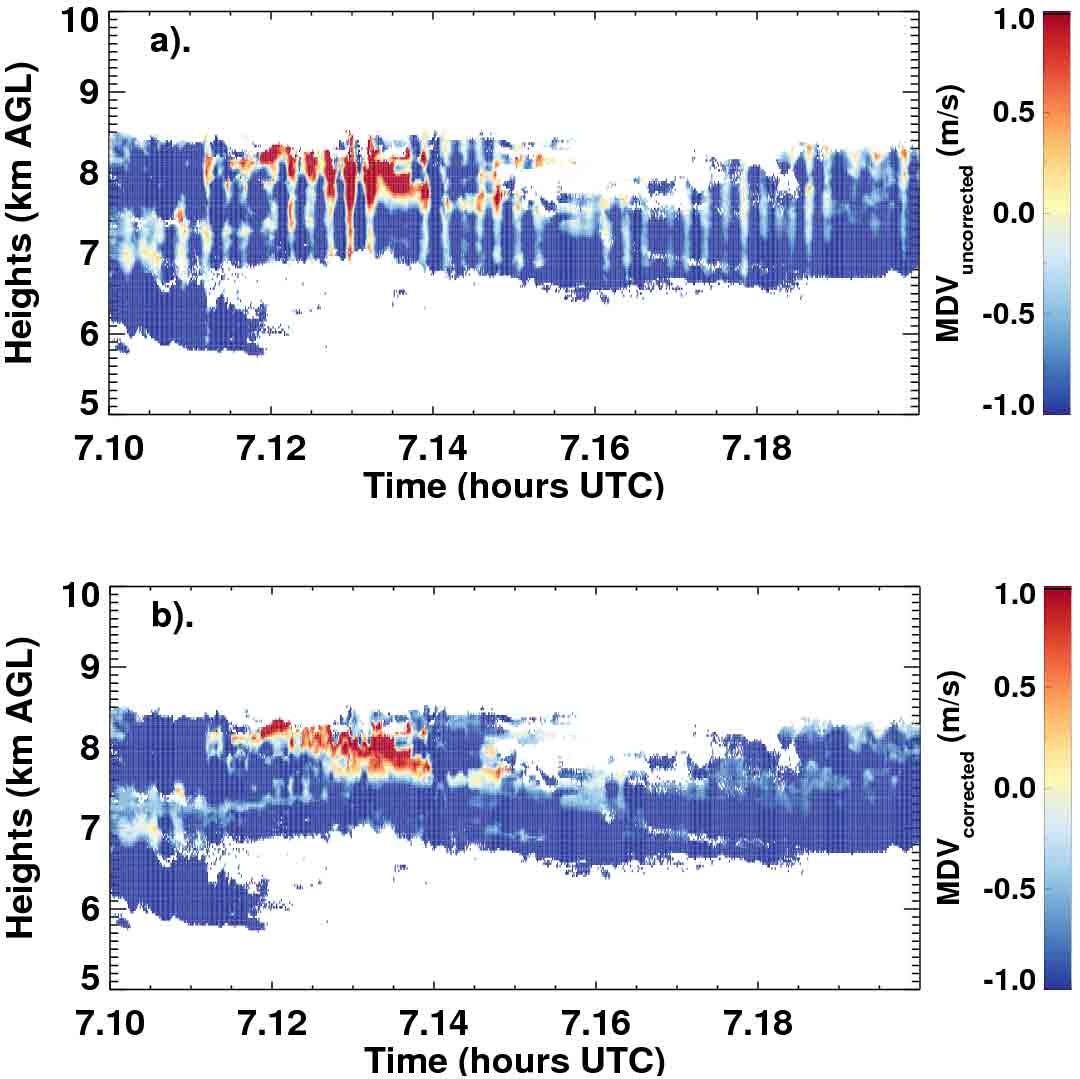
The Ka-band ARM Zenith Radar (KAZR) Ship Correction (KAZRSHIPCOR) VAP produces motion-corrected fields of reflectivity, mean Doppler velocity (MDV), spectral width, and signal-to-noise ratio. Additional corrections are made to MDV to reduce the impact of the horizontal wind component and adjust for ship-heave velocity. The Marine W-band (95 GHz) ARM Cloud Radar (MWACR), unlike the KAZR, is installed on a stable platform, so the MWACR Ship Correction (MWACRSHIPCOR) VAP requires corrections only to MDV.
The Micropulse Lidar (MPL) Ship Correction (MPLPOLFSSHIPCOR) VAP produces corrected signal return values; the High-Spectral-Resolution Lidar (HSRL) Ship Correction (HSRLSHIPCOR) VAP produces corrected particulate extinction, backscatter cross section, and circular depolarization ratio; and the Ceilometer Ship Correction (CEILSHIPCOR) VAP produces corrected cloud base heights.
NAVBE and the ship correction VAPs are currently in evaluation mode. Feedback and use of the data are welcomed and encouraged. For questions or to report data problems, please contact Tami Toto.
To access the data sets, please log into the ARM Data Archive or browse the data from each individual VAP web page above.(Request an account here to download the data.)
*Note:
- GPCI = GCSS Pacific Cross-section Intercomparison, a working group of GCSS
- GCSS = GEWEX Cloud Systems Study
- GEWEX = Global Energy and Water Cycle Experiment, a core project of the World Climate Research Programme.
# # #
The ARM Climate Research Facility is a national scientific user facility funded through the U.S. Department of Energy’s Office of Science. The ARM Facility is operated by nine Department of Energy national laboratories.
The ARM Climate Research Facility is a DOE Office of Science user facility. The ARM Facility is operated by nine DOE national laboratories, including .
Follow Us:


Keep up with the Atmospheric Observer
Updates on ARM news, events, and opportunities delivered to your inbox
ARM User Profile
ARM welcomes users from all institutions and nations. A free ARM user account is needed to access ARM data.


