

Long-Term Best Estimate Data Available for Climate Modelers
Published: 12 February 2008
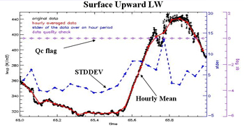
To better serve the needs of climate model development, the ARM Climate Research Facility has devoted significant effort to assemble a “climate modeling best estimate” (CMBE) of the highest-quality cloud and radiation measurements. This data set, specifically tailored for use in evaluating global climate models, includes long-term best estimates from selected ARM measurements for cloud fraction, total cloud cover, shortwave and longwave radiation fluxes, liquid water path, and precipitable water vapor. These quantities are derived from three value-added products and the total sky imager measurements. The current version of this data set contains data averaged over 1-hour time intervals from the ARM Southern Great Plains site from 1996-2007. Similar CMBE data will be available from the other ARM sites (Barrow, Alaska; Nauru Island; Manus Island, Papua New Guinea; and Darwin, Australia) soon.
We encourage your use of these data and welcome your feedback. For more information, see the Cloud Modeling Best Estimate web page. To access these data, log in to the Data Archive. (Go here to request an account.)
The ARM Climate Research Facility is a DOE Office of Science user facility. The ARM Facility is operated by nine DOE national laboratories, including .
Follow Us:


Keep up with the Atmospheric Observer
Updates on ARM news, events, and opportunities delivered to your inbox
ARM User Profile
ARM welcomes users from all institutions and nations. A free ARM user account is needed to access ARM data.


