

Snow Finally Comes to SAIL Site
Published: 25 January 2022
Editor’s note: Daniel Feldman, the principal investigator for the Surface Atmosphere Integrated Field Laboratory (SAIL) campaign in Colorado, provided the following blog post.
After an exceptionally low-snow fall of 2021 during the SAIL study at Gothic, there was a concern that the adage that the surest way to have strange weather patterns is to deploy a field campaign might be coming true. Gothic got no snow in September, 31 centimeters (12.2 inches) in October, and 30 centimeters (11.8 inches) in November. However, winter arrived in December! The snow finally began falling in earnest in the East River Watershed, where SAIL is focused, and hardly took a break until the new year.
With over 300 centimeters (118 inches) of snowfall in December at the main SAIL site in Gothic, there is now a good chance that the accumulation season will be in the normal range and not an extreme outlier.
Initial reports (here and here) indicate that an atmospheric river and a storm from Alaska combined upstream of the Colorado Rockies, both to deliver copious quantities of precipitation and to lead to above-average snowpack for the water year.
The snow dump provided an opportunity to study how these large-scale storms translate to powder on the ground through precipitation and wind processes.
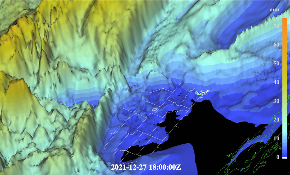
The SAIL campaign can use major meteorological events, such as the blast of precipitation at the end of 2021, to fulfill two of its science objectives: 1) establishing the relationships between precipitation in the SAIL study area and the large-scale circulation and 2) quantifying the importance of wind redistribution and sublimation to the snowpack.
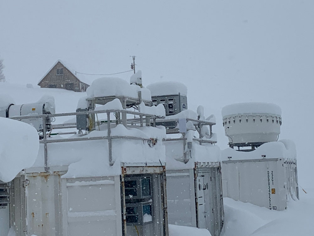
These events also highlighted the literal hard work that is needed to collect data and make it available to the entire scientific community and beyond. Snow is heavy, doesn’t shovel itself, and can directly impact the ability of SAIL instruments to collect data, so a big thanks to the technicians for ensuring that the data continue to flow with minimal interruptions in spite of the subfreezing conditions. Both the science and logistics teams will be digging through this snowfall for some time to come.
2022 has started off not with a fizzle but a bang!

Follow Us:


Keep up with the Atmospheric Observer
Updates on ARM news, events, and opportunities delivered to your inbox
ARM User Profile
ARM welcomes users from all institutions and nations. A free ARM user account is needed to access ARM data.


