

SAIL Group Makes Snow Trek to Survey Sites in Colorado
Published: 16 June 2021
Editor’s note: Dan Feldman, the principal investigator for the upcoming Surface Atmosphere Integrated Field Laboratory (SAIL) field campaign in Colorado, sent in this update.
The start of the SAIL campaign is just around the corner, on September 1, 2021. Preparation is well underway to deploy the second ARM Mobile Facility (AMF2), a Colorado State University (CSU) X-band radar, and potentially a tethered balloon system (TBS) to the Upper Colorado River Basin near Crested Butte, Colorado. One could say that when it comes to the SAIL campaign, things are heating up, both in terms of the science and the air temperature.
On April 1 and 2, with snow still present, a core group of scientists and technicians performed a final site survey to test assumptions of how the instruments and logistics would work in winter. Previous SAIL site surveys occurred before snow started to fall, so this was a unique opportunity to explore the Crested Butte area when it is transformed into a winter wonderland by the seasonal snowpack.
This survey was actually the second attempt at a SAIL site survey with snow on the ground. The first was scheduled to coincide with a site survey for the Study of Precipitation, the Lower Atmosphere and Surface for Hydrometeorology (SPLASH), a sister campaign to SAIL. SPLASH is led by Gijs de Boer, a research scientist with the Cooperative Institute for Research in the Environmental Sciences (CIRES) who has led ARM campaigns in Alaska. However, that coordinated visit was delayed due to a near-record snowfall.
The second time was the charm here, and the site survey successfully took place under bluebird skies. The success of the second attempt clearly highlights both the planning challenges that research in the Rocky Mountains entails and the agility of the team that is committed to collecting data to advance SAIL science.
The survey included the following participants:
- SAIL Principal Investigator Dan Feldman from Lawrence Berkeley National Laboratory
- AMF2 Site Manager Heath Powers and AMF2 SAIL Project Lead John Bilberry, both from Los Alamos National Laboratory
- Garth Rohr and RaeAnn Cook, both from Sandia National Laboratories, who collected information in support of deploying the TBS
- Erik Hulm and Steve Jennison from the Rocky Mountain Biological Laboratory, which will host the SAIL deployment. During the survey, Erik and Steve guided the ski group across snow-covered roads and trails.
Day 1
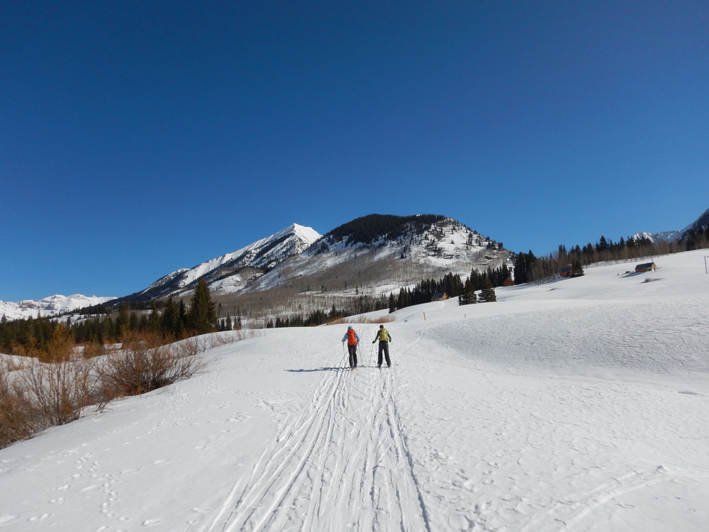
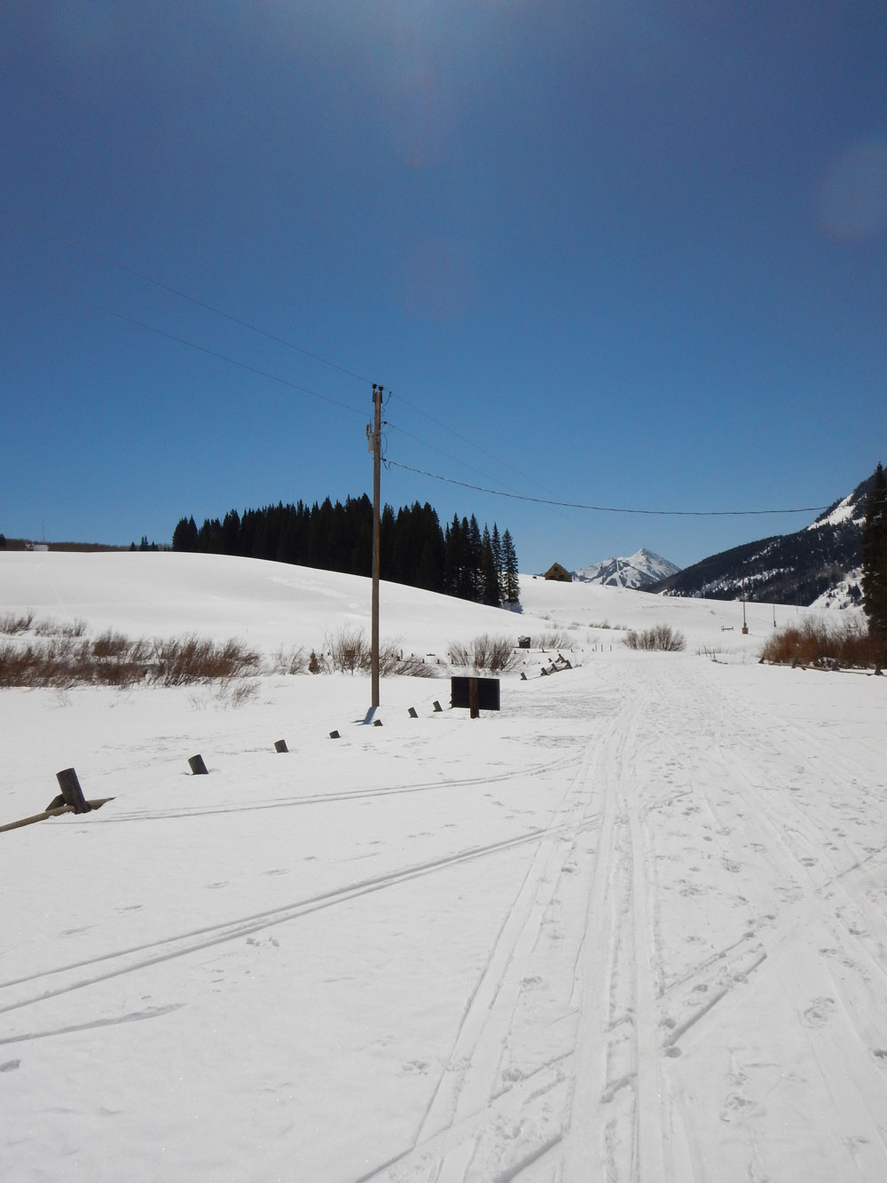
Because the access road has severe limitations on motorized vehicle travel in the fall, winter, and spring to maintain wilderness conditions, the team planned for nonmotorized transportation.
Group members strapped on cross-country skis and snowshoes to traverse the 6-mile round trip from the Snodgrass Trailhead to Gothic Townsite, where the AMF2 instruments will be located, and the extra 2-mile round trip to Kettle Ponds, a possible TBS site.
Along the way, the group took in views of the East River Valley, Crested Butte Mountain, White Rock Mountain, Teocalli Mountain, and Gothic Mountain, which all contribute outsized amounts to snowfall, snowpack, and, ultimately, the water resources of the area.
Garth and RaeAnn evaluated potential deployment sites for the TBS in Gothic Townsite, at Kettle Ponds, and later near the Snodgrass Trailhead. They also performed a set of tests to determine the lift that the TBS would achieve at about 10,000 feet above sea level.
Dan, Heath, and John looked at the selected locations for the AMF2 containers. They also evaluated the conditions for hiking up and down from the containers near Gothic Road to the site of the field instruments, located on a hilltop a few hundred feet away near Gothic Townsite.
During the visit, temperatures changed dramatically throughout the day. The team met at 7:30 a.m., when it was 12 degrees Fahrenheit, and finished in the afternoon when it was 52 F.
Indeed, the group received a firsthand lesson in direct and indirect impacts of atmospheric radiation on the surface and atmosphere. The snow turned to corn—small pellets caused by alternate thawing and freezing—by midday, and everyone had to be sure to use plenty of sunscreen because there was plenty of sunshine and a very bright, glistening snowpack.
Day 2 and Beyond
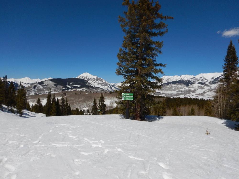
The second day focused on surveying a secondary site for the SAIL campaign on Crested Butte Mountain. This site, at a prominent location hundreds of feet above the East River Valley, will support both the CSU X-band radar and the ARM Aerosol Observing System (AOS). Dan, Heath, John, and Steve strapped on a different set of skis (downhill) for this survey.
Crested Butte Mountain is the site of Crested Butte Mountain Resort, and the high-speed Red Lady Express Lift brought the SAIL group quickly up to the Old Teocalli Lift site to evaluate the elevated location for SAIL measurements. The group found wide-open views across many sectors for the radar and AOS, which enable the long-range sampling that is a key part of the SAIL science objectives and supporting East River Watershed hydrology.
This survey paved the way for the actual concrete and instrument setup that will take place during the summer of 2021. SAIL data will start flowing to the ARM Data Center shortly!
(Check out this Google map pinpointing the sites/landmarks mentioned in this blog.)
In related campaign news, SAIL scientists presented a poster during the AmeriFlux Land-Atmosphere Interactions Workshop, which took place virtually on June 10 and 11.
Next, SAIL and SPLASH investigators will host a breakout session during the virtual Joint ARM User Facility/Atmospheric System Research (ASR) Principal Investigators Meeting. The session is scheduled from 11 a.m. to 1 p.m. Eastern time Wednesday, June 23. Attendees will learn about science needs and opportunities that these campaigns seek to enable, and also take stock of the area’s scenery. The breakout session conveners look to gather user input and interests in these campaigns, and they encourage all to peek at the data and/or consider participating in the interdisciplinary science in the East River Valley.
Follow Us:


Keep up with the Atmospheric Observer
Updates on ARM news, events, and opportunities delivered to your inbox
ARM User Profile
ARM welcomes users from all institutions and nations. A free ARM user account is needed to access ARM data.


