

Overview
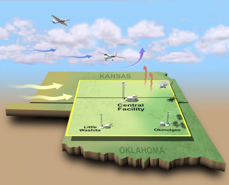
The Cloud and Land Surface Interaction Campaign (CLASIC) was conducted at the ACRF Southern Great Plains (SGP) field measurement site during the summer of 2007. This cross-disciplinary interagency research effort advanced the understanding of how land surface processes influence cumulus convection. Cumulus convection is an important component in the atmospheric radiation budget and hydrologic cycle of the SGP, particularly during the summertime growing season. Human induced changes in the land surface structure associated with plowing, crop rotation, and irrigation can induce changes in the surface latent heat flux, sensible heat flux, albedo, and carbon flux. Changes in surface energy balance and moisture transport to the boundary layer influence cloud processes, thus create a feedback loop.
The ACRF made detailed observations of cumulus convection at the SGP. These routine measurements are the basis of the CLASIC field campaign, which covered a 3-week period in June, a time when the SGP region is likely to be in the process of harvesting the winter wheat. During the harvest period, large changes can occur in the surface albedo, latent heat flux, and sensible heat flux. CLASIC scientists collected additional data sets, both at the surface and from aircraft, which were used to improve parameterizations of cumulus convection and associated parameterizations of land surface processes. The results help decipher the respective roles of local and regional forcing on the observed cloud structure and lead to improved representation of cloud and land surface feedbacks in climate models.
CLASIC was designated as the core of a 2007 priority for the interagency Water Cycle Working Group of the Climate Change Science Program (CCSP). The field campaign served as a prototype for the CCSP focus area, Integration of Water Cycle Observations, Research, and Modeling. The purpose of this focus area is to address significant uncertainties associated with the water cycle through a study that comprehensively addresses the water budget within a limited spatial and temporal domain. The campaign featured concurrent contributions from NASA, NOAA, and USDA to extend CLASIC’s time and space domain to capture the seasonal time scale and regional processes, and expand the observational framework by adding space-based observations, aircraft campaigns, surface and subsurface hydrologic components, isotopic measurements, CO2 fluxes, and associated modeling.
CLASIC scientists also developed a strong collaboration with the North American Carbon Program’s (NACP) Mid Continent Intensive (MCI) study. The two teams recognize that there is significant synergy possible between measurements in SGP and northern MCI, particularly because air masses are flowing from south to north, and the influence of the land surface on atmospheric concentrations can be modeled and tested over large areas. CLASIC also collaborated with DOE’s Atmospheric Science Program’s Cumulus Humilis Aerosol Processing Study (CHAPS). The two science teams evaluated the science questions posed for each campaign and identified overlaps that would benefit both experiments.
Follow Us:


Keep up with the Atmospheric Observer
Updates on ARM news, events, and opportunities delivered to your inbox
ARM User Profile
ARM welcomes users from all institutions and nations. A free ARM user account is needed to access ARM data.


