

ARM’s Southern Great Plains Observatory Hosts Unmanned Aerial Systems
Published: 20 August 2017
CLOUD-MAP Campaign Demonstrates the Future of Atmospheric Data Collection
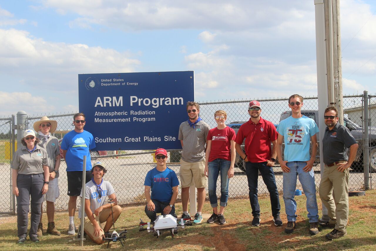
In July, a dozen unmanned aerial systems (UASs) took to the air at ARM’s Southern Great Plains atmospheric observatory in Oklahoma for the second year of the four-year CLOUD-MAP campaign.
Biggest UAS Effort So Far
CLOUD-MAP is an acronym for the project’s formal name, which is a mouthful—Collaboration Leading Operational UAS Development for Meteorology and Atmospheric Physics. Jamey Jacob, professor of mechanical and aerospace engineering at OSU and lead scientist for CLOUD-MAP says: “As far as we know, this experiment is the largest research effort yet attempted to use UASs to study the weather. “
For Jacob, the excitement lies in the team’s mix of engineers and scientists, with the former enabling the latter. “We’ve got atmospheric scientists, physicists, computer scientists, geographers, aerospace engineers, instrument experts—it’s a rich mix,” he says.
That nexus between data-gathering and technology is the sweet spot where human synergy creates new knowledge: it’s also the next frontier for atmospheric science.
Dream Team
CLOUD-MAP is a collaborative development project involving four universities: Oklahoma State (OSU) and the universities of Oklahoma, Kentucky, and Nebraska. It received a $6 million grant from the National Science Foundation in 2015 and began flying the following year. Its goal is to improve atmospheric measurements through use of UASs.
The campaign includes UASs from all participating universities, and each brings specific expertise to the campaign. OSU’s strength is developing UASs and autonomous control systems; Oklahoma’s are meteorology and radar engineering; Nebraska’s is physics; and Kentucky’s are sensor technologies and system integration.
This is the right recipe for the development and implementation of UAS and their integration with sensors for measurements that emphasize meteorology and atmospheric physics, especially complex dynamic processes.
Other organizations beyond the project’s core group include NASA; NOAA; Massachusetts Institute of Technology; University of Colorado, Boulder; the United Kingdom’s National Centre for Atmospheric Science; and various private companies. This truly is a dream team.
CLOUD-MAP’s overall goal is to develop small, affordable unmanned systems and a knowledge base about their use. Jacob is convinced that UASs will become a common tool for researchers because they make aerial data acquisition much easier and cheaper than using aircraft, which also can’t fly as low or slow.

SGP is UAS Friendly
Mike Ritsche, SGP assistant facility manager and a meteorological specialist at Argonne National Laboratory, says that he and his onsite team enjoyed hosting CLOUD-MAP. All went well, except that conditions were too windy for some of the UASs. Still, up to seven took flight at once, and one session included a swarm of five identical quad copters flown synchronously from one control.
Jacob points out that while CLOUD-MAP only arrives in force at SGP once a year to test systems, the experiment uses the site year-round to calibrate instruments.
“It’s only an hour’s drive from OSU,” he adds. “We try to get there once a month. We’re incredibly lucky to have SGP nearby: No one else has its breadth and depth of instrumentation, including tower-mounted and balloon-borne, to calibrate and validate our measurements. It’s a great fit to add UASs to that capability. And SGP’s staff is unfailingly supportive and friendly.”
The High Frontier
Ritsche, too, knows the future when he sees it. “They only got to fly for two days, but they really opened our eyes. They may be back in September, which we’d enjoy. Next year, they’ll also bring Europeans, who want to fly at SGP because of its world-class capabilities. For everyone, this is definitely the way aerial atmospheric measurement is headed, especially for the lower boundary layer, and we want to be part of it.”
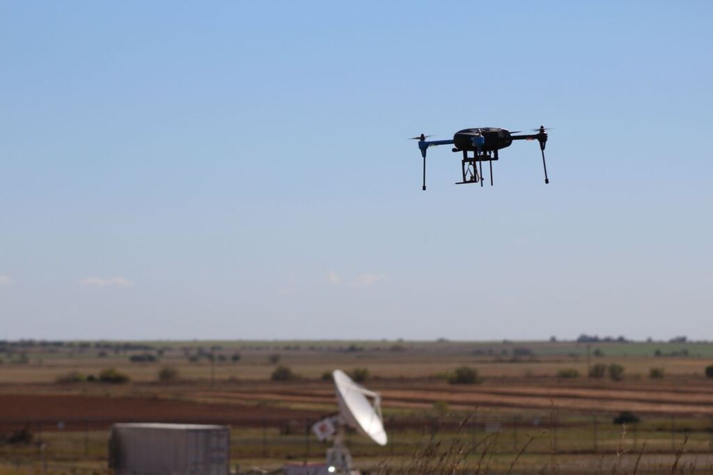
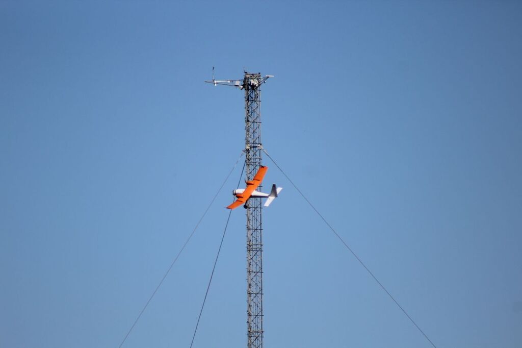
Ritsche explains that UASs can handle a lot of instruments, depending on their size and payload limit. This year, CLOUD-MAP’s vertical-takeoff-and-landing machines included measurements for pressure, temperature, humidity, wind direction, and more. Fixed-wing UASs can carry even more gear, including lidars.
“I’m sure we’ll see more UAS activity here,” Ritsche predicts, “and we’re happy about that.”
Jacob notes that the goal this year was to perform multi-site measurements simultaneously. The CLOUD-MAP team achieved that, though at only two sites instead of the hoped-for three. Last year, they flew 25 hours: this year they clocked 80. There were also 80 participants—an enthusiastic and highly interactive crowd.
Data Collection Out of the Box
“Our goal is to determine best practices,” says Jacob. “A lot of people are watching this project closely. We’re breaking new ground with technology and processes, and we’re collecting good, usable data. In the end, we want to provide out-of-the-box data collection tools for scientists to use without worrying about the technical aspects.” Laughing, he adds, “I have to keep reminding our engineers: it’s all about the data, not the enabling tools.”
With flying finished for now, the CLOUD-MAP team is absorbing the data and tweaking future plans. For example, a new component has been added that will compare UAS-gathered carbon dioxide measurements with those collected by SGP’s tower instruments. With campaign plans to continue over the next two years, expect to see more UAS activity in the Oklahoma sky.
The ARM Climate Research Facility is a DOE Office of Science user facility. The ARM Facility is operated by nine DOE national laboratories, including Argonne National Laboratory.
Follow Us:


Keep up with the Atmospheric Observer
Updates on ARM news, events, and opportunities delivered to your inbox
ARM User Profile
ARM welcomes users from all institutions and nations. A free ARM user account is needed to access ARM data.


