

Scientists Study Clouds’ Impact on West Antarctic Ice Melt
Published: 19 January 2016
Antarctic clouds studied for first time in five decades

It has been half a century since the West Antarctic atmosphere has been studied in detail and an “unprecedented deployment” of instruments from the U.S. Department of Energy’s (DOE) Atmospheric Radiation Measurement (ARM) Climate Research Facility is now delivering data that could help scientists understand how clouds affect melting glaciers.
DOE is collaborating with the National Science Foundation to carry out the ARM West Antarctic Radiation Experiment (AWARE) field campaign, recently highlighted in “Antarctic Clouds Studied for First Time in Five Decades,” an article published January 5 in Nature.
The project deserves attention, according to Scripps Institution of Oceanography research physicist Dan Lubin, who leads the AWARE campaign—simply because West Antarctica is one of the most rapidly warming regions on Earth. Scientists have discovered that glaciers on the West Antarctic Ice Sheet (WAIS) are moving noticeably faster toward the sea and the ice sheet is showing large areas of surface melt in the summer, he points out.
“West Antarctica is losing ice mass rapidly,” Lubin explains. “Upper warm air intrudes from the Southern Ocean and we need to get our surface and upper air measurements right to figure out why the surface is melting. We are lucky to be using the ARM Mobile Facility to get detailed surface and upper air data. There is a need to quantify the impact these changing air masses have on the surface energy balance.”
Remote Deployment
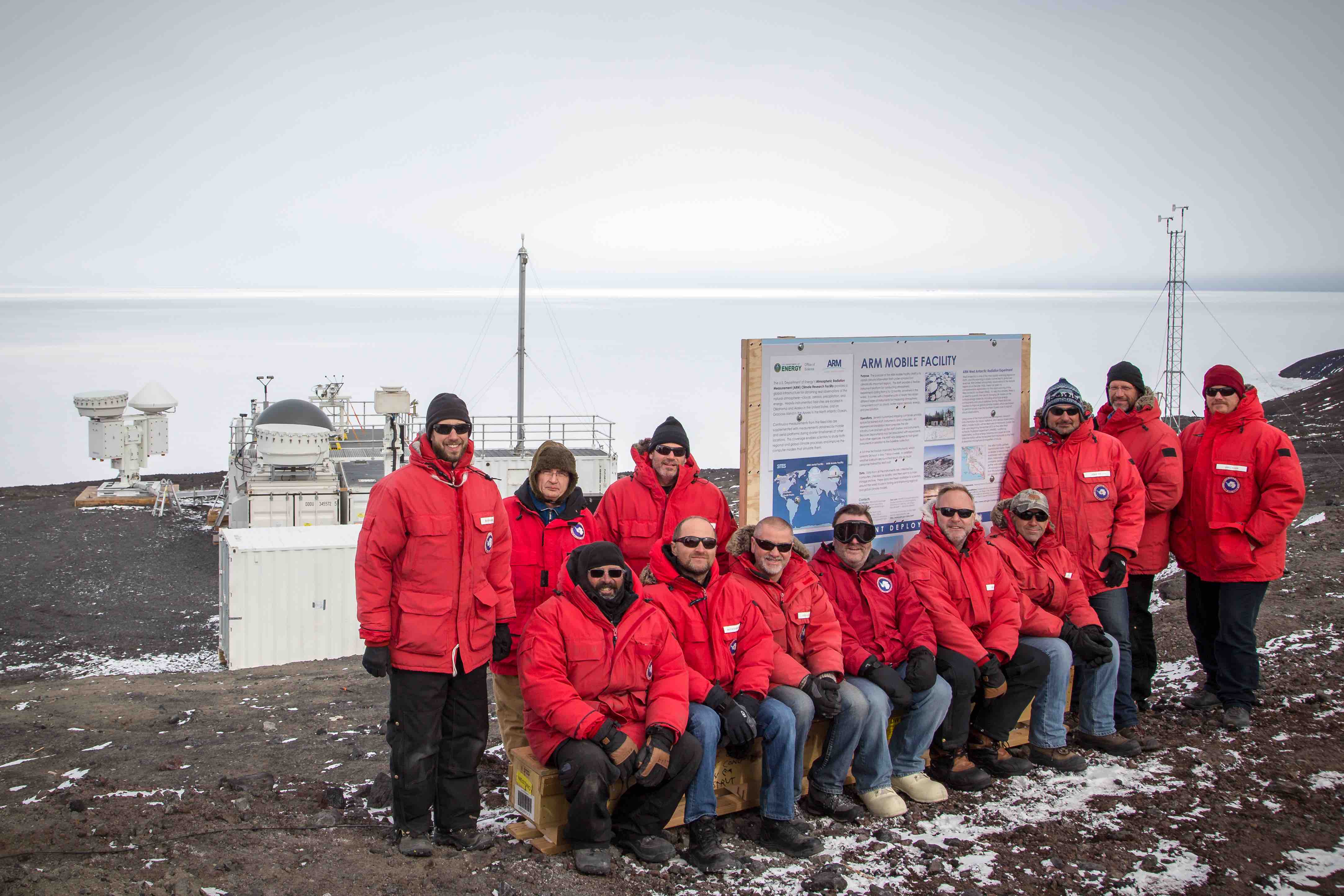
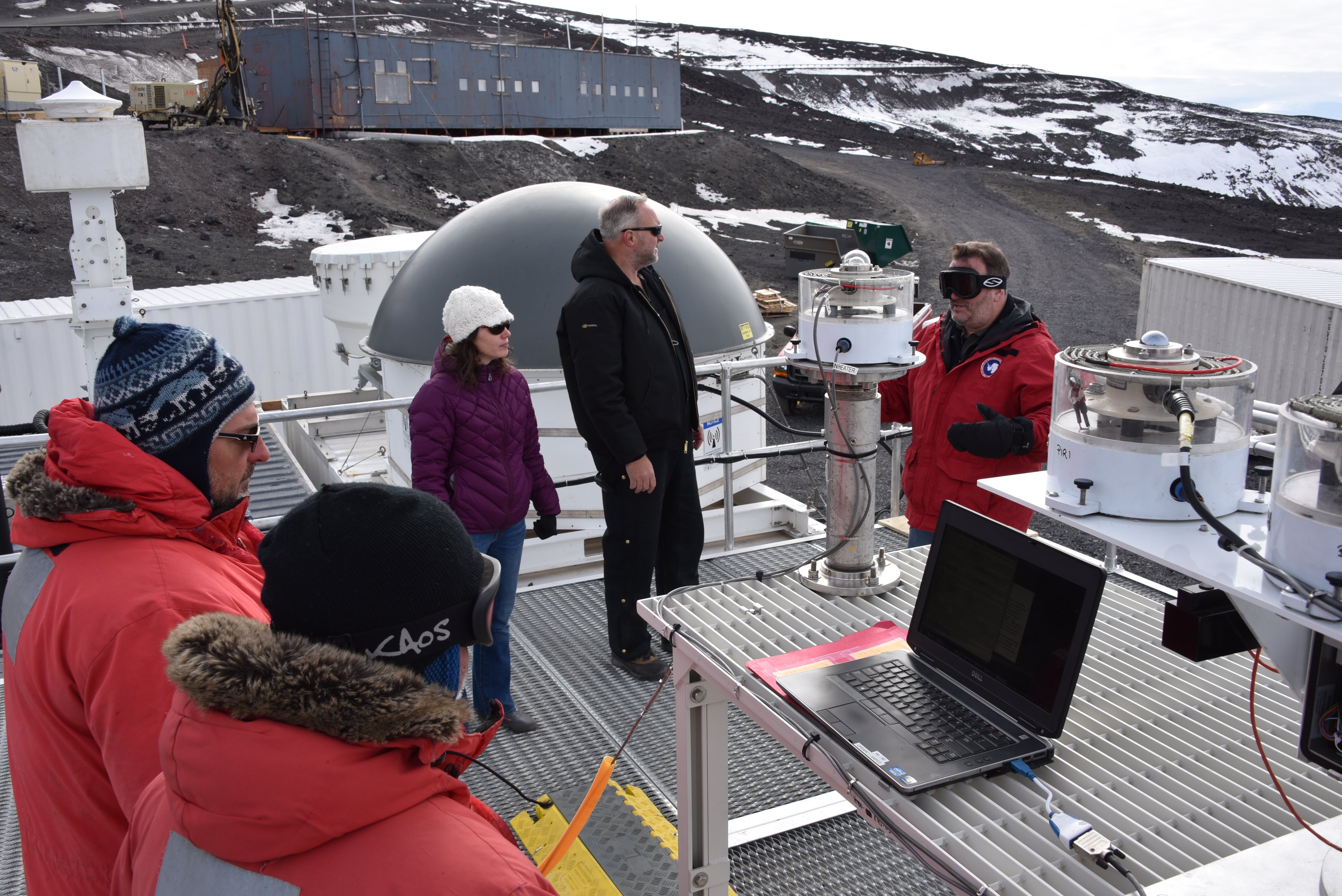
In late November 2015, a set of ARM instruments, including basic radiometric, surface energy balance, and upper air equipment was deployed for 56 days at the WAIS Divide Ice Camp, which is located 1600 kilometers from McMurdo Station and is too remote to operate in the winter. At McMurdo, ARM’s most advanced cloud and aerosol instrumentation, including cloud radar, high spectral resolution lidar, and a complete aerosol suite will be deployed from December 2015 to January 2017, providing cloud information also relevant to conditions on the WAIS due to circulation patterns in the Ross and Amundsen seas.
Together, readings from both sites will provide a total of 14 months of data scientists can use to enhance their understanding of the effects of clouds on antarctic warming in an area where there is no comprehensive explanation for the glacial movement and melting that is taking place.
Important Role in Energy Balance
Clouds play a very important role in the antarctic energy balance. There is currently very little known about the composition of these clouds due to the lack of observations to date. There is a need to quantify how they influence various components of surface energy, as well as cloud radiative forcing.
Collecting accurate data will help scientists understand not only the influence clouds have on climate warming but also how they respond to higher temperatures themselves. In the past, the lack of accurate cloud data has hindered the efforts of scientists to improve the performance of global climate models over the Antarctic and Southern oceans.
“We are trying to connect our work as much as possible to eventually help quantify the rise in sea level resulting from melting polar ice,” Lubin stresses. “We have to place a major focus on clouds and aerosol particles. That’s why we are using the ARM Mobile Facility because it provides some of the best cloud measurement instruments available. These measurements will be of great importance in understanding the big picture of how warming will contribute to a rising sea level in the future.”
This $5 million AWARE campaign is a collaborative effort between DOE and the National Science Foundation, which manages the U.S. Antarctic Program.
For more information on the campaign, please visit the deployment web page. For pictures of the campaign, visit ARM’s Flickr page.
# # #
The ARM Climate Research Facility is a national scientific user facility funded through the U.S. Department of Energy’s Office of Science. The ARM Facility is operated by nine Department of Energy national laboratories, including Los Alamos National Laboratory, which managed the AWARE deployment.
The ARM Climate Research Facility is a DOE Office of Science user facility. The ARM Facility is operated by nine DOE national laboratories, including .
Follow Us:


Keep up with the Atmospheric Observer
Updates on ARM news, events, and opportunities delivered to your inbox
ARM User Profile
ARM welcomes users from all institutions and nations. A free ARM user account is needed to access ARM data.


