

MAGIC Continues to Inspire Insights
Published: 8 February 2016
Data from the first extended at-sea ARM deployment are improving understanding of marine clouds
Because they cover so much of the Earth and reflect large amounts of sunlight, marine clouds play an especially critical role in climate and climate research. However, most non-satellite investigations of such clouds have been relatively short-term (~one month) in fairly small regions. And satellites can only peer so deep into cloud cover and can miss key processes near the surface. The Marine ARM GPCI* Investigation of Clouds (MAGIC) field campaign placed the second ARM Mobile Facility on board the Horizon Lines cargo ship Spirit, traversing the route between Los Angeles and Honolulu in 2012 and 2013.
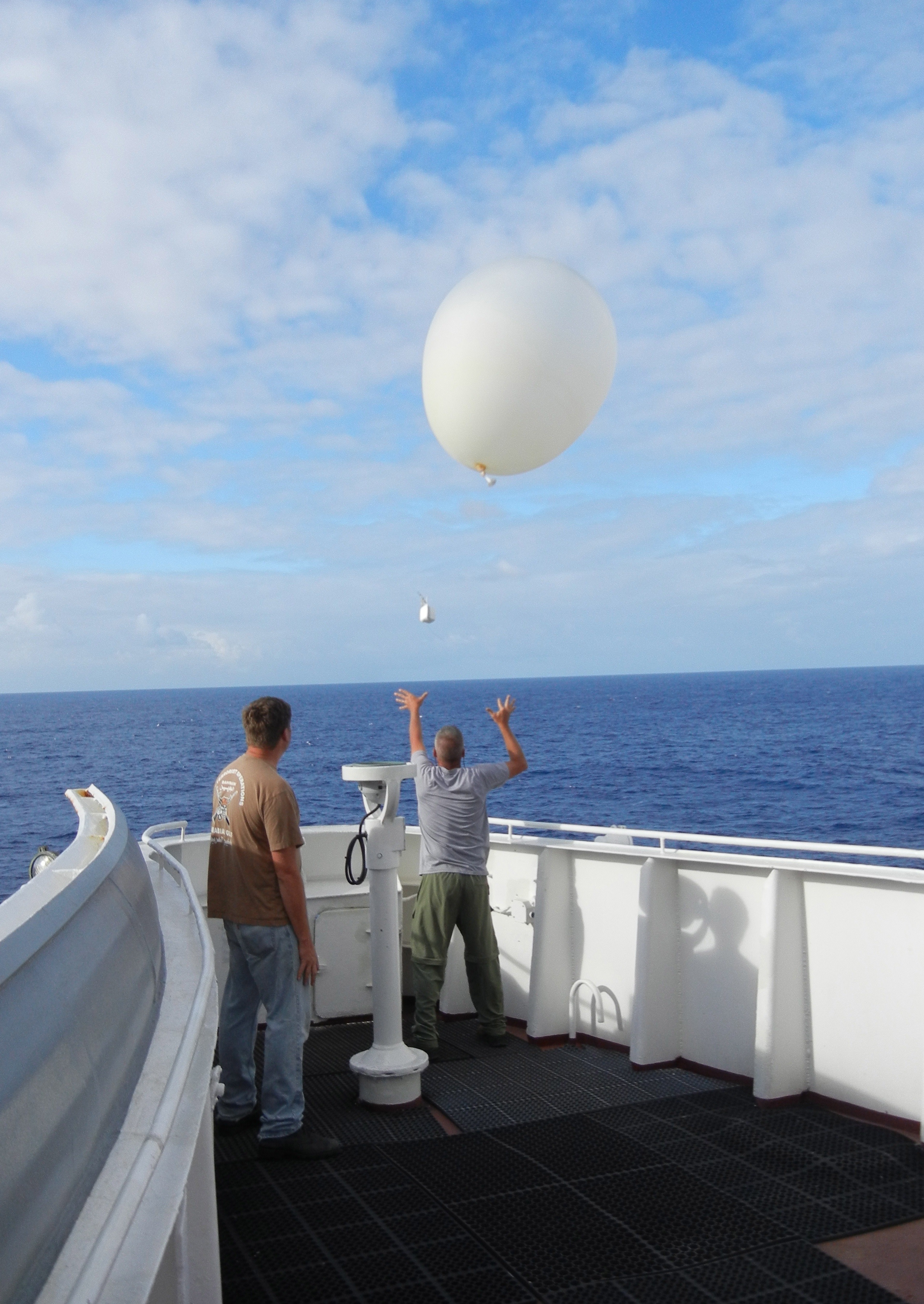
During 20 round trips and nearly 200 days at sea, the second ARM Mobile Facility obtained continuous measurements of clouds and precipitation, aerosols, and atmospheric radiation; surface meteorological variables; and atmospheric profiles from radiosondes launched by weather balloons every 6 hours. By collecting this massive data set, MAGIC sought to improve how climate models represent the transition between stratocumulus and cumulus clouds through a better understanding of the small-scale physical processes, such as turbulence, convection, and radiation, associated with this transition. Now, 2 years after the close of the campaign, the data continue to inspire researchers to reach new heights.
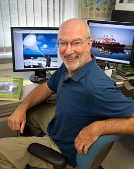
“MAGIC was the first true extended at-sea deployment of an ARM Mobile Facility,” said Ernie Lewis, atmospheric scientist at Brookhaven National Laboratory, who led the campaign. “For the first time, we could start to see what was happening in the clouds without the influence of any land in the vicinity.”
Heads in the Clouds
Researchers from Brookhaven National Laboratory and Canada’s McGill University used the MAGIC data to look more closely at clouds and precipitation along the transect. They found that clouds tended to form most often in the lowest thousand meters above the ocean and during the warm season versus the cold. When these clouds produced precipitation, it frequently evaporated before reaching the ocean surface. In addition, the clouds dissipated quickly, depending on conditions. These aspects of cloud behavior are counter to what is currently found in global climate models, indicating areas for improvement.
Researchers at NASA’s Jet Propulsion Laboratory reached a similar conclusion. They used the MAGIC data combined with satellite information to delve into the boundary layer and tease out how stratocumulus clouds, which tend to cool the Earth, transition to cumulus, which tend to warm it. Changes as small as a 4 percent difference in cloud type could result in a heat increase as large as doubling atmospheric carbon dioxide concentrations. They discovered that the transition between cloud types was more gradual than expected and involved an increase in heat, rain, dry wind, and the height of the boundary layer, with a decrease in warm dry air. In a complementary study, the researchers used data from the radiosondes to validate temperature and moisture information gathered by satellite. Their results show errors in the interpretation of satellite data, which is routinely used in climate modeling, and pinpoint ways to resolve them.
Researchers at the University of Maryland and Hebrew University in Jerusalem also looked at clouds when they undertook the daunting task of disentangling the effects of aerosols and meteorology on cloud properties, some of which could not be measured until recently. Data from MAGIC allowed scientists to simplify, improve, and expand a new method to calculate cloud-based updrafts from satellite measurements for the first time. This new method will allow global climate models to more accurately simulate cloud properties, even when ground-based measurements are lacking.
The Details are in the Drizzle
Scientists have struggled to understand cloud processes over a maritime environment because these clouds are often drizzling, and the radar signal used to measure cloud processes is reflected from drizzle droplets, making it difficult to separate the cloud and drizzle processes. An international team of researchers from the U.K. University of Reading, Finnish Meteorological Institute, NOAA, University of Wisconsin, and Argonne National Laboratory used MAGIC data to test a new method that will provide information on clouds and drizzle simultaneously, even when precipitation does not reach the surface. The approach can also be used to determine how precipitation starts, how aerosol affects drizzle, and how precipitation influences cloud formation and variability.

Researchers from Science Systems and Applications, Inc., teamed with NASA’s Langley Research Center to use MAGIC data to learn how circulation patterns over the northeast Pacific affect cloud condensation nuclei. These nuclei are the tiny aerosol particles around which clouds and precipitation, such as drizzle, form. The research team found that the number of nuclei decreased as the wind intensified. The work can be used to explore more deeply the sources, fates, and composition of aerosols and their impacts on clouds.
“Climate models tend to give us a wide range of results, and we don’t really know the problems that are causing this variation,” said Lewis. “The research fueled by MAGIC data is helping us diagnose model errors so we can fix them, and I think we’ll be reaping the rewards for years to come.”
*Note: GPCI = GCSS Pacific Cross-section Intercomparison, a working group of GCSS; GCSS = GEWEX Cloud Systems Study; GEWEX = Global Energy and Water Cycle Experiment, a core project of the World Climate Research Programme.
References
Fielding MD, JC Chiu, RJ Robin, G Feingold, E Eloranta, EJ O’Connor, and MP Cadeddu. 2015. “Joint retrievals of cloud and drizzle in marine boundary layer clouds using ground-based radar, lidar and zenith radiances.” Atmospheric Measurement Techniques, 8:2663-2683. doi:10.5194/ amt-8-2663-2015.
Kalmus P, M Lebsock, and J Teixeira. 2014. “Observational boundary layer energy and water budgets of the stratocumulus-to-cumulus transition.” Journal of Climate, 27(24):9155-9170. doi:10.1175/jcli-d-14-00242.1.
Kalmus P, S Wong, and J Teixeira. 2015. “The Pacific subtropical cloud transition: A MAGIC assessment of AIRS and ECMWF thermodynamic structure.” IEEE Geoscience and Remote Sensing Letters, 12(7):1586- 1590. doi:10.1109/lgrs.2015.2413771.
Painemal D, P Minnis, and ML Nordeen. 2015. “Aerosol variability, synoptic-scale processes and their link to the cloud microphysics over the northeast Pacific during MAGIC.” Journal of Geophysical Research – Atmospheres, 120:5122-5139. doi:10.1002/2015JD023175.
Zheng Y, and D Rosenfeld. 2015. “Linear relation between convective cloud base height and updrafts and application to satellite retrievals.” Geophysical Research Letters, 42:6584-6491. doi:10.1002/2015GL064809.
Zhou X, P Kollias, and ER Lewis. 2015. “Clouds, precipitation, and marine boundary layer structure during the MAGIC field campaign.” Journal of Climate, 28(6):2420-2442. doi:10.1175/jcli-d-14-00320.1.
# # #
The ARM Climate Research Facility is a national scientific user facility funded through the U.S. Department of Energy’s Office of Science. The ARM Facility is operated by nine Department of Energy national laboratories, including Brookhaven National Laboratory and Argonne National Laboratory.
The ARM Climate Research Facility is a DOE Office of Science user facility. The ARM Facility is operated by nine DOE national laboratories, including .
Follow Us:


Keep up with the Atmospheric Observer
Updates on ARM news, events, and opportunities delivered to your inbox
ARM User Profile
ARM welcomes users from all institutions and nations. A free ARM user account is needed to access ARM data.


