

Covering All Bases: Probing the Spectrum of Land-Atmosphere Interactions
Published: 7 December 2015
ARM-funded experiment to determine the flow of heat and moisture between Earth and air
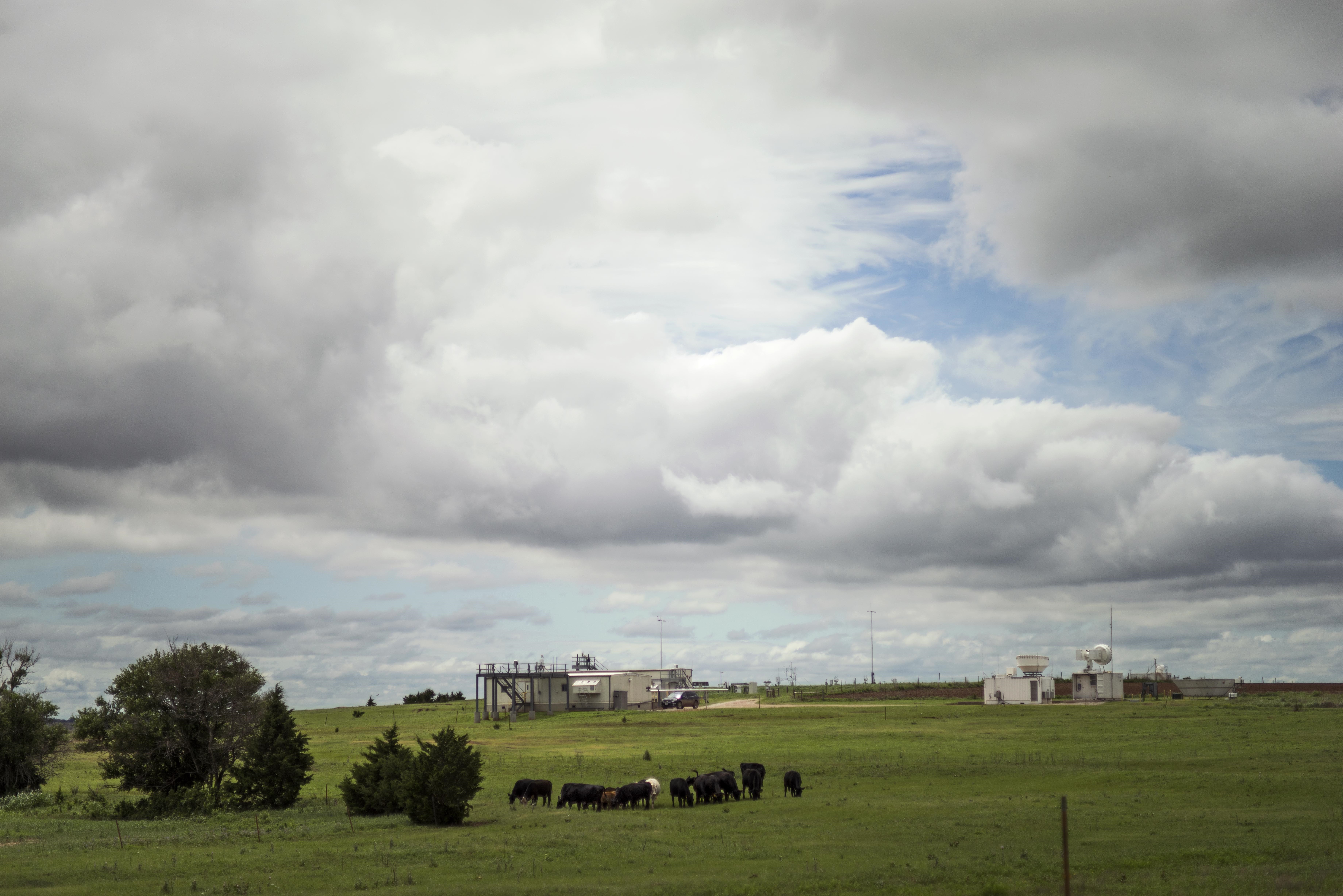
In less than a year, mile-long fiber optic cables will stretch across prairies and crop fields in Oklahoma, allowing scientists to gain the clearest picture yet of the exchange of heat and moisture between the land and the atmosphere.
By determining these interactions, the Cross-Scale Land-Atmosphere Experiment (CSLAEX), which is funded by the U.S. Department of Energy’s (DOE) Atmospheric Radiation Measurement (ARM) Climate Research Facility and the DOE Early Career Research Program, will provide fine-resolution data that will help improve climate models, weather forecasts, and water resources management.
“Our hope is that this experiment will inform better models of heat transfer and evaporation from the land surface,” said Pierre Gentine, CSLAEX’s lead investigator from Columbia University. “Ultimately the goal is to improve weather, climate, and hydrological models,” Gentine said.
A System in Flux
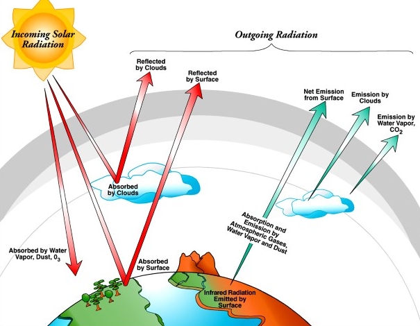
Each day, energy flows between the Earth’s surface and the atmosphere; solar radiation and atmospheric longwave radiation warm the land and oceans and some of this energy is stored in the surface. Some energy, however, returns to the atmosphere, as either evaporation or sensible heat.
“So sensible heat is actually why, everyday, you get an increase in the air temperature,” Gentine said.
This warming, and the subsequent movement of air, can be seen when viewing a road on a hot summer day. “You can witness the motion in the air,” Gentine said. “And the reason is because of these fluxes moving the air around so you can actually witness the turbulence going on.”
Gentine’s goal is to measure the flux of heat and moisture (evaporation) rising to the atmosphere from the land, as such fluxes drastically impact weather and climate.
In particular, Gentine wants to investigate how different land surface types and heterogeneities might impact these fluxes.
Spanning Space and Time
To understand how different land cover might impact the exchange of heat or moisture requires multiple observations but, until now, only point measurements have been taken.
“So basically it’s like a high frequency weather station that just measures at this single point and then they use assumptions to get a sense of the transfer over some area,” Gentine said. “But it is unclear whether these assumptions apply.”
The limited temporal or spatial scale of such observations constrains researchers’ knowledge and ability to understand land-atmosphere interactions. The objective of CSLAEX is to overcome this roadblock, Gentine said. By stretching mile-long fiber optics cables across the areas of interest, the scientists will be able to take temperature and humidity measurements at 10-centimeter intervals, resulting in more than 16,000 data points for a given time interval. The cables will also be placed at different heights above the surface and record data throughout all four seasons.
“That way we can actually see the flux evolving spatially and temporally,” Gentine said. The team will test out the system next March at Oklahoma State University, where they will lay down 200 meter cables for one month. They will then install the full system at ARM’s Southern Great Plains (SGP) site near Lamont, Oklahoma, where it will remain, taking readings for several years.
“When you’re looking at the data for a year or so, you can get a sense of weather and seasonal variability,” Gentine said. “And if you look at it for 10 years or so, you can then follow what is going on with climate variability. When a year is anomalously wet or dry, for example, you want to sample in all of these conditions to correctly represent that in our models.”
At the SGP site, the ARM Facility already measures atmospheric information such as details of the boundary layer, cloud cover, and convention. This information, coupled with the CSLAEX data, will help formulate new heat flux laws and parameterizations for the boundary layer and the land surface. Such improvements will then be implemented into future hydrological and atmospheric models such as the Weather and Research Forecasting (WRF) model and Community Land Model (CLM).
“The results of our study should have relevance to water resource management,” Gentine said. “But it will also impact many fields such as meteorology, climate, ecology, and remote sensing.”
# # #
The ARM Climate Research Facility is a national scientific user facility funded through the U.S. Department of Energy’s Office of Science. The ARM Facility is operated by nine Department of Energy national laboratories.
The ARM Climate Research Facility is a DOE Office of Science user facility. The ARM Facility is operated by nine DOE national laboratories, including .
Follow Us:


Keep up with the Atmospheric Observer
Updates on ARM news, events, and opportunities delivered to your inbox
ARM User Profile
ARM welcomes users from all institutions and nations. A free ARM user account is needed to access ARM data.


