

MC3E: A Legacy of Learning
Published: 7 December 2015
Four years after the field research campaign ended, data are yielding the secrets of storms
Large storm clouds influence the Earth’s climate system by redistributing heat and moisture in the atmosphere and delivering rain to the surface, yet current climate models struggle to accurately reproduce storm systems. To help resolve this issue, the U.S. Department of Energy and National Aeronautics and Space Administration (NASA) collaborated on the Midlatitude Continental Convective Clouds Experiment (MC3E) at Atmospheric Radiation Measurement (ARM) Climate Research Facility’s Southern Great Plains site in central Oklahoma in April and May 2011.
The collaboration leveraged the most comprehensive array of ground-based instruments in the central United States along with an extensive radiosonde array, remote sensing and aircraft measurements, and ground validation remote sensors. The effort provided one of the most complete data sets for storms and their environment to date. This data set is providing a legacy for those seeking to learn the secrets of storms.
Mysteries in the Clouds
Global climate models need to account for processes that occur over scales from millimeters to thousands of kilometers. Models that simulate interactions between individual cloud and precipitation particles feed models that detail clouds or large eddies of air over broader regions.
These in turn can inform regional and global-scale models. Researchers at the University of Kansas, McGill University, and Brookhaven National Laboratory coupled large-eddy simulations with cloud measurements made during MC3E. They found that the fine details documented by the scanning radar can provide useful data for models on how the structure of clouds, precipitation, and associated processes evolve over time.
In another study, researchers at Lawrence Livermore and Brookhaven National Laboratories and Stony Brook University compared two typical convective systems for the region and identified similarities and variations in the conditions in which the storms formed and persisted. The results of these two efforts advance our understanding of precipitation and other processes that influence storm life cycle.
To better understand the properties of storms, researchers at the University of North Dakota examined the complex physical properties associated with ice particles in the upper portions of storms. The work indicated that the aircraft measurements made during MC3E can serve as an important data set to validate ground-based and satellite measurements as well as model simulations.
Now Playing in 3-Dimensional
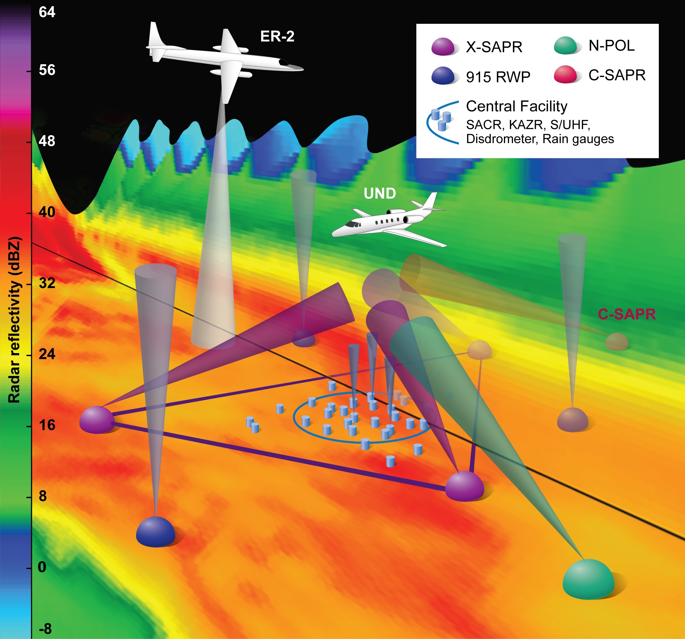
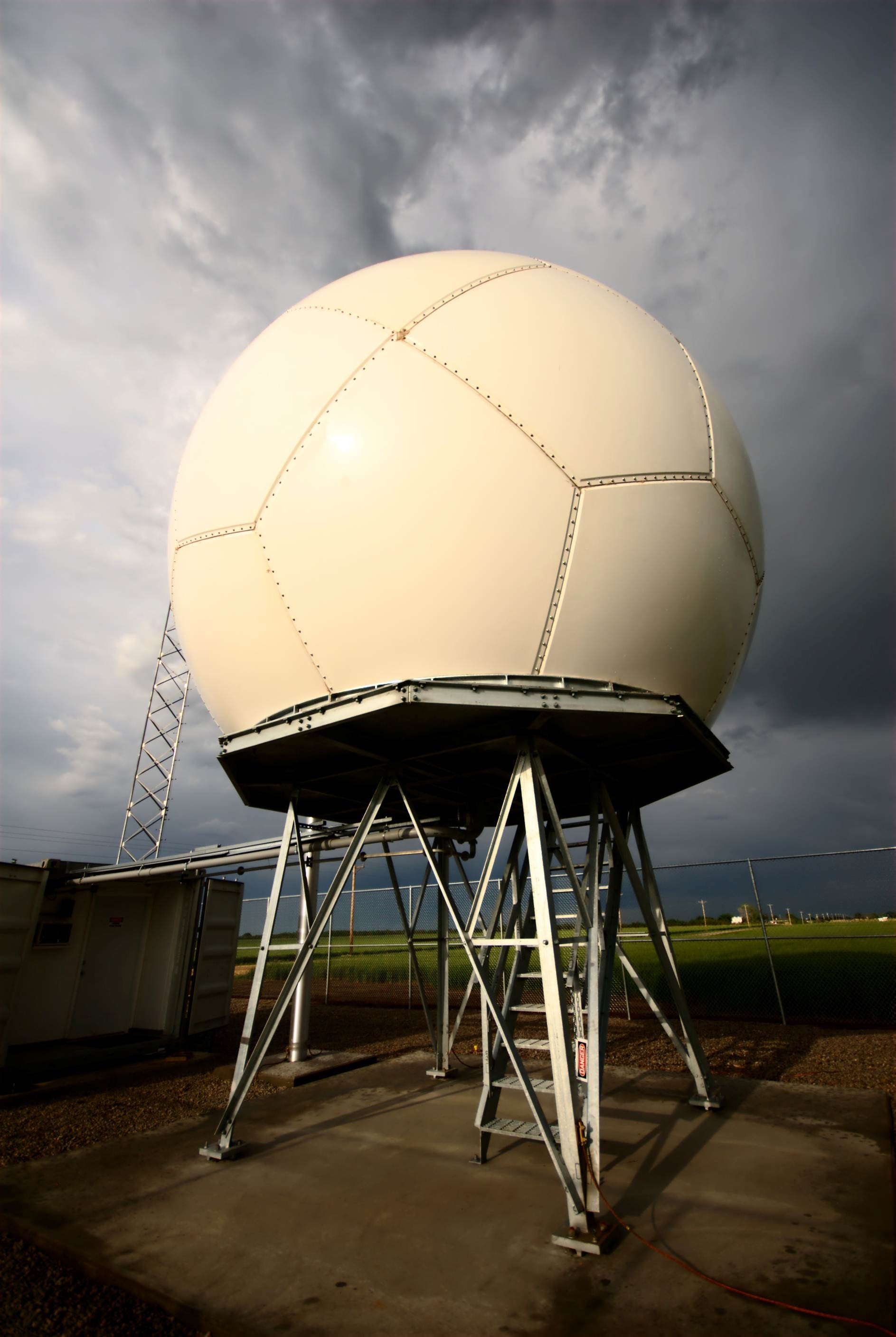
Until MC3E, most ground-based cloud radars were limited to profiling the column of air directly above them. Efforts under MC3E used ARM’s scanning cloud radar (SACR) to provide information on the 3-dimensional structure of clouds and precipitation. Researchers at McGill University teamed with scientists at Brookhaven National Laboratory to document the life cycle of shallow cumulus clouds, from formation through precipitation and dissipation. Their work can be used to help relate the evolution of clouds to aerosol properties and larger-scale meteorological conditions.
A major component of the MC3E campaign was a six-site radiosonde network designed to set the boundaries of atmospheric pressure, temperature, humidity, and winds in models. Over the course of the 46-day campaign, researchers launched a total of 1,362 radiosondes. To ensure other researchers could make the best use of the extensive data set, a team from Brookhaven, Argonne, and Lawrence Livermore National Laboratories; and Colorado State University detailed the instrumentation used and data processing approach including quality checks and bias corrections.
“MC3E provided us with a unique opportunity,” said Michael Jensen, atmospheric scientist from Brookhaven National Laboratory, who led the campaign. “We had a tremendous set of assets in one place. The wealth of data they produced continues to provide dividends.”
Raindrops on Radar
Researchers at the National Center for Atmospheric Research, North Carolina State University, and National Oceanic and Atmospheric Administration (NOAA) looked at new ARM radar data from MC3E to study how raindrops form in a storm cloud. As raindrops fall, their size and shape evolve depending on a host of processes such as how they collide. Their growth behavior affects not only the rainfall rate at the surface but also the dynamics of a storm. The work suggests that radar data may be useful for distinguishing among various raindrop growth and decay processes.
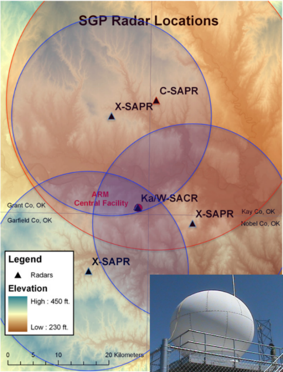
Another team from Brookhaven and Argonne National Laboratories, the University of Oklahoma, and NASA’s Goddard Space Flight Center compared data from ARM’s scanning precipitation radars (SAPRs) to data generated by the National Weather Service’s operational Doppler weather surveillance radar (WSR-88D). The WSR-88D radar is often used to estimate rainfall for operational weather forecasting. The results show that the SAPR, which operates in the C band (the frequency used by many weather radars) performs well when quantifying rainfall compared to the WSR-88D. This comparison highlights the capabilities of the ARM radars, which may be deployed in remote regions where there are few other measurements.
Researchers at the Scripps Institution of Oceanography, on the other hand, looked at what triggers a global climate model to initiate a storm. The performance of these so-called convection triggers can affect how realistically climate models simulate the time and location where storms will occur. Using data from MC3E, the researchers evaluated model performance and identified three types of triggers that allow global climate models to deliver results that most closely align with real-world measurements.
References
Borque P, P Kollias, and S Giangrande. 2014. “First observations of tracking clouds using scanning ARM cloud radars.” Journal of Applied Meteorology and Climatology, 53:2732-2746. doi:10.1175/JAMC-D-13-0182.1.
Giangrande S, S Collis, A Theisen, and A Tokay. 2014. “Precipitation Estimation from the ARM Distributed Radar Network During the MC3E Campaign.” Journal of Applied Meteorology and Climatology, 53(9):2130–2147. doi:10.1175/JAMC-D-13-0321.1.
Jensen M, T Toto, D Troyan, P Ciesielski, D Holdridge, J Kyrouac, J Schatz, Y Zhang, and S Xie. 2015. “The Midlatitude Continental Convective Cloud Experiment (MC3E) Sounding Network: Operations, Processing and Analysis.” Atmospheric Measurement Techniques, 8:421-434. doi:10.5194/amt-8-421-2015.
Kumjian M and O Prat. 2014. “The impact of raindrop collisional processes on the polarimetric radar variables.” Journal of the Atmospheric Sciences, 71(8): 3052–3067. doi:10.1175/JAS-D-13-0357.1.
Mechem D, S Giangrande, C Wittman, P Borque, T Toto, and P Kollias. 2015. “Insights from modeling and observational evaluation of a precipitating continental cumulus event observed during the Midlatitude Continental Convective Clouds Experiment field campaign.” Journal of Geophysical Research – Atmospheres, 120(5): 1980-1995. doi:10.1002/2014JD022255.
Suhas E and G Zhang. 2014. “Evaluation of trigger functions for convective parameterization schemes using observations.” Journal of Climate, 27(20):7647-7666. doi:10.1175/JCLI-D-13-00718.1.
Wang J, X Dong, and B Xi. 2015. “Investigation of ice cloud microphysical properties of DCSs using aircraft in situ measurements during MC3E over the ARM SGP site.” Journal of Geophysical Research – Atmospheres, 120(8):3533-3552. doi:10.1002/2014JD022795.
Xie S, Y Zhang, S Giangrande, M Jensen, R McCoy, and M Zhang. 2014. “Interactions between cumulus convection and its environment as revealed by the MC3E sounding array.” Journal of Geophysical Research – Atmospheres, 119(20): 11,784-11,808. doi:10.1002/2014JD022011.
# # #
The ARM Climate Research Facility is a national scientific user facility funded through the U.S. Department of Energy’s Office of Science. The ARM Facility is operated by nine Department of Energy national laboratories, including Brookhaven National Laboratory, Lawrence Livermore National Laboratory, and Argonne National Laboratory.
The ARM Climate Research Facility is a DOE Office of Science user facility. The ARM Facility is operated by nine DOE national laboratories, including .
Follow Us:


Keep up with the Atmospheric Observer
Updates on ARM news, events, and opportunities delivered to your inbox
ARM User Profile
ARM welcomes users from all institutions and nations. A free ARM user account is needed to access ARM data.


