Expanding Horizons for Climate Research
Published: 31 January 2012
New observation sites in Arctic, Atlantic Ocean provide details of important climate regimes
One of the continuing challenges for scientists trying to understand and predict the future of Earth’s climate system is the lack of accurate, long-term reference data sets from the various types of climate regimes. In a few months, the U.S. Department of Energy’s Atmospheric Radiation Measurement (ARM) Climate Research Facility begins outfitting two new remote climate observation sites at opposite ends of the climate spectrum—one in the harsh arctic environs of Oliktok Point, Alaska, and the other in the mild marine climate of the Azores, in the North Atlantic Ocean.
Scientists identified the need for data from these regions to evaluate and improve computer simulations of climate at the global scale, as well as simulations for these climate-sensitive regions. They will use measurements from the new observation sites to study the interactions between clouds and aerosols in these regions and how they impact the planet.
The new sites join ARM’s existing suite of permanent climate observation facilities around the world—in Barrow, Alaska; Oklahoma; Darwin, Australia; and Manus Island, Papua New Guinea—as well as its mobile and aerial research facilities. Each facility includes nearly two-dozen different instruments that monitor various elements of the climate, such as clouds, aerosols, precipitation, solar and thermal energy, and basic weather components.

Ironically, the Arctic is a “hotbed” of scientific study due to evidence of climate change occurring faster there than anywhere else on the planet. Numerous scientific organizations conduct research throughout the North Slope, as it’s known, and ARM’s research site at the “top of the world” in Barrow has been operating continuously since 1997.
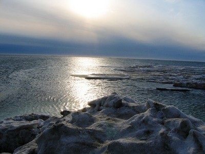
Located along the coastline about 164 miles (264 kilometers) east-southeast of Barrow, “Oliktok” is reported to come from a native Iñupiat name, “Olikto,” meaning “it shakes or trembles.” Resident workers and visitors to Oliktok attribute the origins of that name to robust winds common at Oliktok Point. The nearest native village to Oliktok Point is Nuiqsut, about 30 miles southwest of Oliktok. Deadhorse, Alaska, is roughly 35 miles southeast.
The new Oliktok Point site will be established as an extended-duration mobile facility deployment. Data from this site will expand ARM data collections for use in studies of Arctic climate processes and to support modeling activities for improving climate simulations for this rapidly changing climatic regime. In addition to the ground-based instruments and contingent on FAA approval, regular deployments of small unmanned aerial vehicles (UAVs) will obtain similar measurements in the sky. These data complement and extend the observational coverage of ARM’s North Slope of Alaska locale to the North Pole.
“Dramatic changes in the Arctic over the last few decades are a big deal and scientists have repeatedly emphasized the need for more data to understand what’s happening in that region,” said Mark Ivey, a project manager at DOE’s Sandia National Laboratories, which operates ARM’s North Slope of Alaska research sites. “Despite that challenges of operating in remote northern Alaska, the decision by DOE to move forward with this site is a clear indication of how important these data are for studying Arctic sea ice, cloud processes, and other climate components.”

About 70 percent of the Earth is covered by oceans, so marine clouds are by far the most common cloud type on the planet. In addition, marine boundary-layer clouds are particularly important in the global climate system. They modulate solar energy, sea surface temperature, and the strength of trade winds on seasonal-to-interannual timescales.
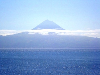
Surrounded by the Atlantic Ocean, the Azores—a remote island chain about midway between the U.S. east coast and Portugal—provides the opportunity to obtain critical long-term observations of marine clouds and aerosols. Scientists will use the measurements from the ARM Azores site to test and validate computer simulations of marine cloud systems.
The Azores research site builds upon a successful 16-month deployment of the ARM Mobile Facility to Graciosa Island for the Clouds, Aerosol, and Precipitation in the Marine Boundary Layer field study. This prolonged deployment resulted in the first climatology of the detailed vertical structure of low clouds at a remote subtropical marine site.
“As a result of the successful deployment of the ARM Mobile Facility deployment on Graciosa Island in 2009 and 2010, the science community recommended the development of a permanent site in the Azores,” said Kim Nitschke, a project manager at Los Alamos National Laboratory, which operates ARM’s tropical sites, a mobile facility, and now the Azores site. “In addition to furthering the scientific benefit of that data set, this new site provides an opportunity to rekindle the close relationships with the people of the Azores who helped make the first temporary deployment such a success.”
About ARM
The ARM Climate Research Facility is a component of the Office of Biological and Environmental Research within DOE’s Office of Science. As a DOE scientific user facility, it provides the climate research community with strategically located in situ and remote sensing observatories designed to improve the understanding and representation of clouds and aerosols in climate and earth system models, including their interactions and coupling with the Earth’s surface. All data collected is freely available to anyone. For more information, visit www.arm.gov.
‘
The ARM Climate Research Facility is a DOE Office of Science user facility. The ARM Facility is operated by nine DOE national laboratories, including .
Keep up with the Atmospheric Observer
Updates on ARM news, events, and opportunities delivered to your inbox
ARM User Profile
ARM welcomes users from all institutions and nations. A free ARM user account is needed to access ARM data.


