
Improving Modeled Cloud Drizzle-Turbulence Interactions
Published: 7 May 2021
National laboratory researchers use ARM data to enhance future earth system predictions
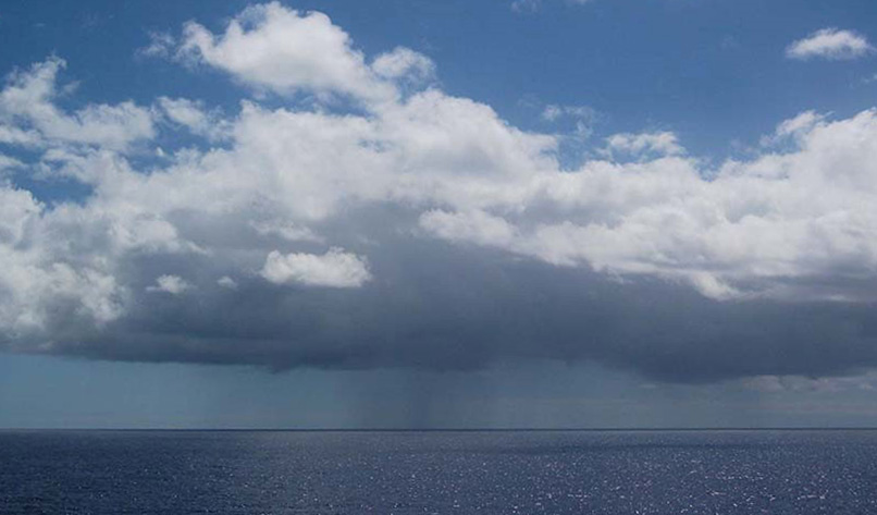
Large decks of closely spaced stratocumulus clouds hover over the ocean and cover vast areas—literally thousands of miles of the subtropical oceans—and linger for weeks to months.
These marine clouds reflect more solar radiation than the surface of the ocean, providing a cooling effect on the Earth’s surface. Stratocumulus clouds are an important component of the Earth’s radiation balance and are crucial to the earth system models (ESMs) used to predict future climate conditions.
To improve cloud representations in ESMs, researchers from Lawrence Livermore and Argonne national laboratories have compared them to observations from the Atmospheric Radiation Measurement (ARM) user facility.
With support from ARM and the U.S. Department of Energy’s (DOE) Atmospheric System Research (ASR) program, researchers combined measurements from ARM’s Eastern North Atlantic atmospheric observatory to derive properties of water vapor and drizzle in and below the clouds.
Drizzle is constantly present within and below these marine cloud systems. It is a key for achieving more accurate climate forecasts because its presence affects and is affected by turbulence—fast-changing air motions that are primarily responsible for cloud lifetimes.
“The analysis of the developed data set allowed us to show that drizzle decreases turbulence below stratocumulus clouds, something that was only shown by model simulations in the past.”
Virendra Ghate, Argonne National Laboratory
Argonne’s Virendra Ghate and Maria Cadeddu were interested in geophysical variables, such as cloud water content and drizzle particle size. So they developed an algorithm that retrieved all the necessary parameters involved in drizzle-turbulence interactions. The algorithm uses ARM radar, lidar, and radiometer data to derive the geophysical variables of interest: size (or diameter) of precipitation drops, amount of liquid water corresponding to cloud droplets, and precipitation drops.
“The analysis of the developed data set allowed us to show that drizzle decreases turbulence below stratocumulus clouds, something that was only shown by model simulations in the past,” says Ghate, an Argonne atmospheric scientist. “The richness of the developed data will allow us to address several fundamental questions regarding drizzle-turbulence interactions in the future.”
Their results led to a collaborative effort with modelers from Livermore. In that effort, the team used ARM observations to improve the representation of drizzle-turbulence interactions in DOE’s Energy Exascale Earth System Model (E3SM).
“The observational references provided by our Argonne collaborators helped us identify that E3SM version 1 produces unrealistic drizzle processes,” says Livermore staff scientist Xue Zheng, who led a paper in the journal Monthly Weather Review focusing on a case study from the 2012–2013 Marine ARM GPCI Investigation of Clouds (MAGIC) field campaign in the eastern Pacific Ocean. “Our collaborative study implies that comprehensive examinations of the modeled cloud and drizzle processes with observational references are needed for current climate models.”
For more information on the research and links to related papers, read the full news releases from Livermore and Argonne.
Follow Us:


Keep up with the Atmospheric Observer
Updates on ARM news, events, and opportunities delivered to your inbox
ARM User Profile
ARM welcomes users from all institutions and nations. A free ARM user account is needed to access ARM data.


