

ICECAPS Gets the Last Word
Published: 5 November 2018
The back-page “Back Scatter” feature in a recent Physics Today devoted a long note and a dramatic picture to ICECAPS, a project designed to better understand regional cloud and atmosphere processes above the Greenland ice sheet.
ICECAPS, formally known as the Integrated Characterization of Energy, Clouds, Atmospheric state, and Precipitation at Summit project, is funded primarily by the Arctic Observing Network of the National Science Foundation (NSF).
From the beginning, the suite of ICECAPS instruments has included some provided by the U.S. Department of Energy’s Atmospheric Radiation measurement (ARM) user facility.
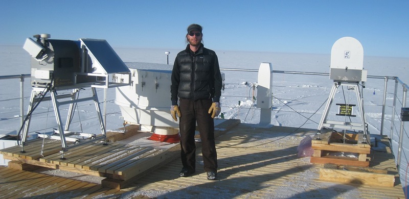
“Summit” refers to Summit Station, the ICECAPS study facility, a longtime regional science hub in Greenland, and the highest point on the Greenland ice sheet. It is about 400 kilometers (248 miles) from the east and west coasts, and provides a uniquely continental environment prized by scientists studying land influences on the arctic atmosphere.
Satellite observations offer a valuable perspective but often struggle to distinguish clouds from the highly reflective surface of the ice sheet.
To date, ICECAPS is the most comprehensive effort to study the atmospheric structure and clouds at Summit.
Other ICECAPS funders include the National Oceanic and Atmospheric Administration (NOAA), which has been doing measurements at the site since the mid-1990s, and Environment Canada.
ICECAPS is led by a four-person principal investigator team: David Turner, a NOAA meteorologist; Matthew Shupe, a University of Colorado research scientist also at NOAA; Von Walden, a professor at Washington State University; and Ralf Bennartz, a professor at Vanderbilt University.
The project “just recently got a positive response on renewed funding from the NSF,” says Shupe. “We intend to remain at Summit for another two, possibly three, years.”
Comprehensive, Complementary Instrumentation
ICECAPS depends on a complementary suite of instruments, including those launched twice a day on radiosondes. The rugged hardware provides year-round measurements of important cloud properties, atmospheric thermodynamic states, precipitation, and radiation above Summit Station.
The ARM instruments being used during ICECAPS are a micropulse lidar (MPL) and a Vaisala ceilometer. Both help determine the height and properties of clouds and are important to gathering data on the optically thin clouds found above the site and that prevail over the Arctic at large.
The MPL also detects atmospheric aerosols.
The ICECAPS instrument suite was intentionally modeled after other long-term observatories in the Arctic. Those include ARM’s North Slope of Alaska in Barrow (officially known as Utqiaġvik) and the NOAA-Canadian Network for Detection of Atmospheric Change site in Eureka, Canada.
The MPL and ceilometer datastreams from Summit are available through the ARM Data Center, along with other ICECAPS datastreams.
An Influential Ice Sheet
Studying the atmosphere above the Greenland ice sheet is important for a convergence of reasons.
The ice sheet, at 2,400 kilometers (1,500 miles) long, is the second largest body of ice in the world. Its size and height significantly influence the Northern Hemisphere’s large-scale meteorological conditions, known as its synoptic flow.
If fully melted, there is enough fresh water captive in the vast ice sheet to raise global sea levels by 7 meters (about 23 feet).
Greenland is also a significant part of the world’s arctic landscape, which is changing rapidly. These changes have potential (and largely unknown) consequences to Earth’s radiative budget: that is, how much solar energy is either absorbed by the planet or reflected back into space.
Follow Us:


Keep up with the Atmospheric Observer
Updates on ARM news, events, and opportunities delivered to your inbox
ARM User Profile
ARM welcomes users from all institutions and nations. A free ARM user account is needed to access ARM data.


