

ARM Best Estimate Cloud Radiation Data Released for MOSAiC
Published: 19 May 2023
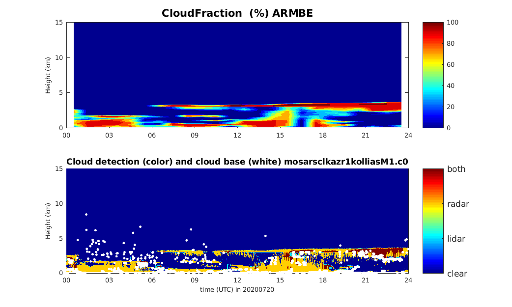
The Atmospheric Radiation Measurement (ARM) user facility provides tailored datastreams known as ARM Best Estimate (ARMBE) data products for use in the evaluation of global climate models. ARM Best Estimate Cloud Radiation (ARMBECLDRAD) data are now available from the Multidisciplinary Drifting Observatory for the Study of Arctic Climate (MOSAiC) expedition in the central Arctic. These data contain cloud and radiation quantities from November 2019 through October 2020.
ARMBECLDRAD assembles quantities that are both well observed by ARM and are often used in model evaluation into a single data set. The product consists of hourly averages and thus has temporal resolution comparable to a typical resolution used in climate model output.
Due to the lack of some required input files for ARMBE, such as satellite-measured radiative fluxes and cloud information, the ARMBECLDRAD product for MOSAiC contains fewer parameters compared with regular ARMBECLDRAD data released from other ARM sites.
Because the Data Quality Assessment for ARM Radiation Data (QCRAD) product is unavailable for MOSAiC, a data product generated from radiation instruments on ice (ICERAD) is used as an alternative option in the ARMBECLDRAD data for radiative fluxes. The ICERAD product is QCRAD-like and includes automated and manual quality control. Please note that ICERAD data are missing for a number of periods because of instrument issues. This presentation summarizes the ICERAD data availability.
To address an issue with the moving platform used during MOSAiC, the ARMBE team merged navigational data into ARMBECLDRAD to track the ship position.
Typically, ARMBECLDRAD data are released along with the ARM Best Estimate Atmospheric Measurements (ARMBEATM) product, which contains basic atmospheric quantities. For MOSAiC, creation of ARMBEATM data is on hold until necessary input data are available.
Scientists can use the MOSAiC ARMBECLDRAD data now. Find more information about ARMBE data products on the ARMBE web page.
Feedback on the data is always welcome. If you have questions/suggestions, please contact Yuying Zhang or Shaocheng Xie.
Users can access the ARMBECLDRAD data from the ARM Data Center. (Go here to create an account to download the data.)
To cite the data, please use doi:10.5439/1333228.
Follow Us:


Keep up with the Atmospheric Observer
Updates on ARM news, events, and opportunities delivered to your inbox
ARM User Profile
ARM welcomes users from all institutions and nations. A free ARM user account is needed to access ARM data.


