

Cloud Type Classification Product Released for COMBLE Campaign
Published: 27 September 2022
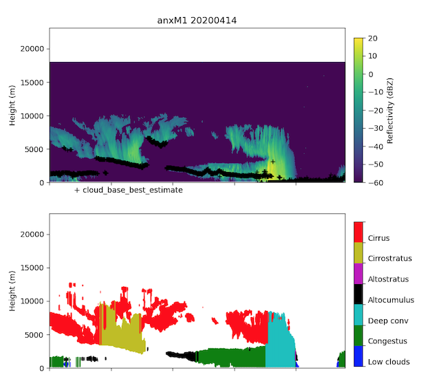
The Cloud Type Classification value-added product (CLDTYPE VAP) is now available for the 2019–2020 Cold-Air Outbreaks in the Marine Boundary Layer Experiment (COMBLE) deployment near Andenes, Norway.
CLDTYPE provides an automated cloud type classification based on macrophysical quantities derived from vertically pointing lidar and radar at sites operated by the Atmospheric Radiation Measurement (ARM) user facility. Up to 10 layers of clouds are classified into seven cloud types based on predetermined and site-specific thresholds of cloud top height, cloud base height, and thickness.
Scientists can use the new CLDTYPE data now. Access the data in the ARM Data Center. (Go here to create an account to download the data.)
More information about CLDTYPE can be found on the VAP web page. For questions about the VAP, please contact ARM translator Damao Zhang or developer Krista Gaustad.
To cite the CLDTYPE data, please use doi:10.5439/1349884.
Follow Us:


Keep up with the Atmospheric Observer
Updates on ARM news, events, and opportunities delivered to your inbox
ARM User Profile
ARM welcomes users from all institutions and nations. A free ARM user account is needed to access ARM data.


