

New Data Available From Updated Raman Lidar Value-Added Product
Published: 24 September 2021
New production data are now available from an updated version of the Raman Lidar MERGE value-added product (VAP). This VAP provides input data for the Atmospheric Radiation Measurement (ARM) user facility’s higher-level Raman Lidar Profiles (RLPROF) VAPs.
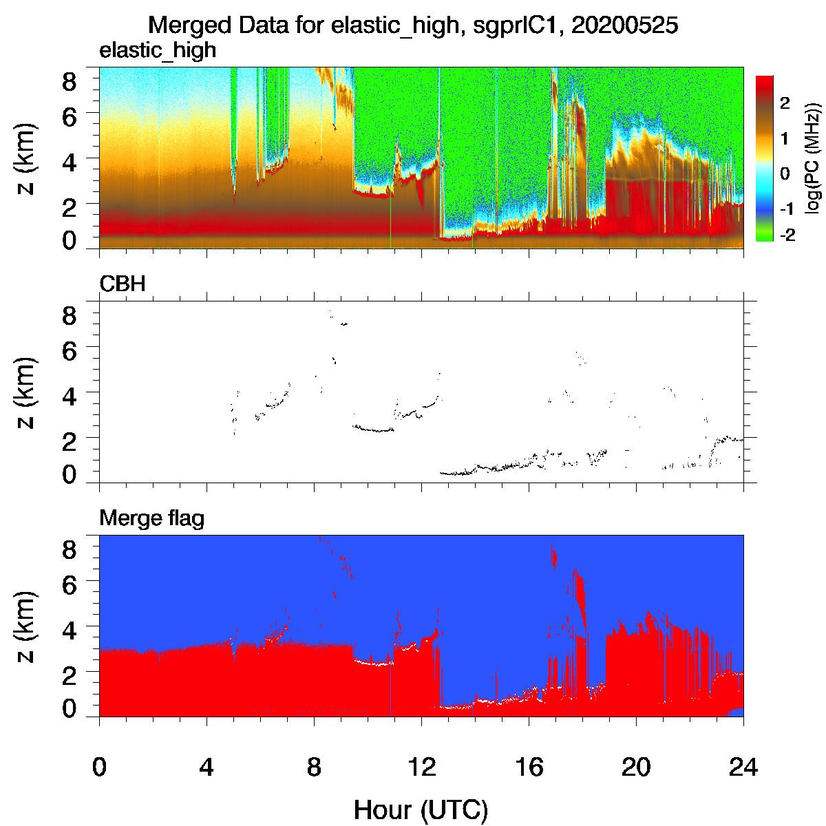
Raman lidars provide time- and height-resolved measurements of water vapor mixing ratio, temperature, aerosol extinction, depolarization, and backscatter. The first stage in the data processing involves combining or merging simultaneous measurements of photon counts and analog voltage for each of the nine detection channels in the system.
The photon counting signal provides excellent sensitivity at low signal levels, but it becomes increasingly nonlinear at higher signal levels. Analog voltages, on the other hand, show good linearity at high signal levels but poor sensitivity at low signal levels. The MERGE VAP combines these two measurements into a single signal for each detection channel with improved dynamic range for use in other RLPROF VAPs.
The revised MERGE VAP streamlines the processing of the raw lidar data by eliminating nonfunctional developmental legacy code. In addition, it provides signal clipping flags—indicating when the detector gets saturated and the signal maxes out—and noise floor estimates (i.e., dark current) for each detection channel, as well as improved cloud-base height estimates. The cloud-base height estimates are provided at the raw time and height resolution of the lidar (i.e., 10 seconds and 7.5 meters).
The new MERGE data cover the period from January 1, 2011, to October 31, 2015, at ARM’s Southern Great Plains Central Facility near Lamont, Oklahoma.
Scientists can use the new data now. More information about RLPROF VAPs can be found on the VAP web page.
For questions or to report data problems, please contact Rob Newsom, ARM’s lead instrument mentor for Raman lidars.
Access the MERGE data in the ARM Data Center. (Go here to create an account to download the data.)
To cite the MERGE data, please use doi:10.5439/1325950.
Follow Us:


Keep up with the Atmospheric Observer
Updates on ARM news, events, and opportunities delivered to your inbox
ARM User Profile
ARM welcomes users from all institutions and nations. A free ARM user account is needed to access ARM data.


