

2D Best Estimate Data Sets From MC3E Now Available
Published: 14 October 2014
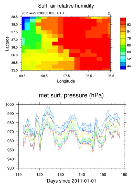 Data sets for the ARM Best Estimate 2-Dimensional Grid (ARMBE2DGRID) and Station-based Surface (ARMBESTNS) are now available for the Midlatitude Continental Convective Clouds Experiment (MC3E) period, which occurred during April to June 2011.
The primary goal of these two data sets is to provide 2-dimensional (2D) spatial data of important surface variables to facilitate studies on precipitation, clouds, and radiation, which require high spatial and temporal observations.
Data from ARMBE2DGRID are processed with the interpolation and quality control (QC) algorithms at 0.25° x 0.25° x 1 hour, while only QC is applied to ARMBESTNS and data are reported hourly at the original site locations. Users have the flexibility to use pre-processed 2D data or to process the station-based data with the approach that is more suitable for their applications. Both data sets are in netCDF format. Next steps are to expand the data sets to all of year 2011.
Feedback and use of the data are welcomed and encouraged. For questions, suggestions, or to report data problems, please contact Shaocheng Xie or Qi Tang.
Log into the ARM Data Archive for access to the ARMBE2DGRID and ARMBESTNS data sets. (Request an account here.)
The ARM Climate Research Facility is a DOE Office of Science user facility. The ARM Facility is operated by nine DOE national laboratories, including .
Follow Us:


Keep up with the Atmospheric Observer
Updates on ARM news, events, and opportunities delivered to your inbox
ARM User Profile
ARM welcomes users from all institutions and nations. A free ARM user account is needed to access ARM data.


