New Best Estimate Data Available for WACR-ARSCL
Published: 19 June 2014

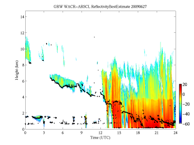
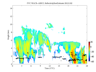
New data from the 95 GHz W-band ARM Cloud Radar-Active Remote Sensing of Clouds (WACR-ARSCL) value-added product (VAP) (Kollias and Miller, 2007) are now available in the ARM Data Archive. In addition to the WACR data, this VAP uses observations from the micropulse lidar and ceilometer to produce cloud boundaries and time-height profiles of cloud location, radar moments, and linear depolarization ratio fields. The basic algorithm used in the WACR-ARSCL VAP is similar to that employed by the ARSCL VAP, based on 35-GHz millimeter cloud radar observations described in this ARM Technical Report.
Updated data are available for the following ARM Mobile Facility deployments:
Graciosa Island, Azores, data are available from June 6, 2009, to December 31, 2010, from the Clouds, Aerosol, and Precipitation in the Marine Boundary Layer (CAP-MBL) campaign. To browse this data set, go to the ARM Data Archive.

Cape Cod, Massachusetts, data are available as an ARM evaluation product from October 12, 2012, to June 14, 2013, taken during the Two-Column Aerosol Project (TCAP). To share feedback, ask questions, or report data problems, please contact Mike Jensen.
If you need an ARM Data Archive account, go here to request one.
The ARM Climate Research Facility is a DOE Office of Science user facility. The ARM Facility is operated by nine DOE national laboratories, including .
Keep up with the Atmospheric Observer
Updates on ARM news, events, and opportunities delivered to your inbox
ARM User Profile
ARM welcomes users from all institutions and nations. A free ARM user account is needed to access ARM data.


