

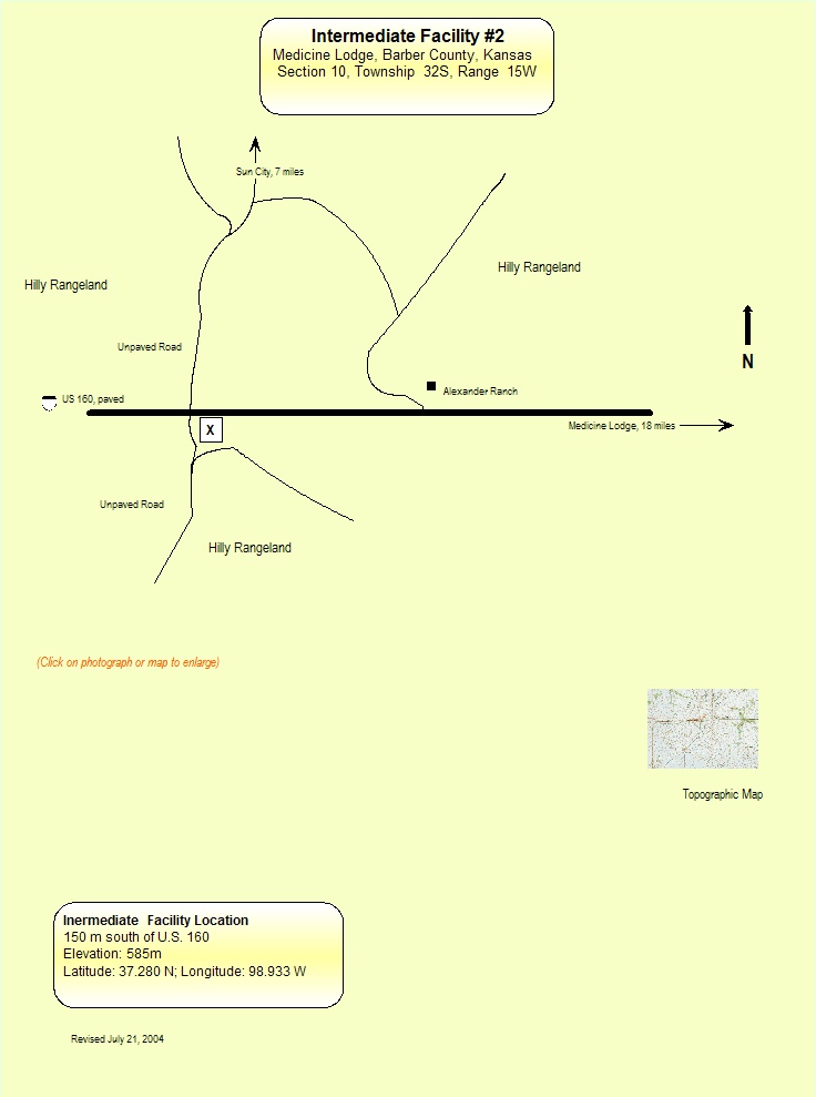
I2
SGP - Medicine Lodge, KS (Intermediate)
Established
4 March 1997
Removed
9 September 2008
Latitude
37.28°
N
Longitude
98.933°
W
Altitude
616 meters
Surface Type
Rangeland
Instruments
1 (0
active)
Primary Measurement Types
5 (0 active)
The I2 site is located 18 miles west of Medicine Lodge, Kansas along US 160. There are hilly rangelands.
Instruments deployed at SGP - Medicine Lodge, KS (Intermediate)
No instruments currently active
Primary Measurements collected at SGP - Medicine Lodge, KS (Intermediate)
Backscattered radiation
Browse DataHorizontal wind
Browse DataRadar Doppler
Browse DataVertical velocity
Browse DataVirtual temperature
Browse DataNo measurements currently active
Follow Us:


Keep up with the Atmospheric Observer
Updates on ARM news, events, and opportunities delivered to your inbox
ARM User Profile
ARM welcomes users from all institutions and nations. A free ARM user account is needed to access ARM data.


Atmospheric Radiation Measurement (ARM) | Reviewed
March 2025