First Phase of Research Flights Completed for GOAMAZON
Published: 2 June 2014

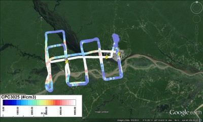
Based out of Eduardo Gomes International Airport in Manaus, the G-1 flew with a scientific payload of more than 30 instruments and sensors. Flying at low, mid, and high altitudes, they obtained measurements of cloud and aerosol properties, trace gases, radiation, and general atmospheric state parameters to support the following research goals:
- evolution of the aerosol and trace gas plume from Manaus
- aerosol-cloud interactions
- ice formation in the mid-levels of the troposphere
- calibration and validation of remote sensing instruments at the Manacapuru site.
Scientists will use this information to study the potential environmental impact of urban growth in tropical areas.
Into the Plume and Beyond

The intense heat and humidity of the rainforest wet season presented new challenges for the AAF team. As with other campaigns, they planned to fly twice a day to measure conditions both in the morning and afternoon. This plan was soon scratched, as afternoon temperatures became too hot for the aircraft and instruments to cool down enough for a second flight. But as it turned out, they didn’t need that second flight after all.
On most days, as the temperature and humidity rose, heavy clouds developed. By early afternoon, the clouds let loose with rain, washing out the aerosol “signature” in the plume from Manaus. Because the plume never lasted long enough to rise very high, the G-1 often flew between 300 and 500 meters above the terrain, below the cloud layer, to capture the evolution of aerosols and trace gases in a single daily flight.
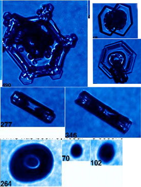
Because aerosols may affect cloud formation, the G-1 payload also included a number of probes to measure cloud properties, such as ice crystal shape and size distribution, in cloud layers at various altitudes. Information from these probes will be used to compare against data obtained by research radars operating from the ARM Mobile Facility site, or T3.
For instance, this animated “loop” on YouTube shows low-level reflectivity—an indication of rain intensity and storm organization—measured by the Sistema de Proteção da Amazônia (SIPAM) radar in Manaus between February 15 and March 20, 2014. Loops like these provide large-scale context for the aircraft data and ground-based measurements obtained at the T3 site.

The aircraft component of GOAMAZON, called the Intensive Airborne Research in Amazonia, or IARA, was made possible through a cooperative program between Pacific Northwest National Laboratory (PNNL) and the National Institute for Space Research (INPE) in Brazil, under the guidance of Dr. Karla Longo. Less than a year after ARM approved the GOAMAZON field campaign proposal in 2010, she received approval for IARA under the umbrella of the Large-scale Biosphere Atmosphere Experiment in Amazonia and initiated discussions with the regulatory and military authorities in Brazil.
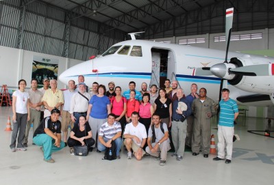
When the G-1 arrived in February, it was the first U.S. research aircraft in Brazil in almost 20 years. A pilot from the Brazilian Air Force joined the flight crew and science team on each flight as an observer.
“The success of this effort is a statement to the persistence of the science teams and the importance of this data set for climate studies,” said Beat Schmid, a scientist at PNNL and the AAF technical director.
GOAMAZON began in January 2014 and goes through December 2015, as described in this feature article. Phase II of IARA takes place between September and October 2014, during the Amazon Basin’s dry season.
The ARM Climate Research Facility is a DOE Office of Science user facility. The ARM Facility is operated by nine DOE national laboratories, including .
Keep up with the Atmospheric Observer
Updates on ARM news, events, and opportunities delivered to your inbox
ARM User Profile
ARM welcomes users from all institutions and nations. A free ARM user account is needed to access ARM data.


