

Future Field Campaigns Span Atlantic Ocean to Indian Ocean
Published: 16 November 2010
 Each year, the ARM Climate Research Facility reviews proposals to use key components of the Facility for extended field campaigns. The Department of Energy recently announced the selection of major ARM field campaigns that will take place from 2011 through 2014. Studies led by principal investigators Chuck Long, Carl Berkowitz, and Scot Martin will examine atmospheric circulation in the tropics, and aerosol-cloud interactions in the North Atlantic and Amazon Basin, respectively.
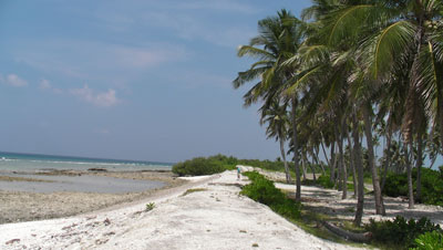
ARM MJO Investigation Experiment on Gan Island (AMIE-Gan). Led by Chuck Long of Pacific Northwest National Laboratory, this campaign is part of a large international research effort involving two island-based and two ship-based measurement sites. Scientists hope to obtain a comprehensive data set for testing and analyzing several current hypotheses regarding the initiation and propagation of the Madden-Julian Oscillation (MJO) in the Indian Ocean area. As a component of the overall DYNAMO and CINDY2011 campaigns, AMIE-Gan will obtain data using the second ARM Mobile Facility (AMF2) from October 1, 2011 through March 31, 2012 on Gan Island in the Maldives. Gan will be outfitted as a cloud radar “supersite” to record the entire size range of hydrometeors and convective clouds from small cumulus through precipitating deep convection.

The Gan Island area is where the MJO typically initiates and starts its eastward propagation, and Manus Island in Papua New Guinea is the general area where the MJO regains strength after the weakening that occurs over the Maritime Continent in climate models. Since the MJO is the dominant mode of intra-seasonal climate variability in the tropics and it interacts with both the Indian and Australian monsoons and El Nino, improved simulations are important for climate modeling. Therefore, the MJO is a very important target for the modeling community. Combined with a related study at the ARM site on Manus Island (AMIE-Manus), intensive radar observations and atmospheric soundings from these various research efforts will contribute invaluable information to the continuous record of tropical data provided by ARM’s permanent Tropical Western Pacific sites.
Two-Column Aerosol Project (TCAP). Led by Carl Berkowitz of Pacific Northwest National Laboratory, TCAP is designed to provide measurements of aerosol composition, size, and optical properties within two columns of air off the coast of North America. These measurements will help scientists evaluate detailed process models and aid in the development of large-scale 3D atmospheric models suited to study both direct and indirect effects of aerosols on climate. The field campaign will deploy the ARM Mobile Facility (AMF) and Mobile Aerosol Observing System (MAOS) on Cape Cod, Massachusetts for a 12-month period starting in the summer of 2012, supplemented with intensive aircraft observation periods in summer and winter using the ARM Aerial Facility’s Gulfstream-1 research aircraft.

The ground-based measurements will be used to quantify aerosol properties, radiation and cloud characteristics at a location subject to both clear and cloudy conditions, and clean and polluted conditions. Aircraft operations by the G-1 will provide in situ measurements of aerosol optical properties, particle composition and direct-beam irradiance within two columns of air: one located over the AMF/MAOS Cape Cod site and a second column located a few hundred kilometers east of Cape Cod. Additional research aircraft may be added to the campaign to fly directly over the G-1 to provide continuous optical and cloud properties in the atmospheric column above the G-1.
Data from TCAP will help scientists refine the mathematical algorithms used to represent aerosol transformation and cloud-aerosol interactions in large-scale models. These algorithms are currently highly simplified and contribute to large uncertainties associated with aerosol direct and indirect forcing and its effect on greenhouse gas levels in the Earth’s climate system.
The ARM Climate Research Facility in the Amazon Basin. Led by Scot Martin, a professor at Harvard University, scientific collaborators from the U.S. and Brazil are seeking to understand aerosol and cloud life cycles, particularly the effect of aerosols on cloud formation and precipitation. To support their research, ARM will deploy its ARM Mobile Facility (AMF), ARM Aerial Facility’s Gulfstream-1, and the Mobile Aerosol Observing System within the Amazon Basin from January through December 2014. The deployment site in Manaus is situated so that it experiences the extremes of (1) a pristine atmosphere when the Manaus pollution plume meanders and (2) heavy pollution and the interactions of that pollution with the natural environment when the plume regularly intersects the site.
The hydrologic cycle of the Amazon Basin is one of the primary heat engines of the Southern Hemisphere. Therefore, accurate climate models must succeed in simulating the Basin environment, both in its natural state and in states perturbed by regional and global human activities. The city of Manaus is an industrial zone which produces high emissions of soot, with a population of 3 million people who use high-sulfur oil as their primary source of electricity. Particle number and mass concentrations of aerosol are 10 to 100 times greater in the pollution plume compared to the times when pristine conditions prevail.

Measurements obtained from ARM instruments in Manaus will enable the study of how aerosol and cloud life cycles, including cloud-aerosol-precipitation interactions, are influenced by pollutant outflow from a tropical megacity. Additional DOE sponsors are supplementing the deployment with a Fourier Transform Spectrometer from Los Alamos National Laboratory, and additional research aircraft and instruments may be added to further expand the experiment.
1. Kuhn, U, L Ganzeveld, A Thielmann, T Dindorf, G Schebeske, M Welling, J Sciare, G Roberts, FX Meixner, J Kesselmeier, J Lelieveld, O Kolle, P Ciccioli, J Lloyd, J Trentmann, P Artaxo, and MO Andreae. 2010. “Impact of Manaus City on the Amazon Green Ocean atmosphere: ozone production, precursor sensitivity and aerosol load.” Atmospheric Chemistry and Physics 10, 9251-9282.
The ARM Climate Research Facility is a DOE Office of Science user facility. The ARM Facility is operated by nine DOE national laboratories, including .
Follow Us:


Keep up with the Atmospheric Observer
Updates on ARM news, events, and opportunities delivered to your inbox
ARM User Profile
ARM welcomes users from all institutions and nations. A free ARM user account is needed to access ARM data.


