The Python ARM Radar Toolkit, the world's leading interactive radar toolkit
Submitter:
Helmus, Jonathan — Argonne National Laboratory
Collis, Scott Matthew — Argonne National Laboratory
Area of research:
Cloud Processes
Journal Reference:
Science
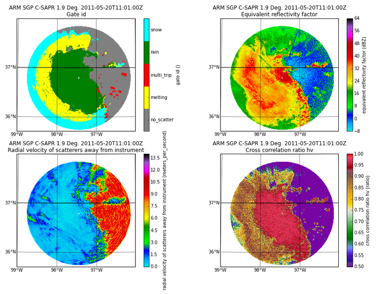
Weather radars provide an abundant source of data related to the conditions present in the atmosphere. The Python ARM Radar Toolkit (Py-ART) allows scientists to effectively work with this data and extract scientific insights from these large data sets. Py-ART is used for analysis of weather radar data using established routines available in the software and has also been used to develop new processing techniques.
Impact
Py-ART provides an environment for researchers to examine data from all types of weather radars including those operated by the ARM Climate Research Facility. The software allows for quick visualization of the data, correction of common artifacts, and in-depth analysis. Py-ART has over one hundred users who participate in mailing list discussions and has been downloaded over 6,000 times. The library is used to create visualization for a number of website and has been used for analysis in multiple peer-reviewed publications.
Summary
A community of scientists, software engineers, and open source enthusiasts have come together to develop the Python ARM Radar Toolkit (Py-ART) a library for reading, visualizing, correcting, and analysis of data from weather radar. The recent publication on the library provides details on the history, the implementation, and the features available in the package.
This toolkit provides a platform for scientists to examine data from weather radars operated by the ARM program as well as radars operated by other groups including the National Weather Service's NEXRAD network.
Py-ART comes with a number of built-in processing and analysis routines that can be used to correct errors in weather radar data and retrieve meaningful geophysical parameters from the moments collected by the radar. Additionally, the toolkit can be used as a platform to rapidly design and test new techniques for examining radar data.
The toolkit is written in the Python programming language and built on top of libraries in the Scientific Python ecosystem including NumPy, SciPy, and matplotlib. The package is open source software and can be used, modified, and extended by anyone free of charge. Development is coordinated on the social coding website, GitHub, where others are encouraged to contribute and participate.