Rain and Cloud Resistance
Submitter:
Flaherty, Julia — Pacific Northwest National Laboratory
Area of research:
Cloud Distributions/Characterizations
Journal Reference:
Science
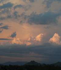
Tropical cloudiness has its own timeline. That’s what researchers at Pacific Northwest National Laboratory found when they compared development of turbulent clouds to the timing of the atmospheric perturbation that rolls over the region every 60 to 90 days. Contrary to past assumptions, rather than a smooth transition, they found two peaks in cloudiness and rainfall during the active phase of the atmospheric phenomenon known as the Madden-Julian Oscillation (MJO for short).
Impact
The PNNL research team used high-resolution, ground-based radar data from the ARM Climate Research Facility site in the Tropical Western Pacific to evaluate the impact of the MJO on clouds and meteorological conditions over Manus Island. They used data gathered during 13 MJO events over 6 winter seasons to develop a single composite event for their evaluation. Their data included cloud frequency, precipitation, specific humidity, temperature, and wind during the 13 MJO cycles.
Their analysis used a unique view of daily cloud processes, rather than the more typically used 5-day timescale. They found frequent shallow cloudiness driven by time scales shorter than the MJO. Between 8 and 4 days before the MJO convective peak at Manus, deeper convection developed, but, likely inhibited by the dry mid-troposphere, it typically did not extend beyond 8 km. The team postulated that some of the features of this process in previous studies may have been masked by the use of 5-year averaged data rather than daily data, or by averaging the cloud and rain characteristics over larger areas.
Summary
Like the ocean tides, the atmosphere has its own cyclic routine. For the tropical western Pacific region, the MJO is a major influencing force. Simple to say, but more complicated to describe or predict. The Madden-Julian Oscillation brings increased rain and winds in its path, affecting monsoons in the tropics and heavy rainfall and winds as far away as North America. Scientists are trying to nail down the MJO's influence on the climate by simulating the phenomenon in climate models. In this study, using site measurements, they knocked down a previous assumption of a single peak in the timing and intensity of local rain tied to the passage of the MJO. Filling in the gaps on the MJO’s impact on the climate will help scientists better understand and model the MJO, and planners better project future events under the influence of climate change.