Chinese Researchers Report Reliable Method for Monitoring Soil Moisture
Submitter:
Bhattacharya, Atreyee — Pacific Northwest National Laboratory
Area of research:
Surface Properties
Journal Reference:
Science
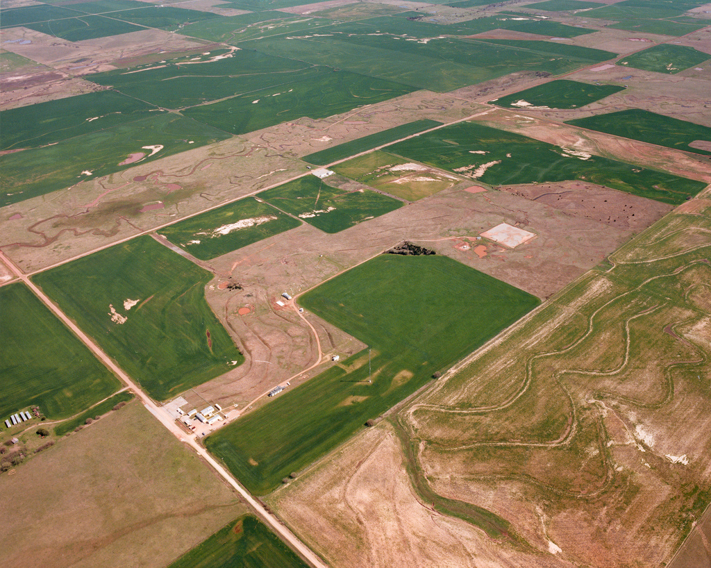
Moisture trapped in soil provides water necessary for vegetation and crops, but how much of that moisture makes its way into the atmosphere and influences regional meteorology? The poor understanding of the role of soil moisture in regional and global climate is primarily because monitoring soil moisture, particularly on a large scale, continues to be notoriously difficult. At present, measurements either are limited to specific locations or are expensive to acquire.
Using instruments and sites developed and maintained by the U.S Department of Energy (DOE), and with funding provided jointly by the European commission and the National Natural Science Foundation of China, researchers from China have proposed a potential solution.
Impact
In a paper published last December in the journal Agricultural and Forest Meteorology, Sun et al. combined remote sensing technology with on-site measurements over an estimated 55,000 square kilometers of the U.S. Southern Great Plains. In doing so, the researchers expected to derive a reliable technique to monitor soil moisture conditions at a regional scale.
In the spring of 1992, the DOE’s Atmospheric Radiation Measurement (ARM) Program set up its first field site on the Southern Great Plains, known as the SGP site. Today the site maintains more than 30 instrument suites strategically placed throughout Oklahoma and parts of Kansas. The instruments continuously measure heat, moisture, and several climatic parameters over a broad range of soil, vegetation, and land use conditions. These measurements thus provide the ideal information necessary for calibrating comparable parameters detected from satellites.
Indeed, the researchers show that calibrating soil moisture and vegetation indices, detected from the Moderate Resolution Imaging Spectroradiometer (MODIS) onboard the Terra satellite, with detailed surface measurements at the SGP site provides a reliable method for monitoring soil moisture conditions. The method, however, works best only for broad geographical regions covering a range of climate, soil, and water stress environments.
Summary
The authors hope that their study will spearhead research, such as theirs, that holds the potential to monitor soil moisture conditions, particularly over arable parts of the world, such as the SGP; the latter produces substantial quantities of wheat and cotton in America.