Weather and Atmospheric Overview during Study of Natural and Urban Emissions (CARES)
Submitter:
Fast, Jerome D — Pacific Northwest National Laboratory
Area of research:
Aerosol Properties
Journal Reference:
Science
Like testing the wind direction before taking flight, researchers led by scientists at Pacific Northwest National Laboratory assessed the meteorological conditions during a large observational study of carbon-containing atmospheric particles in central California. Researchers documented the weather conditions during the study and gauged how these affected the sampled areas on a daily basis. This study provides a large body of foundational information of mixing patterns for future analysis of data from the Carbonaceous Aerosol and Radiative Effects Study (CARES).
Impact
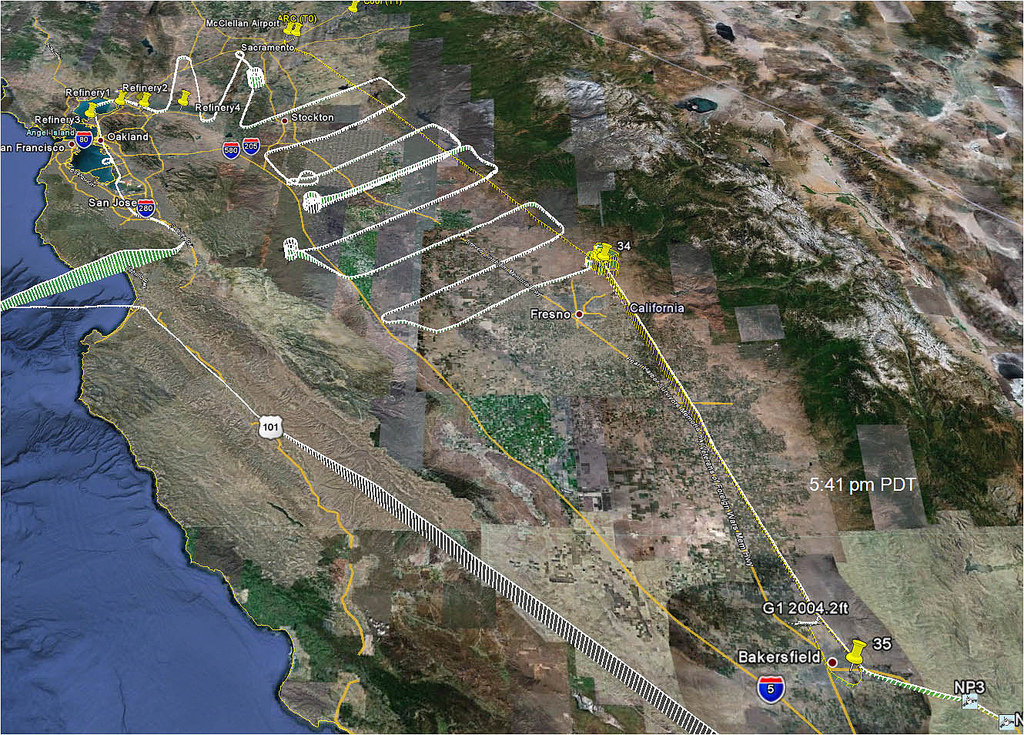
The CARES campaign combined aircraft and ground-based sampling of weather and atmospheric conditions, and atmospheric chemistry. The PNNL G-1 aircraft flew over 67 hours of sampling flights in 21 instances. The NASA B-200 aircraft provided remote sensing of aerosol profiles to complement the G-1 aircraft and ground-based data.
For this study, the purpose of research was threefold. First was to provide an overview of meteorology during the campaign which can be used by other scientists to interpret their data. For this purpose, scientists ran the Weather Research Forecasting model and emitted unique carbon monoxide tracers from separate cities to trace and document the source of pollutants. Next, they analyzed the model output to look for periods when the atmosphere was dominated by air from Sacramento or the San Francisco Bay area. A unique feature of the area is that due to thermally driven wind patterns, the Sacramento area is “cleaned out” periodically and then the aerosols build up again. These winds change the aerosol measurements on a daily basis.
Finally, they found that local atmospheric recirculation can create layers of pollution over Sacramento that can be entrained into the lowest part of the atmosphere, the local boundary layer, the next day. Aircraft-based atmospheric measurements were timed for twice a day to capture this phenomenon by specifically looking at the layers above the boundary layer in the morning. They also found that the Sierra mountains trap the urban pollutants and send them back into the valley. This will have an impact on how SOAs are formed.
Summary
The phrase “carbon emissions” often conjures images of black exhaust spewing from the back of a diesel truck or belching from an industrial smoke stack. These sources of soot, a.k.a. black carbon, are easily pictured. But carbon is also released from biogenic processes as well. As plants and forests grow, they emit volatile chemicals into the atmosphere that react and can form carbon-containing particles. One of the main questions scientists want to answer is what happens when the carbon from human activities, such as industry and transportation, meets and mixes with these natural sources. Knowing the fate of different sources of carbon, and how they mingle and react with each other in the atmosphere, will reveal regional climate interactions and their effect on the global climate.