
Lead Scientist Abstract
Marine ARM GPCI Investigation of Clouds
 Clouds remain a major source of uncertainty in climate projections. In this context, subtropical marine boundary layer (MBL) clouds play a key role in cloud-climate feedbacks that are not well understood yet play a large role in biases both in seasonal coupled model forecasts and annual mean climate forecasts. In particular, current climate models do not accurately represent the transition from the stratocumulus (Sc) regime, with its high albedo and large impact on the global radiative balance of Earth, to shallow trade-wind cumulus (Cu), which play a fundamental role in global surface evaporation and also albedo. Climate models do not yet adequately parameterize the small-scale physical processes associated with turbulence, convection, and radiation in these clouds. Part of this inability results from lack of accurate data on these clouds and the conditions responsible for their properties, including aerosol properties, radiation, and atmospheric and oceanographic conditions.
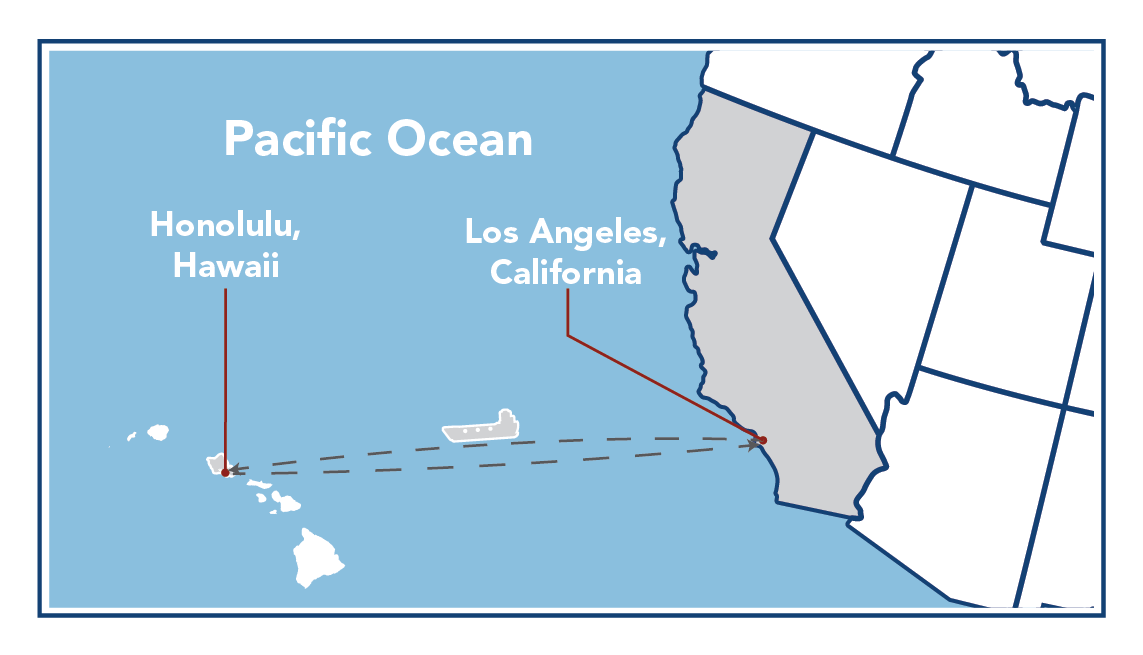
In MAGIC, the Marine ARM (Atmospheric Radiation Measurement) GPCI Investigation of Clouds, the second ARM Mobile Facility (AMF2) was deployed on the Horizon Lines cargo ship Spirit traversing the route between Los Angeles, California, and Honolulu, Hawaii, for one full year, from October 2012 through September 2013. AMF2's unique capabilities were utilized to observe and characterize the properties of clouds and precipitation, aerosols, and atmospheric radiation; standard meteorological and oceanographic variables; and atmospheric structure. Additionally, two intensive observational periods were conducted in January and July 2013, during which more detailed measurements of the atmospheric structure were made.
This first marine deployment of AMF2 yielded an unparalleled and extremely rich data set that will greatly enhance the ability to understand and represent clouds and precipitation, aerosols, and radiation, and the interactions among them; the processes that determine their properties; and factors that control these processes. Deployment of AMF2 on a ship that routinely traverses this route provided an opportunity to collect a long-term data set over a vast cloud region which is of intense interest to climate modelers. Specifically, the transect lies closely along the cross section used for the GPCI, and the data collected provided constraint, validation, and support for this modeling effort, and for associated modeling efforts such as the CGILS and EUCLIPSE. The founders of ARM recognized the importance of these marine cloud regimes and the original document recommending locales for ARM sites explicitly called for sites in the eastern north Pacific or eastern north Atlantic Ocean. This deployment, at long last, met the identified requirement for ARM measurements in this region.

*Note:
GPCI = GCSS Pacific Cross-section Intercomparison, a working group of GCSS
GCSS = GEWEX Cloud Systems Study
GEWEX = Global Energy and Water Cycle Experiment, a core project of the World Climate Research Programme.