
An ARM deployment in Finland helps puzzle out biogenic aerosols
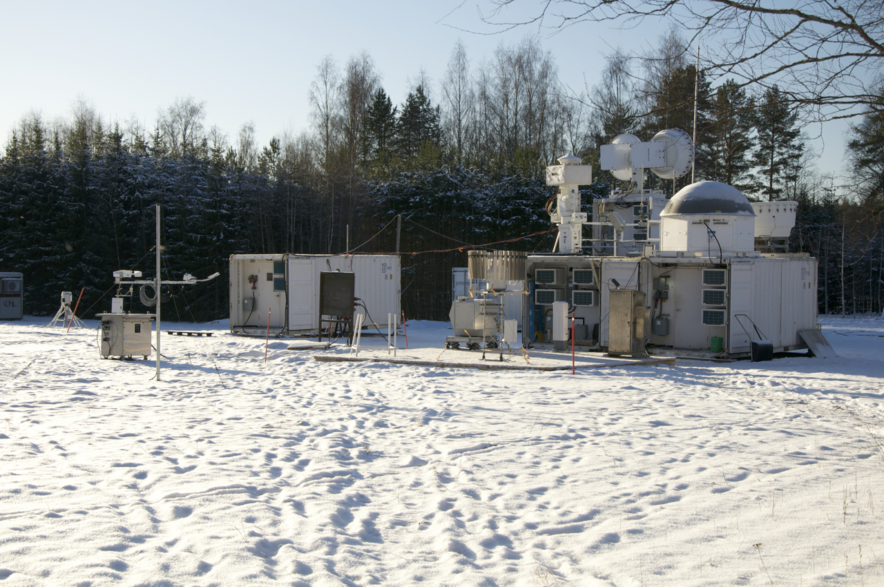
In January 2014, radar mentor Iosif “Andrei” Lindenmaier was part of an Atmospheric Radiation Measurement (ARM) Climate Research Facility team installing four radars in a remote tract of boreal forest in Finland. (The science goal, aided by ARM instruments: Help unravel the effect that biogenic aerosols have on cloud formation.) On the job, the ARM crew—led by Kevin Widener, who was Radar group team leader at the time—braved freezing rain, then steady snow, and then temperatures that dipped to minus 15 degrees Celsius.
“It was cold, cold,” said Lindenmaier, a physics Ph.D. and originally from Romania, who is on a team of ARM radar experts based at the Pacific Northwest National Laboratory. Luckily he was already a hard-winter veteran after a previous job in frigid Thunder Bay, Ontario. He added, “Radars are usually designed to work in harsh weather.”
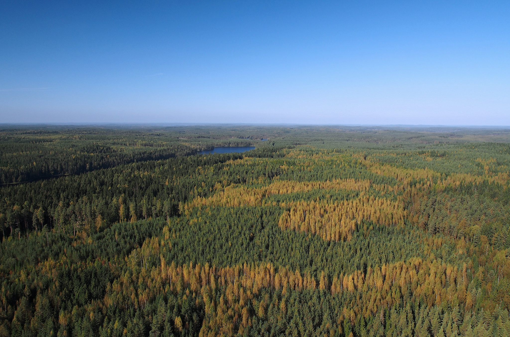
The radars in question were part of the second ARM Mobile Facility (AMF2), a 50-instrument portable atmospheric and climate observation unit. It was deployed by the ARM Facility to Finland in support of a field campaign called Biogenic Aerosols – Effects on Clouds and Climate (BAECC), which gathered atmospheric data within tall thickets of Scots pine from February to September of 2014.
BAECC was the subject of a recent article in the Bulletin of the American Meteorological Society, the latest of five papers to come out of the campaign. The study, “BAECC: A Field Campaign to Elucidate the Impact of Biogenic Aerosols on Clouds and Climate,” was the work of a five-nation team of scientists under the lead of Tuukka Petäjä at the University of Helsinki in Finland.
Unwrapping the Role of Biogenic Aerosols
Gases escaping from the forest cover influence atmospheric conditions and the climate. Moreover, particles of pollen and other materials on the trees—those biogenic aerosols—act as nuclei around which clouds form. The radars that Lindenmaier and other AMF2 technicians installed collected data about the phase of clouds (liquid or ice), their shape and size, and the air motions within them. They complemented data pulled in from the comprehensive ground instruments operating at SMEAR-II in order to get a more holistic view of the tropospheric column above the boreal forest cover. To round out the picture of cloud-aerosol interactions in a boreal environment, and to get a good sense of cloud-to-precipitation processes, the BAECC campaign also included extensive surface precipitation measurements, as well as measurements from aircraft and radiosonde launches.
Pointing to the Sky, Pointing to the Future
There were challenges beyond snow and bitter cold, of course. For one, the W-band and the K-band radars are designed to point to the sky—but you have to be able to see the sky first.
“Tree cover was a problem,” and there were no prominent bare hills to use for siting the instruments, said Lindenmaier. “That part of Finland, everywhere, is flat, flat, flat.” So the AMF2 team stacked up two sea containers to get the radars high enough to point through pines boughs.
The work in Finland is making a difference beyond the boreal. Broadly, BAECC data sets will inform improvements to models of aerosol sources and transport, authors of the paper say. The data will also improve simulations of cloud microphysical processes and boundary layer structures. And the numerical models employed in BAECC will help bridge the gap between measurements taken at the surface and those taken in the troposphere.
# # #
The ARM Climate Research Facility is a national scientific user facility funded through the U.S. Department of Energy’s Office of Science. The ARM Facility is operated by nine Department of Energy national laboratories, including the Pacific Northwest National Laboratory, which manages ARM’s radar facilities, and Argonne National Laboratory, which managed the second ARM Mobile Facility for BAECC.