At the 2009 AMS Meeting in Phoenix, Arizona, scientists involved in the Department of Energy’s Atmospheric Radiation Measurement (ARM) Program will share their latest research findings related to the interaction of clouds and radiation. Scientists from around the world use the ARM Climate Research Facility ground-based climate measurement capabilities for studies ranging from short-term field campaigns to long-term data analyses, model comparisons, and measurement validation efforts. Below are just a few highlights that will be presented at the AMS meeting between January 12 and 14.
Visibility Forecasting For Warm and Cold Fog Conditions
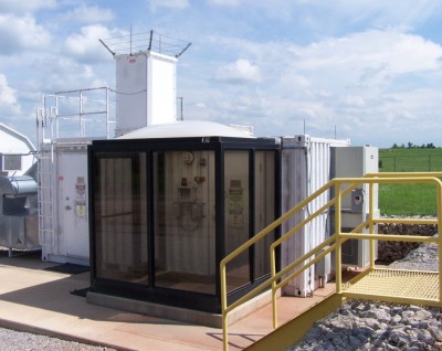
Data obtained during the Fog Remote Sensing and Modeling (FRAM) project suggests improved scientific understanding of fog formation can lead to better forecasting/nowcasting skills, which will benefit both aviation and public forecasting programs. The FRAM project was conducted between 2005 and 2008 at three different climate regimes in Canada and the United States, including the ARM site in Barrow, Alaska.
P1.22-Tuesday, Jan. 13, 9:45-10:45 am
Validating Model Simulations of Arctic Clouds
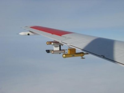
This study investigates the difference between arctic aerosols observed at the North Slope of Alaska during the Indirect and Semi-Direct Aerosol Campaign in April 2008 and those measured during the Mixed-Phase Arctic Cloud Experiment in October 2004. Observations from research aircraft and ground-based instruments are compared to the Weather Research Forecast model run at 1km resolutions, and used to examine aerosol effects on the microphysical and macrophysical properties of arctic clouds and the surface energy balance.
Session 4.6-Tuesday, Jan. 13, 3:30-5:30 pm, Room 131B
Lidar Measurements Used to Study Cloud Entrainment, Boundary Layer Turbulence, and Models
Long-term continuous measurements of water vapor and cirrus clouds obtained by the Raman lidar at the ARM Southern Great Plains site are used in studies that address various atmospheric phenomena important for improving model simulations.
Session 7.1- Wednesday, Jan. 14, 10:30 am, Room 122A;
P1.7 and P1.14-Wednesday, Jan. 14, 2:30 pm-4:00 pm
Using Ground-Based Observations to Validate Satellite Measurements
Remote sensing from satellites can obtain a wealth of information about clouds, radiation, and other atmospheric properties, but it is vital that these remotely-sensed parameters be validated by comparisons with in-situ or other active observations. Results presented at AMS are as follows:
- Clear versus Cloudy Skies. To extend satellite infrared sounding products from clear to cloudy skies, a new retrieval algorithm is applied to GOES-12 Sounder radiance measurements and compared with radiosondes measurements from the ARM Southern Great Plains site and the European Centre for Medium-Range Weather Forecasting. Analyses show improvements to retrievals in thin or low clouds, as well as those in clear-sky. JP 1.24-Monday, Jan. 12, 2:30-4:00 pm
- Cloud and Energy Feedbacks. Comprehensive measurements of cloud properties and the radiation budget are essential for understanding meso- and large-scale processes that drive climate variability. The deployment of the ARM Mobile Facility to Niamey, Niger in 2006, and to the Black Forest in Germany in 2007, provided an excellent opportunity to compare satellite and surface derived cloud properties. JP 1.29-Monday, Jan. 12, 2:30-4:00 pm
- Seasonal Variability of Water Content. Total precipitable water is a very useful parameter for forecasters to determine atmospheric stability and the probability of convection and severe weather. This poster compares the retrievals of total precipitable water from satellite-based infrared sounding instruments and ground-based radiometers and GPSs, highlighting both seasonal and diurnal variability. JP2.13-Tuesday, Jan. 13, 9:45-11:00 am
- How Bright Are Marine Clouds? The brightness of marine boundary layer clouds is important to the planetary energy balance because they cover large regions of the oceans; however, global climate models do a poor job of simulating this parameter. Six years of satellite observations of these cloud properties are analyzed for seasonal cycles and compared to data from the ARM Mobile Facility while deployed at Point Reyes National Seashore in California in 2005. J13.5-Wednesday, Jan. 14, 9:30 am, Room 224AB
 Preview: Effects of Sea Ice on Arctic Precipitation
Scientists from Dartmouth University recently began a 2-year field campaign at the ARM North Slope of Alaska sites to obtain precipitation measurements from storms passing through Barrow and Atqasuk. They will use the data to study how moisture evaporated from the Arctic Ocean and surrounding seas contribute to precipitation in the Arctic regions, and how such moisture supplies are controlled by sea ice.
 Exhibit Hall Display Features Live Data, Research Results
The ARM exhibit showcases streaming data from its research sites across the globe, as well as a large poster featuring key research results from the past year and many other informational materials. Visit the display to talk with scientists who use the facility for their research, or pick up the 2008 Annual Report and other fact sheets to learn about ARM field campaigns and data collections. The display is available all week at the AMS Exhibit Hall in space 517.


