
XDS: MOLTS
molts: Model Output Location Time Series
General Data Description
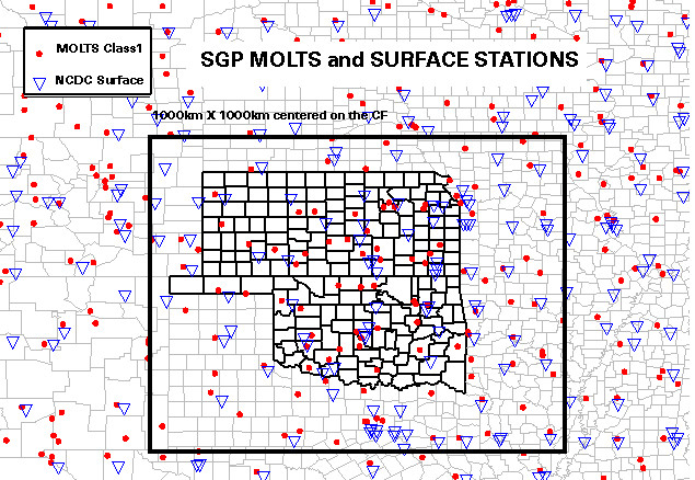
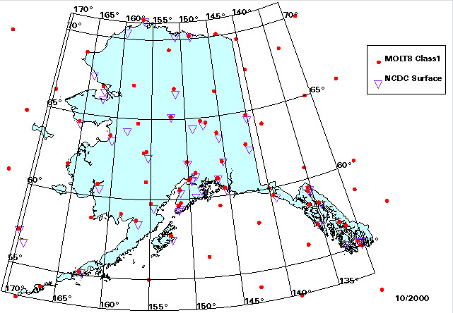
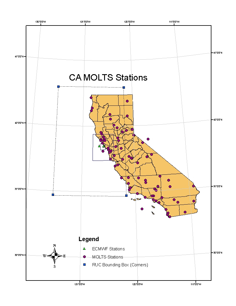
The Model Output Location Time Series (MOLTS) data are provided by the National Centers for Environmental Prediction (NCEP). Currently there are over 500 MOLTS stations across the United States (including Alaska and Hawaii) and southern Canada. The locations of the MOLTS stations are based on requests from the scientific community.
The measurements provided here are products of NCEP’s mesoscale numerical weather prediction (NWP) model known as the Early Eta Model and its associated 4-D data assimilation system, known as the EDAS (for Eta Data Assimilation System). The name “Eta” derives from the model’s vertical coordinate known as the “eta” or “step-mountain” coordinate. Whereas the Eta forecast model generates forecast fields out to 36 hours from initial states at 00Z and 12Z, the EDAS generates eight 3-hourly initial states or analyses during each 24-hour period, utilizing a vast set of observed data.
These data are the hourly output at the selected locations that contain values for various surface parameters and “sounding” output at model levels.
There are two possible classes assigned to each station, Class 0 (basic) and Class 1 (enhanced). The classes differ in the number of surface parameters and sounding parameters reported. After November 1999 only Class 1 data are provided but with many more stations than previously.
Measurement Description
MOLTS Measurements
Temporal Coverage
| Datastream Name | Start Date | End Date |
|---|---|---|
| nsamoltsedassfcclass0X1.a1 and nsamoltsedassndclass0X1.a1 | 06/01/1997 | 09/27/1999 |
| sgpmoltsedassfcclass0X1.a1 and sgpmoltsedassndclass0X1.a1 | 06/01/1997 | 09/27/1999 |
| **nsamoltsedassfcclass1X1.a1 and nsamoltsedassndclass1X1.a1 | 06/01/1997 | Present |
| pyemoltsedassfcclass1X1.a1 and pyemoltsedassndclass1X1.a1 | 03/01/2005 | Present |
| **sgpmoltsedassfcclass1X1.a1 and sgpmoltsedassndclass1X1.a1 | 06/01/1997 | Present |
**There is a gap from 9/28/1999 – 2/29/2000.
Data are available at the ARM Archive approximately 4 days after they are generated.
Area Covered
Datastream Inputs
*nacmoltsedasclass0X1.00 (ends September 27, 1999)
*nacmoltsedasclass1X1.00
*nac = North American Continent
Related Links
NWP Overview
MOLTS Info
BUFR Documentation
Contacts
ARM Data Center
Data Source
Processing History
Beginning on January 1, 2005 the measurement named time_offsets was changed to time_offset in
nsamoltsedassfcclass1X1.a1
nsamoltsedassndclass1X1.a1
sgpmoltsedassfcclass1X1.a1
sgpmoltsedassndclass1X1.a1
Data User Notes
See the following Data Quality Reports via the ARM DQR web service
D020131.7 SGP/NSA/MOLTS/X1- value incorrect
D001031.1 SGP/NSA/MOLTS- gap in data
D000627.3 NSA/MOLTS- Misnamed units
D000627.2 SGP /MOLTS – Misnamed units
D000531.7 SGP/NSA/MOLTS – Misnamed measurement – short name
D041112.2, D041112.5, D041112.7, D041112.8 and P040012.1 – all document the error in the measurement name time_offsets (changed to time_offset)
Acronyms
MOLTS   Model Output Location Time Series
NAC     North American Continent
NCEP    National Centers for Environmental Prediction
NSA     North Slope of Alaska
NWP     Numerical Weather Prediction
PYE     Point Reyes
SGP     Southern Great Plains
Citable References
Rogers, E, DG Deaven, and GS Dimengo. 1995. “The Regional Analysis System for the Operational “Early” ETA Model: Original 80-km Configuration and Recent Changes.” Weather and Forecasting 10(4): 810-825, doi: 10.1175/1520-0434(1995)010%3C0810:TRASFT%3E2.0.CO;2
Yarosh, ES, CF Ropelewski, and KE Mitchell. 1996. “Comparisons of humidity observations and Eta model analyses and forecasts for water balance studies.” Journal of Geophysical Research: Atmospheres 101(D18): 23,289-23,298, doi: 10.1029/96JD02196