
RADAGAST
RAdiative Divergence using AMF, GERB and AMMA STations (RADAGAST)
1 January 2006 - 7 January 2007
Lead Scientist: Anthony Slingo
Observatory: amf, nim
- Background Despite a great deal of effort over many years, significant disagreements persist between estimates of the partitioning of the Earth’s radiation budget between the atmosphere and surface. While the radiation budget at the top of the atmosphere is now well determined by successive satellite missions, that at the surface is much less well understood. As a result, estimates of the globally averaged absorption of solar radiation within the atmosphere vary from 67 to 93 Wm-2 and there are similar differences between estimates of the longwave cooling of the atmosphere by thermal radiation. Radiative transfer models cannot reproduce the higher value of the solar absorption when the observed atmospheric properties are included, leading to suggestions of additional, or “excess” absorption by clouds, aerosols, water vapour dimers or other absorbing species. Many investigations have attempted to make direct estimates of the radiative divergence across the atmosphere in order to resolve this problem. Under the ARM program itself, the ARESE I and II experiments in 1995 and 2000 combined airborne measurements with those from the SGP facility, but definitive results on the existence of any additional absorption could not be obtained. A fundamental problem with all airborne experiments is the limited spatial and temporal sampling of the variability of the radiative fluxes, because of the limited duration of the flights and the significant atmospheric variability. There is thus a need for extended observations, simultaneously both from space and from the surface, to provide the improved sampling that is needed.
The primary purpose of this deployment was to combine an extended series of measurements from the ARM Mobile Facility (AMF) with those from the GERB broad-band Earth radiation budget instrument on the METEOSAT operational geostationary satellite, to provide the first well-sampled, direct estimates of the divergence of solar and thermal radiation across the atmosphere. The deployment, at Niamey in Niger, was timed to coincide with the field phases and Special Observing Periods (SOPs) of the African Monsoon Multidisciplinary Analysis (AMMA) and related experiments in 2006. The SOPs sampled absorbing aerosols from desert dust and biomass burning in the dry season (in the DABEX experiment), through to deep convective clouds and large column moisture loadings during the summer monsoon, thus sampling many of the conditions that have been hypothesized as providing the source of any additional solar absorption. Several other applications were made possible by this deployment, notably studies of the impact of clouds, aerosol and water vapour on surface fluxes and validation of satellite-based estimates of surface fluxes through the large seasonal synoptic changes experienced in this part of West Africa.
- Scientific requirements The basic scientific requirement on the AMF is to provide continuous measurements of the broad-band upward and downward solar and thermal broad-band radiative fluxes at the surface. These were combined with the corresponding measurements from GERB to estimate the radiative divergence across the atmosphere (averaged over a time-scale to be determined). This sounds simple, but in practice a great many other measurements were needed in order to interpret and analyze the fluxes, to provide input to radiative transfer calculations and to the BroadBand Heating Rate Profile (BBHRP) value added product and to deal with various sampling issues.
The most obvious sampling issue addressed was the fact that GERB observes the Earth with a pixel size of about 50km at nadir, whereas the hemispheric radiometers at the AMF are sensitive to a much smaller area. This area depends on the instrument and conditions, but is no more than a few km. For cloudy conditions, for example, the effective area has a radius roughly twice the height of the cloud base. The active instruments measure conditions over a even smaller area, directly above the site.
Relating the measurements from GERB to those from the AMF thus involved bridging a gap of at least one order of magnitude in scale. The problem was not quite so daunting as it might have appeared, because the GERB operational processing system uses data from the SEVIRI high resolution imager on Meteosat-8 (Schmetz et al. 2002). The system performs scene identification using the SEVIRI radiances and then uses these radiances together with the CERES directional models to create a “resolution enhanced” flux product on a scale of 3x3 SEVIRI pixels; nominally 9km at nadir (Gonzalez et al. 2000, Harries et al. 2005). This product, together with the SEVIRI data themselves, carry information about the heterogeneity of the scene within the 50km GERB pixel and were used to bridge the scale gap between GERB and the AMF. A further problem at the time was that the GERB data was subject to a significant geolocation error, although this was reduced substantially by the time of the AMF deployment.
How serious the scaling problem was clearly depended on the magnitude of the heterogeneity of the atmosphere above the site and of the surface around the site. This was important because instantaneous radiances and fluxes are determined by the 3-dimensional distribution of atmospheric absorption and scattering above the site and by the distribution of surface properties (e.g. reflectivity, emissivity, temperature) in an area around the site. The scaling problem could be reduced for a uniform surface and for clear-sky conditions, but broken cloud cover and a non-uniform surface could cause problems. While the effects of atmospheric heterogeneities on the radiative fluxes could be reduced by temporal averaging (assuming that the wind advects atmospheric features with statistically unchanging properties over the site, which depends on the meteorological conditions), the effects of surface heterogeneities cannot be reduced in this way, since they remain in the same place relative to the AMF. These issues needed to be considered and it was important to map the surface characteristics around the site.
The list of variables required was as follows; 1. Broad-band upward and downward solar and thermal broad-band radiative fluxes at the surface. 2. Information on the atmospheric structure above the site. This included the atmospheric temperature and humidity profiles, the cloud structure (base, top, liquid and/or ice water mixing ratios, effective particle size). 3. Aerosol profile and information on the particle size distribution and phase function. This was especially important through DABEX, which was timed to coincide with the peak of the biomass burning season in this region, although outbreaks of Saharan dust could occur at any time of the year. 4. Spectrally resolved solar and thermal radiative fluxes/radiances. These were very useful in order to interpret the broad-band fluxes and as further validation for models. 5. Information on the heterogeneity of the atmosphere and surface surrounding the ARM site. Two scales were important; the smallest was concerned with the area likely to make an impact on the fluxes and radiances observed from the AMF itself (up to a few kilometres, as noted above). The largest represented a GERB pixel (about 50km at the sub-satellite point and slightly larger than this at Niamey). On that scale, it was also necessary to characterise the heterogeneity of the scenes within the GERB pixel, which required the scene identification analysis of SEVIRI data performed as part of the GERB data processing. 6. Information on the meteorological context of the AMF measurements, in the form of local synoptic measurements and operational numerical weather prediction (NWP) analyses and forecasts.
Many of the ARM measurements were themselves useful to other groups, for example those studying the geographical variability of the surface fluxes as well as the atmospheric structure. The data was also valuable for evaluating the NWP models.
- Experimental approach Continuous measurements were required from the AMF to provide input to the divergence calculations and for comparisons with other observational platforms. The following list matches the capabilities of the AMF baseline instruments to the scientific requirements listed in the previous section and identifies additional measurements that were not currently included in the AMF baseline.
- Broad-band instruments, including GNDRAD and SKYRAD.
- Balloon-borne sounding system (BBSS), microwave radiometer profiler (MWR), W-band (95GHZ) cloud radar, micropulse lidar (MPL), Vaisala ceilometer (VCEIL), total sky imager.
- The Micropulse lidar (MPL) provided some basic information on the existence of aerosol layers, but quantitative information on the aerosol size distribution and phase function required additional instrumentation, such as a CIMEL sun photometer.
- The Atmospheric Emitted Radiance Interferometer (AERI) provided spectrally resolved thermal radiances, but there was also a need for spectrally resolved solar radiances and/or fluxes, particularly in view of the long-standing arguments regarding where in the solar spectrum any additional or excess absorption might occur.
- Mapping the surface characteristics around the site required the use of additional surface measurements, aircraft flights and/or high resolution satellite remote sensing. If the surface conditions varyied slowly then high resolution satellite imagery (e.g. from LANDSAT, SPOT or other satellites) was used to monitor vegetation changes. The possibility of deploying a network of radiometers around the site was also considered.
- A significant involvement of Numerical Weather Prediction (NWP) centres was anticipated. These centres provided input for operational planning of the AMMA SOPs and for the subsequent data analysis. It was therefore possible to place the ARM observations in the context of the wider meteorological situation. Simulations of the surface radiative fluxes from these models are available for comparison with the ARM data.
In addition, AMMA groups deployed an enhanced network of surface observations and radiosonde launches. Several research aircraft were based in Niamey during AMMA and contributed to the project.
- Special issues affecting the implementation From the above, the following measurements were deemed critical;
- Sufficient measurements of the atmospheric structure to enable the BBHRP product to be derived.
- Aerosol measurements using CIMEL sun photometer(s).
- Spectrally resolved solar radiances/fluxes.
- Additional measurements to characterise the heterogeneity of the area around the site on various scales.
- Measurements from GERB and from various AMMA platforms and sites. Less critical, but very useful, was the availability of a weather radar at or near Niamey. The AMF data are available through the normal ARM archive. To perform divergence calculations, the AMF data was merged with the data from GERB.
While it was intended to operate the AMF on a continuous basis, the work was enhanced considerably by coordination with the operational planning of the AMMA field phases. This required the establishment of suitable communications links with the AMMA teams, many of which were based in Niamey.
- Timeline for deployment There was no critical timeline requirements for coordination with GERB, since the plan was to operate GERB instruments continually on the Meteosat Second Generation (MSG) series of operational satellites. However, there were clearly significant advantages in coordinating the AMF deployment with the AMMA SOPs, when a large number of additional surface and aircraft measurements were made. The operational dates are were as follows;
- Dust And Biomass EXperiment, DABEX (SOP0): January-February 2006.
- Monsoon onset (SOP1): June-July 2006.
- Active monsoon (SOP2): July-August 2006.
-
Period of peak downstream impact (SOP3): August-September 2006.
-
Collaborative participation in deployment A presentation on RADAGAST was made by Slingo to the GERB International Science Team meeting, held in Brussels, Belgium, from 8-10 November 2004. There was strong support for the project, which fits in well with the GERB objectives. Direct participation in the deployment itself was unlikely, but the GERB team continually monitors the performance of GERB and the imagery from the instrument, so interaction was therefore expected on a daily basis with the AMF team in Niamey.
-
References Gonzalez, L., A. Hermans, S. Dewitte, A. Ipe, G. Sadowski, N. Clerbaux, 2000. Resolution enhancement of GERB data. Proc. EUMETSAT Meteorological Satellite Data User's Conf., Bologna, Italy, EUMETSAT, 619-625 Harries, J.E. and 42 authors, 2005. The Geostationary Earth Radiation Budget (GERB) project. Bull. Amer. Meteorol. Soc., accepted for publication Schmetz. J., P. Pili, S. Tjemkes, D. Just, J. Kerkmann, S. Rota, A. Ratier, 2002. An introduction to Meteosat Second Generation (MSG). Bull. Amer. Meteor. Soc., 83, 977-992
-
Links to relevant websites GERB website at Rutherford Appleton Laboratory; http://www.ssd.rl.ac.uk/gerb/ GERB Ground Segment Processing System; http://ggsps.rl.ac.uk/ GERB Project Homepage at Imperial College; http://www.sp.ph.ic.ac.uk/gerb/ SINERGEE project at ESSC; http://www.nerc-essc.ac.uk/~rpa/GERB/gerb.html DABEX; http://metresearch.net/DABEX/ CLOUDNET; http://www.met.rdg.ac.uk/radar/cloudnet/ AMMA-UK: http://www.env.leeds.ac.uk/research/ias/dynamics/amma/ CEH Wallingford; http://www.ceh.ac.uk/aboutceh/wallingford.htm AMMA-SAT; http://ammasat.lmd.polytechnique.fr/WelcomeE.html
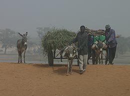
From January to March, the lower atmosphere in Niamey, Niger, is often laden with dust blown from the Sahara Desert, causing poor visibility. Scientists used data collected by the ARM Mobile Facility in 2006 to study the effects of Saharan dust and the West African monsoons.
Timeline
Related Publications
2024
Nie Y, X Li, Q Paletta, M Aragon, A Scott, and A Brandt. 2024. "Open-source sky image datasets for solar forecasting with deep learning: A comprehensive survey." Renewable and Sustainable Energy Reviews, 189, 113977, 10.1016/j.rser.2023.113977.
2023
Borg LA and RO Knuteson. 2023. Land-based cal/val campaigns. In Field Measurements for Passive Environmental Remote Sensing: Instrumentation, Intensive Campaigns, and Satellite Applications,, pp. 219-233. Ed. by Nicholas R. Nalli, Amsterdam: Elsevier.
2022
Phillips C, U Nair, and S Christopher. 2022. "The Influence of Dust‐Smoke Mixtures on Boundary Layer Processes and Nocturnal Warming in the Sahel." Journal of Geophysical Research: Atmospheres, 127(11), e2021JD036349, 10.1029/2021JD036349.
Lopes F, E Dutra, and I Trigo. 2022. "Integrating Reanalysis and Satellite Cloud Information to Estimate Surface Downward Long-Wave Radiation." Remote Sensing, 14(7), 10.3390/rs14071704.
2021
Garcia-Carreras L and J Marsham. 2021. "Capturing convection essential for projections of climate change in African dust emission." npj Climate and Atmospheric Science, 4(1), 44, 10.1038/s41612-021-00201-x.
Titos G, M Burgos, P Zieger, L Alados-Arboledas, U Baltensperger, A Jefferson, J Sherman, E Weingartner, B Henzing, K Luoma, C O'Dowd, A Wiedensohler, and E Andrews. 2021. "A global study of hygroscopicity-driven light-scattering enhancement in the context of other in situ aerosol optical properties." Atmospheric Chemistry and Physics, 21(17), 10.5194/acp-21-13031-2021.
2020
Burgos M, E Andrews, G Titos, A Benedetti, H Bian, V Buchard, G Curci, Z Kipling, A Kirkevåg, H Kokkola, A Laakso, J Letertre-Danczak, M Lund, H Matsui, G Myhre, C Randles, M Schulz, T van Noije, K Zhang, L Alados-Arboledas, U Baltensperger, A Jefferson, J Sherman, J Sun, E Weingartner, and P Zieger. 2020. "A global model–measurement evaluation of particle light scattering coefficients at elevated relative humidity." Atmospheric Chemistry and Physics, 20(17), 10.5194/acp-20-10231-2020.
Saidou Chaibou A, X Ma, and T Sha. 2020. "Dust radiative forcing and its impact on surface energy budget over West Africa." Scientific Reports, 10(1), 12236, 10.1038/s41598-020-69223-4.
Muradyan P and R Coulter. 2020. Radar Wind Profiler (RWP) and Radio Acoustic Sounding System (RASS) Instrument Handbook. Ed. by Robert Stafford, U.S. Department of Energy. DOE/SC-ARM/TR-044. 10.2172/1020560.
Johnson R and P Ciesielski. 2020. "Potential Vorticity Generation by West African Squall Lines." Monthly Weather Review, 148(4), 10.1175/MWR-D-19-0342.1.
View All Related Publications
NIM Data Sources
| Name | Full Name | Browse Data |
|---|---|---|
AERI |
Atmospheric Emitted Radiance Interferometer | Browse Data |
AERINF |
AERI Noise Filtered | Browse Data |
AIP |
Aerosol Intensive Properties | Browse Data |
AOS |
Aerosol Observing System | Browse Data |
ARMBE |
ARM Best Estimate Data Products | Browse Data |
CAMSITE |
camera that monitors a site area | Browse Data |
CCN |
Cloud Condensation Nuclei Particle Counter | Browse Data |
CEIL |
Ceilometer | Browse Data |
CSPHOT |
Sunphotometer | Browse Data |
ECMWFDIAG |
European Centre for Medium Range Weather Forecasts Diagnostic Analyses | Browse Data |
ECOR |
Eddy Correlation Flux Measurement System | Browse Data |
GNDRAD |
Ground Radiometers on Stand for Upwelling Radiation | Browse Data |
MERGESONDE |
Merged Sounding | Browse Data |
MET |
Surface Meteorological Instrumentation | Browse Data |
MFRSR |
Multifilter Rotating Shadowband Radiometer | Browse Data |
MPL |
Micropulse Lidar | Browse Data |
MWR |
Microwave Radiometer | Browse Data |
MWRP |
Microwave Radiometer Profiler | Browse Data |
MWRRET |
MWR Retrievals | Browse Data |
NCEPGFS |
National Centers for Environment Prediction Global Forecast System | Browse Data |
PBLHT |
Planetary Boundary Layer Height | Browse Data |
QCECOR |
Quality Controlled Eddy Correlation Flux Measurement | Browse Data |
QCRAD |
Data Quality Assessment for ARM Radiation Data | Browse Data |
RAD |
Radiation Measurements at AMF | Browse Data |
RADFLUXANAL |
Radiative Flux Analysis | Browse Data |
RWP |
Radar Wind Profiler | Browse Data |
SKYRAD |
Sky Radiometers on Stand for Downwelling Radiation | Browse Data |
SONDE |
Balloon-Borne Sounding System | Browse Data |
SONDEADJUST |
Sonde Adjust | Browse Data |
TSI |
Total Sky Imager | Browse Data |
WACR |
W-Band (95 GHz) ARM Cloud Radar | Browse Data |
WACRARSCL |
W-band Cloud Radar Active Remote Sensing of Cloud | Browse Data |