
The coastal marine cloud-aerosol campaign now enters a phase of energetic data analysis
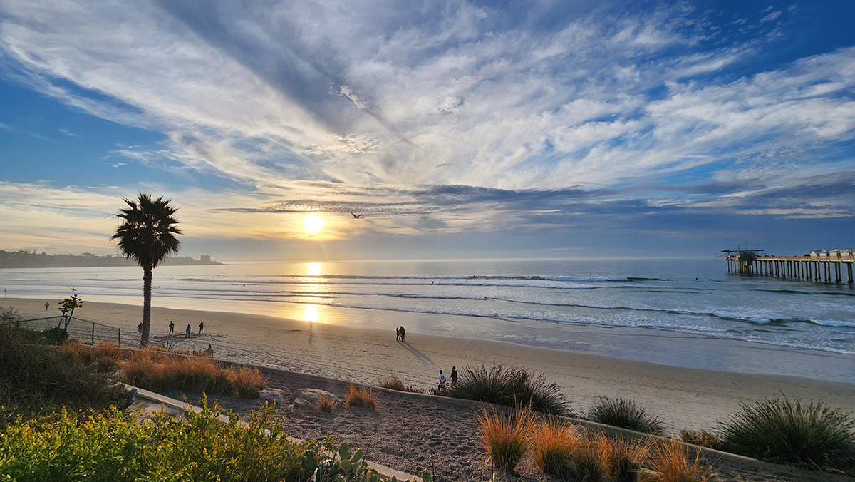
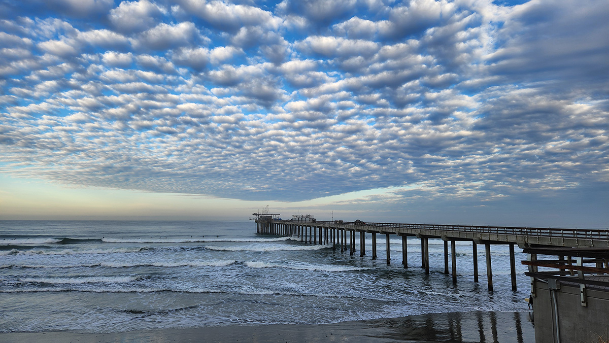
Off the coast of La Jolla, California, not far from downtown San Diego, marine stratocumulus clouds often appear in dramatic decks.
The surfers who crowd along either side of the Ellen Browning Scripps Memorial Pier might take for granted these gatherings of liquid water, ice (occasionally), particles, and complex gases.
But to a cohort of international scientists, these clouds are of intense interest.
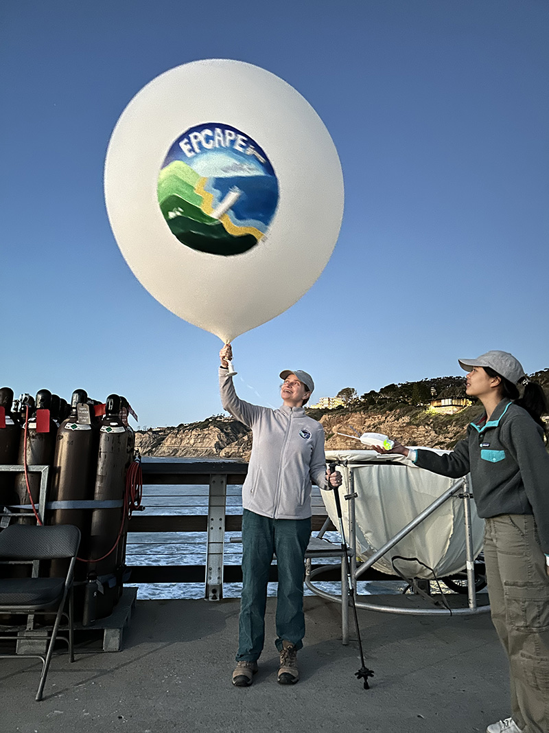
A field campaign called the Eastern Pacific Cloud Aerosol Precipitation Experiment (EPCAPE) finished its yearlong observational phase in La Jolla in mid-February 2024. Now comes the complex and rewarding work of analyzing EPCAPE data.
The prospects are exciting for EPCAPE Principal Investigator Lynn Russell, a Distinguished Professor of Climate and Atmospheric Sciences at Scripps Institution of Oceanography at the University of California San Diego.
EPCAPE “was amazingly successful,” she says. “We got more clouds, more data, and more investigators than we expected.”
‘Detailed and Extensive’
Enthusiasm for EPCAPE data is shared by the campaign’s 17 co-investigators, who represent a dozen universities in the United States and Canada, three U.S. Department of Energy (DOE) national laboratories, NASA, and Environment and Climate Change Canada.
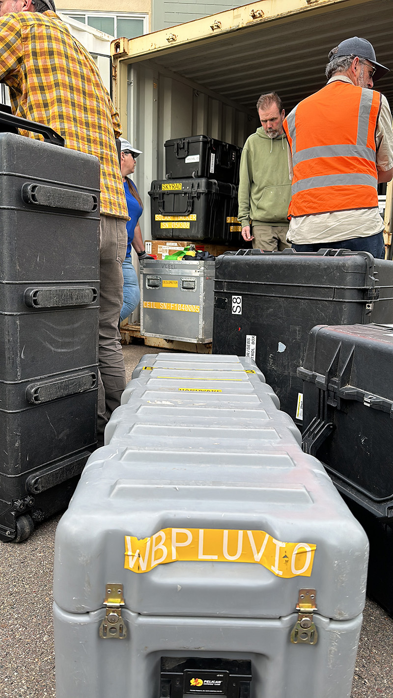
DOE’s Atmospheric Radiation Measurement (ARM) user facility supplied the main instrumentation for EPCAPE, supplemented by the campaign’s many partners.
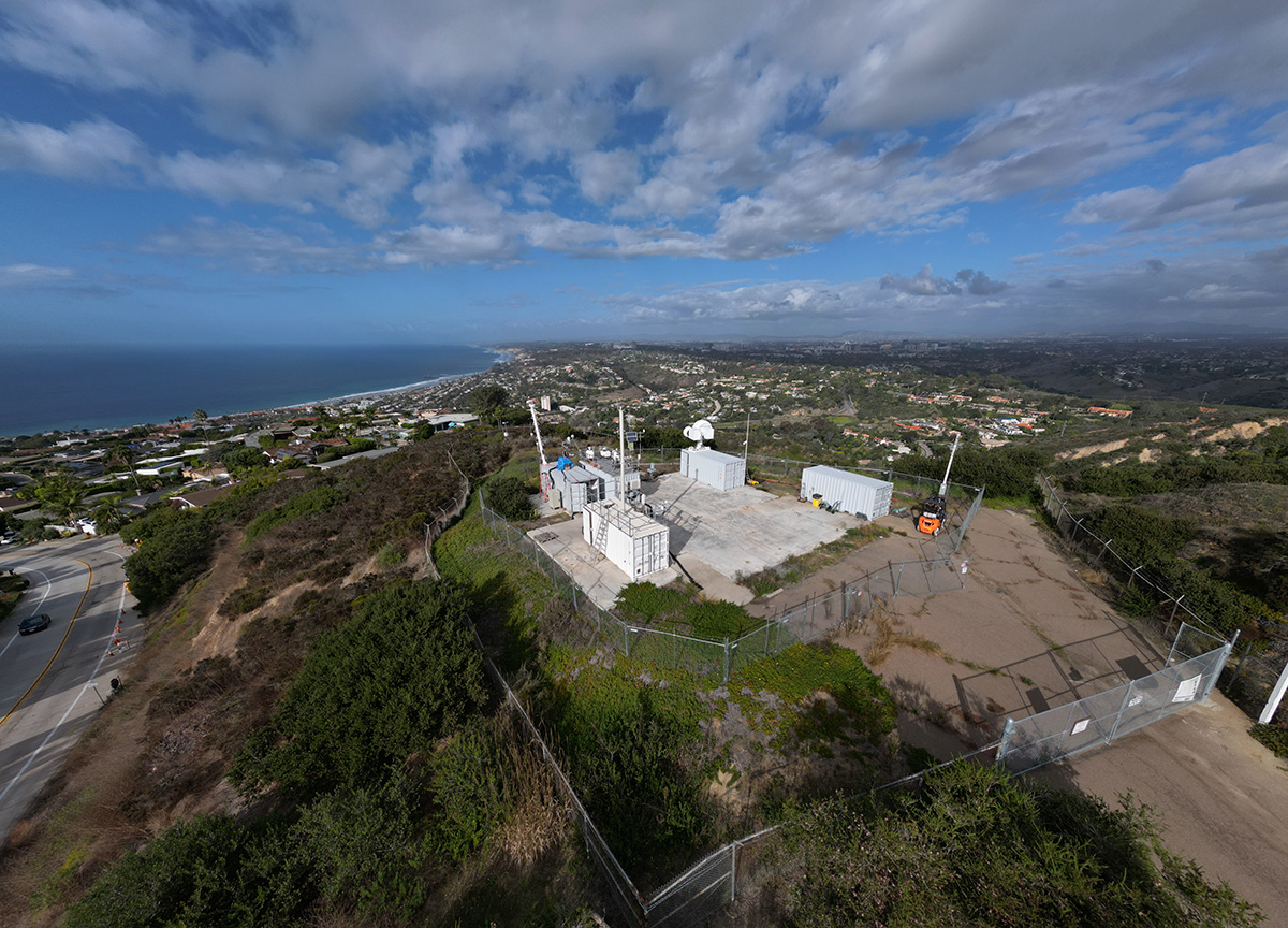
ARM deployed one of its three portable atmospheric observatories, known as the first ARM Mobile Facility (AMF1), along Scripps Pier. A smaller set of ARM and guest instruments operated on Mount Soledad, 3 kilometers (1.9 miles) from the pier.
“To my knowledge, EPCAPE has produced the most detailed and extensive probing of California coastal marine stratus to date,” says EPCAPE co-investigator Mark Miller, a professor of atmospheric science at Rutgers University. “Especially unique is the comprehensive aerosol and cloud microphysical assays collected on Mount Soledad, which deeply enrich the data collected by AMF1.”
Most of the year’s direct measurements are freely available in the ARM Data Center and the University of California San Diego’s digital library collections.
Four-Season Data
Marine stratocumulus clouds, the object of EPCAPE’s year of observational attention, reside in the lower mile or so of the troposphere―what scientists call the atmosphere’s boundary layer.
They also predominate over oceans in the Earth’s middle latitudes―the regions between 30 and 60 degrees north and south of the equator.
Marine stratocumulus clouds, easily perturbed by environmental changes, influence how much solar radiation reaches the Earth’s surface as well as patterns and amounts of precipitation.
EPCAPE was designed to provide unprecedented four-season data on the properties of coastal marine clouds, including their radiative effects and the role human-made particles play.
The yearlong data add great value, says aerosol chemist Allison Aiken, an EPCAPE co-investigator from Los Alamos National Laboratory (LANL) in New Mexico. “The data set reflects periods of clean marine origin, urban emissions that have aged (evolved) over the ocean, and periods when clouds moved inland from the main site at the pier to the supplementary site on Mount Soledad.”
‘Rare and Unique Globally’
You can think of EPCAPE’s year of observations as a two-layer cake. The bottom layer captured ocean-like influences at the surface, largely by ARM instruments strung along the pier. The second layer, on Mount Soledad, collected data on marine clouds higher up.
Despite its modest altitude (250 meters, or 820 feet), Mount Soledad sometimes sat within the cloud layer itself, yielding in-cloud measurements, including particle and aerosol composition.
Atmospheric aerosols are tiny particulate hybrids of solids and liquids, including water. They make clouds and precipitation possible.
Researchers will be able to examine aerosols with very similar histories measured during EPCAPE both in cloud and out of cloud, says Russell. “That’s one of the most exciting outcomes.”
Aiken couldn’t agree more. She believes EPCAPE was the first time that guest instruments, using specialized inlets, could sample aerosols directly from inside clouds.
Such data, says Aiken, “are rare and unique globally, and we hope to help answer some of the outstanding questions (about cloud formation) in an area impacted by different marine and urban sources.”
Cloud formation requires understanding turbulence, water vapor evaporation and condensation, the presence of condensation nuclei from dust and other particles, precipitation, cloud radiative absorption and scattering, and aerosol formation and evolution.
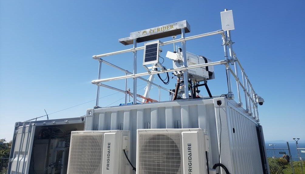
Calling on CC-RIDER
Russell and Scripps colleagues have started working with modelers to analyze EPCAPE’s turbulence, cloud, and aerosol measurements.
Turbulence in the atmospheric boundary layer, marked by chaotic swirls and eddies of air and particles, can accelerate heat transfer and modify cloud formation.
EPCAPE co-investigator Dan Lubin, a climate sciences researcher at Scripps, plans to analyze his own data for different turbulent conditions. His analysis will include how turbulence affects cloud liquid water content, he says, along with “optical depth and brightening, and ultimately surface shortwave and longwave radiation.”
On Mount Soledad, he installed a suite of broadband and filter radiometers called Clouds and Climate-Remote Integrated DEployment of Radiometers (CC-RIDER). The instruments, paired with data from ARM’s roughly equivalent sky radiometers on stand for downwelling radiation (SKYRAD) on the pier, will provide radiometric measurements at two altitudes.
“Preliminary data are very interesting,” says Lubin, who has done some early analysis.
But a full analysis, he adds, can only happen after post-campaign calibration of the CC-RIDER radiometers by the manufacturer.
The Old, the New, and the Small
Miller is eager to get at EPCAPE data too, perhaps as early as June 2024.
Mount Soledad was in cloud for about 700 hours during the campaign, which is “surprising,” he says. “Early indications suggest that at least some of these clouds have not been overwhelmingly influenced by the terrain and may be similar in structure to the clouds measured at the Scripps Pier.”
Miller is privy to special insights. In 2005, he was the principal investigator during ARM’s Marine Stratus Radiation Aerosol and Drizzle (MASRAD) field campaign on the Northern California coast.
MASRAD, which later influenced EPCAPE’s science plan, allowed researchers to study the microphysical characteristics of marine stratus clouds as they moved onshore.
Russell anticipates more EPCAPE data analysis from associated smaller campaigns, many of them funded by DOE’s Atmospheric System Research (ASR) program.
On Mount Soledad in the fall of 2023, Aiken’s own ASR campaign, EPCAPE Partitioning Thrust (EPCAPE-PT-LANL), with lead scientist Kyle Gorkowski of LANL, included aerosol mass spectrometer data.
LANL researchers are analyzing the data now, she says, in part to understand cloud processing better by looking for “chemical differences in the aerosol” during in-cloud and out-of-cloud periods.
Meanwhile, a number of graduate students and early career researchers have contributed to EPCAPE investigations of the origins and composition of ultrafine particles, cloud condensation nuclei activity, and the composition of individual particles.
Bonus Data
Heavy doses of extreme weather enriched EPCAPE data.
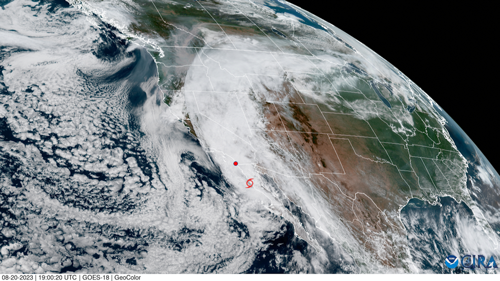
Atmospheric rivers—ribbon-like currents of ocean moisture—contributed to record California rainfall, including an epic rainstorm in March 2023. In August, Tropical Storm Hilary was the first such storm to hit Southern California in 84 years.
“Those events looked rather different than what we were generally expecting in the science plan,” says EPCAPE co-investigator and ARM data analyst Israel Silber.
Silber, an earth scientist at Pacific Northwest National Laboratory in Washington state, wrote a September 2023 ARM blog about the instrumented glimpse of Hilary by EPCAPE radars, lidars, and other observation platforms.
“It was more of an exciting coincidence than a finding, per se,” he says. “But additional analysis of this event might provide new insights.”
Interested in EPCAPE data? Check out past data announcements, and go to the ARM Data Center.
An ARM total sky imager on Scripps Pier captured daylight images that provide a video-like timeline of Hilary’s prefrontal clouds and precipitating storm cells.
“We had a pretty exciting year in terms of meteorology,” says Russell, “much more rainfall than we’ve probably had in decades—more precipitation than we expected.”
Heavy rain might factor into aerosol-cloud events in some intriguing ways, she adds, because it is good at “cleaning up the air” by stripping aerosols from the atmosphere, even those still in the gas phase.
This means processes are wiped clean and can start over, says Russell. “Heavy rain provides a reset of particle and some vapor concentrations. That’s going to be super interesting to look into.”
# # #Author: Corydon Ireland, Staff Writer, Pacific Northwest National Laboratory
ARM is a DOE Office of Science user facility operated by nine DOE national laboratories.