
Smoke From African Fires: Studying its Impact on Low Clouds
Published: 23 May 2016
New 17-month ARM campaign investigates airborne carbonaceous particles
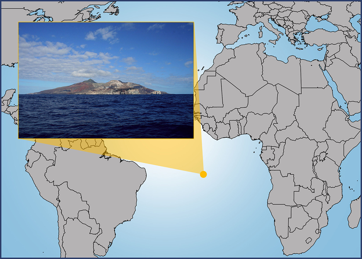
Over a thousand miles off the coast of Angola in West Africa is Ascension Island, a volcanic remnant that has 34 miles of land, 25 miles of paved roads, one school, and an airfield named Wideawake. But from June 1, 2016, through October 31, 2017, this tiny island in the South Atlantic Ocean will be ground zero for the newest field campaign by the U.S. Department of Energy’s (DOE) Atmospheric Radiation Measurement (ARM) Climate Research Facility.
The Layered Atlantic Smoke Interactions with Clouds (LASIC) effort will deploy atmospheric profiling instrumentation from the first ARM Mobile Facility (AMF1). The mission is to gather data on how the properties of smoke evolve after long-range transport through the atmosphere, in particular their ability to absorb shortwave radiation. It is also to assess how such smoke affects low clouds.
Unexplored Climate Regime
Midway to Brazil, the remote island is just the place for this mission. It lies beneath the main aerosol outflow pathway that smoke follows across the Atlantic. And the source of that smoke is wood and grassland fires in West and Southern Africa.

“Africa is the world’s largest emitter of smoke, with the smoke seasonally blowing westward over one of the largest low cloud decks on the planet,” said Paquita Zuidema, a University of Miami Rosenstiel School of Marine and Atmospheric Science scientist, who is principal investigator for LASIC. “The smoke provides one of the largest climate warmings of the planet that we have. How low clouds respond to the presence of smoke can completely change the climate impact of the smoke. But how low clouds adjust to the presence of smoke is as yet poorly known.”
Understanding the full impact of the smoke on marine low clouds, she added, “is an unexplored climate regime for ARM so far.”
After 17 months of data have been acquired, the hope is that scientists will be able to improve the global aerosol models used to predict climate change.
Pathway of Smoke
On both local and global scales, emissions from fire are significant contributors to aerosol particles in the air. In the United States alone, wildland fires contribute about 20 percent of fine airborne particulate matter. But biomass burning (scientists call it “BB”) is a bigger contributor in parts of Africa, primarily because of agricultural practices.
LASIC will be the first study to gather comprehensive data with ground-based instruments on changes to the radiative properties of smoke-related aerosols after their long-range transport along the main aerosol outflow pathway that smoke follows across the Atlantic. It will also be the first time that data are gathered on a diurnal cycle.
“This may provide a subtle yet robust assessment of the low-cloud response because the smoke only absorbs sunlight during the day,” said Zuidema. “The day-night cycle could be so different. Seventeen months of data would be fantastic.”
She will travel to Ascension in July to assess early data, and perhaps, attend the campaign’s opening with ARM Technical Operations Manager and Los Alamos National Laboratory employee Heath Powers and LASIC technicians on the island.
“It would be a way to thank the local community that has helped us pull this off,” said Zuidema.
Assessing Aging Aerosols
Scientists taking measurements on Ascension can also fruitfully study how smoke chemically “ages” in the atmosphere. The aging of carbonaceous particulate matter refers to its chemical evolution when exposed to sunlight and other factors during transport. What happens to the radiative properties of these particulate aerosols as they age? Some studies suggest the ability of smoke to absorb sunlight changes from July through October, but this has not yet been assessed over the remote Atlantic.
“We’re really interested in how the ability of smoke particles to absorb sunlight changes as they age. It’s something we need to know better than we do,” said Zuidema. “If you have sunlight hitting a smoke layer, what fraction of that sunlight gets absorbed by the smoke?”
Part of the problem is that smoke contains microscopically tiny carbonaceous particles that appear dark when over clouds and light when over a darker surface like the ocean. So the net effect of smoke on scattering and absorbing sunlight is difficult to assess. In addition, regional and seasonal affects can vary widely.
LASIC researchers are interested in the interaction of smoke with low clouds (abundant in the vicinity of Ascension) because such clouds are the main source for climate cooling, said Zuidema. “They reflect sunlight back into space, without changing the terrestrial longwave emission by much.” (Terrestrial longwave emission is the energy radiated from Earth back into space as infrared radiation.) Low clouds, she added, provide “the biggest uncertainty in predicting climate change” and are very difficult to model.
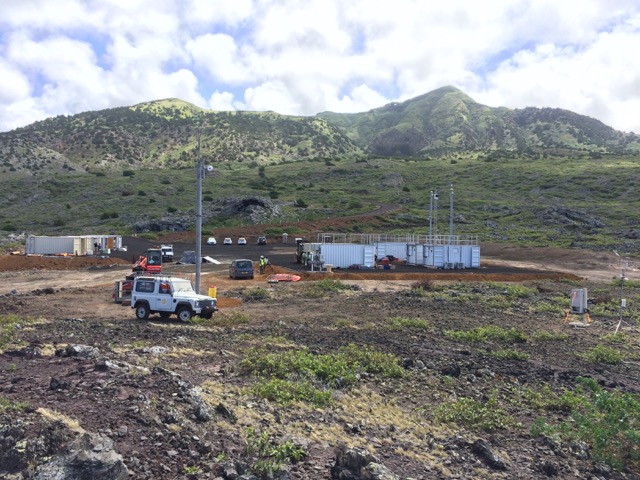
Complete Measuring Packages
Data during the campaign will be gathered seven days a week, every hour of every day. The data will be shared online, free of charge, to scientists around the world. On Ascension, getting high resolution temporal and vertical measurements requires the full complement of instruments in ARM’s toolbox. Broadly, these tools are meteorological instrumentation, a suite of broadband and spectral radiometers, and remote sensing instruments. They include different types of cloud radar, sky and ground radiation systems, a wind profiler and total sky imager, and a system for observing aerosols.
A balloon-borne radiosonde system (weather balloon with a probe attached) will be launched at regular intervals every day to measure profiles of temperature, humidity, and winds. An intensive radiosonde observational period, with eight launches daily, is planned for August and September, during the height of the biomass burning season. This period also coincides with planned visits by other aircraft campaigns.
“We have the complete ARM aerosol package, as well as their cloud remote sensing package,” said Zuidema, adding that LASIC got the bonus of one extra radar. “Now we have two upward-looking radars at two different wavelengths. It gives us extra capabilities.”
LASIC instrumentation will also assess the evolution of the cloudy boundary layer from Ascension to neighboring St. Helena. (This island, famous for Napoleon Bonaparte’s end-of-life exile, will also be fitted with similar surface-based instrumentation.)
Overlapping with LASIC, said Zuidema, will be “complementary aircraft campaigns” run by the United Kingdom and the National Aeronautic and Space Administration (NASA). The U.K. plane will be on Ascension a whole day to do LASIC-related science, she said. “That will be a great boon to us.”
Collaborating with the LASIC team is an international team of scientists, from the United Kingdom, France, South Africa, and Namibia, where all of the research aircraft will be staged.
# # #
The ARM Climate Research Facility is a national scientific user facility funded through the U.S. Department of Energy’s Office of Science. The ARM Facility is operated by nine Department of Energy national laboratories, including Los Alamos National Laboratory. Los Alamos manages the first and second ARM mobile facilities.
The ARM Climate Research Facility is a DOE Office of Science user facility. The ARM Facility is operated by nine DOE national laboratories, including .
Follow Us:


Keep up with the Atmospheric Observer
Updates on ARM news, events, and opportunities delivered to your inbox
ARM User Profile
ARM welcomes users from all institutions and nations. A free ARM user account is needed to access ARM data.


