
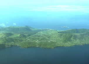
In 2009, the ARM Mobile Facility will be deployed in the Azores to support the Clouds, Aerosol, and Precipitation in the Marine Boundary Layer (CAP-MBL) field campaign. From April through December, the AMF will be located on Graciosa Island in the Azores, a Portuguese archipelago located about 3,900 km (2,400 mi) from the east coast of North America. The Azores are ideally located to sample the transition from the overcast stratocumulus regime in the spring to the broken trade cumulus regime in the summer. Led by principal investigator Robert Wood, scientists involved in the campaign will use the data from the AMF to study processes controlling the radiative properties and microphysics of marine boundary layer clouds over the remote subtropical Northeast Atlantic Ocean (NEA).
A previous study, the Atlantic Stratocumulus Transition Experiment in 1992, sampled clouds in the NEA and featured one of the first successful deployments of millimeter radars to study marine boundary layer clouds. The results of that study suggest that CAP-MBL will sample a broad range of these cloud types and aerosol conditions. The campaign will address science questions about daily to seasonal lower tropospheric processes over the NEA, such as:
- synoptic-scale features that dominate the variability in subtropical low clouds, and
- variability in precipitation frequency and strength in the subtropical cloud-topped marine boundary layer, including how this variability may be correlated with variability in aerosol properties.
Synthesized long term data from this campaign will be used to initialize, constrain, and validate numerical models including large eddy simulation, single column, and regional and global atmospheric models.