ARM Megasites Previewed at Annual Science Team Meeting
Published: 4 April 2014

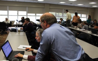
Each year, the DOE Atmospheric System Research Principal Investigator’s meeting provides an opportunity for scientists and ARM Facility staff to gather and review progress and plans related to their collaborations using ARM facilities and data. In early March, attendees at ASR’s fifth annual meeting were among the first to hear details about the ARM Facility’s plans for enhanced measurements to speed climate model advancements.
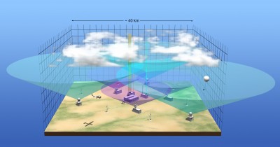
Announced in January, ARM is embarking on a reconfiguration of its long-standing operational paradigm. At Tuesday’s opening plenary session, Wanda Ferrell, ARM Facility Program Director for the Department of Energy, described the reconfiguration of ARM sites as a 4D “data cube” with improved and higher density measurements to accelerate progress in model development.
Emphasizing that plans are still in progress, Ferrell previewed a series of upcoming workshops where science questions related to the enhanced ARM “megasites” will be discussed. Workshop participants will include a cross section of scientists with expertise in process research, modeling, and observations. Jim Mather, ARM Technical Director, led a breakout session later on Tuesday with more details about plans related to the ARM megasites.
A Note of Thanks for a Job Well Done
Also during the opening plenary, Ferrell recognized with appreciation the dedication of two long-time ARM leaders:
- Bob Ellingson, professor of meteorology at Florida State University, for more than two decades of sustained professional and personal contributions to ARM and ASR in a variety of leadership roles, notably as leader of the original ARM Instantaneous Radiative Flux Working Group, mission scientist for the ARM Unmanned Aerospace Vehicle (UAV) Program from 1994-2003, chair of the ARM Science Team Executive Committee from 1995 to 2009, and for the past five years as chair of the ARM and ASR Science and Infrastructure Steering Committee.
- Kevin Widener (in absentia), an engineer at Pacific Northwest National Laboratory, for 20 years of dedicated contributions as chief architect of the ARM Facility’s one-of-a-kind global radar network; designer and builder of the original ARM Mobile Facility; and 16 isolated weeks as ARM team lead during the ground- (ice-) breaking Arctic field campaign, Surface Heat Budget of the Arctic Ocean (SHEBA).
ARM Updates and User Help

Nearly three dozen ARM infrastructure team members presented poster updates about ARM sites, instruments, field campaigns, and data. ARM staff also led three lunchtime tutorials centered around ARM data and services. They included:
- Introduction to ARM Data and Processes – Giri Palanisamy and Raymond McCord, Oak Ridge National Laboratory
The first half-hour of this session included an overview of topics ranging from accessing and citing ARM data to submitting publications, research highlights, and new data products. The second half involved one-on-one help from ARM Facility team members for attendees with specific questions in these areas. - Reading and Visualizing ARM Data – Justin Monroe, University of Oklahoma
Aimed at new users and those interested in learning basic Python to interact with ARM data, Monroe introduced attendees to ARM data conventions and showed them how to use Python to read and plot data stored in ARM netCDF files. - ARM Radar Data and Py-ART – Scott Collis, Argonne National Laboratory
Collis guided attendees through a series of three lessons to investigate, plot, and map ARM radar data using the Python ARM Radar Toolkit, or Py-ART. Collis and colleagues from Baltrad and Wradlib will conduct a similar full-day short course at the 8th European Conference on Radar in Meteorology and Hydrology in Germany later this year.
In an effort to provide this assistance to more scientific users, the tutorials were recorded and are being made available through ARM’s YouTube channel under the playlist “Tutorials.” Online notebooks from the latter two tutorials are also available via GitHub.
For the full ASR meeting agenda, presentations, and posters, see the ASR meeting website.
The ARM Climate Research Facility is a DOE Office of Science user facility. The ARM Facility is operated by nine DOE national laboratories, including .
Keep up with the Atmospheric Observer
Updates on ARM news, events, and opportunities delivered to your inbox
ARM User Profile
ARM welcomes users from all institutions and nations. A free ARM user account is needed to access ARM data.


