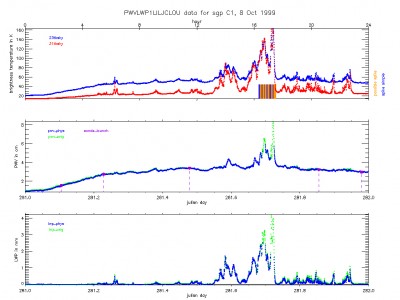
The Microwave Radiometer Retrievals (MWRRET) value-added product (VAP) has now been released as an operational product, and data for the Southern Great Plains (SGP), North Slope of Alaska (NSA), and Tropical Western Pacific (TWP) sites are now available. Data are also available for the Black Forest, Germany deployment of the ARM Mobile Facility (AMF). Additional AMF deployments will be processed in the next year. MWRRET output files are named “[site]mwrret1liljclou[facility].LL” where:
- [site] is the ARM site name (SGP, TWP, NSA)
- [facility] is the facility name (C1, C2, etc.)
- LL is the data level (c1, s1, c2, s2).
The MWRRET VAP retrieves column precipitable water vapor (PWV) and liquid water path (LWP) from the 2-channel microwave radiometers using a physical retrieval methodology that provides improved retrievals over the standard statistical coefficient method.
MWRRET data, which were previously available as an Evaluation Product, have been reprocessed to address several inconsistencies and errors in the data set. Any user who downloaded MWRRET data before April 2011 is encouraged to download the newer data files from the Archive.
The newest version of the MWRRET VAP has two stages of processing. In the first stage, which produces .c1 and .s1 level files, the VAP is run in near-real time to produce timely operational files. The second stage of processing, which produces .c2 and .s2 level files, is run yearly and applies improved offsets to the 23.8 GHz channel, improving the PWV retrievals. It also uses information on cloud vertical extent from the Active Remote Sensing of Clouds (ARSCL) VAP rather than ceilometer data to obtain the correct temperature of the liquid water layers in the atmosphere. When available, .c2 or .s2 level files should be used, as they are expected to be the most accurate.
More information on MWRRET is available at the VAP web page. To access these data, log in to the Data Archive. (Go here to request an account.)

